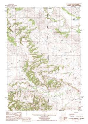
The Forks Topo Map Wyoming
To zoom in, hover over the map of The Forks
USGS Topo Quad 44104f1 - 1:24,000 scale
| Topo Map Name: | The Forks |
| USGS Topo Quad ID: | 44104f1 |
| Print Size: | ca. 21 1/4" wide x 27" high |
| Southeast Coordinates: | 44.625° N latitude / 104° W longitude |
| Map Center Coordinates: | 44.6875° N latitude / 104.0625° W longitude |
| U.S. States: | WY, SD |
| Filename: | o44104f1.jpg |
| Download Map JPG Image: | The Forks topo map 1:24,000 scale |
| Map Type: | Topographic |
| Topo Series: | 7.5´ |
| Map Scale: | 1:24,000 |
| Source of Map Images: | United States Geological Survey (USGS) |
| Alternate Map Versions: |
The Forks SD 1954, updated 1954 Download PDF Buy paper map Slaughter Reservoir SD 1984, updated 1984 Download PDF Buy paper map Slaughter Reservoir SD 2012 Download PDF Buy paper map Slaughter Reservoir SD 2015 Download PDF Buy paper map |
1:24,000 Topo Quads surrounding The Forks
> Back to 44104e1 at 1:100,000 scale
> Back to 44104a1 at 1:250,000 scale
> Back to U.S. Topo Maps home
The Forks topo map: Gazetteer
The Forks: Dams
Oak Creek Dam elevation 984m 3228′The Forks: Mines
A A Sisson Mine elevation 1113m 3651′A R Nelson Property Mine elevation 1069m 3507′
Black Vein Seven Mine elevation 1066m 3497′
C Helmer Property Mine elevation 1043m 3421′
Heetland Mine elevation 1076m 3530′
Helmer Mine elevation 1087m 3566′
Helmer Ranch Mine elevation 1113m 3651′
Lake Reservoir Area Number Two Mine elevation 1071m 3513′
Nelson Mine elevation 1152m 3779′
Sisson Mine elevation 1076m 3530′
State Lease Number 0-22090 Mine elevation 1157m 3795′
The Forks: Reservoirs
Oak Creek Reservoir elevation 984m 3228′Slaughter Reservoir elevation 964m 3162′
The Forks: Streams
Middle Fork Hay Creek elevation 1041m 3415′North Fork Hay Creek elevation 1045m 3428′
Pine Draw Creek elevation 1051m 3448′
South Branch Grummit Canyon Creek elevation 967m 3172′
South Branch Grummit Canyon Creek elevation 966m 3169′
South Fork Hay Creek elevation 1037m 3402′
The Forks: Summits
Norgrain Hill elevation 1118m 3667′The Forks: Valleys
Headland Draw elevation 959m 3146′The Forks digital topo map on disk
Buy this The Forks topo map showing relief, roads, GPS coordinates and other geographical features, as a high-resolution digital map file on DVD:
Eastern Wyoming & Western South Dakota
Buy digital topo maps: Eastern Wyoming & Western South Dakota


