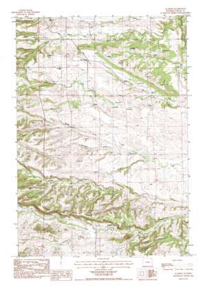
Aladdin Topo Map Wyoming
To zoom in, hover over the map of Aladdin
USGS Topo Quad 44104f2 - 1:24,000 scale
| Topo Map Name: | Aladdin |
| USGS Topo Quad ID: | 44104f2 |
| Print Size: | ca. 21 1/4" wide x 27" high |
| Southeast Coordinates: | 44.625° N latitude / 104.125° W longitude |
| Map Center Coordinates: | 44.6875° N latitude / 104.1875° W longitude |
| U.S. State: | WY |
| Filename: | o44104f2.jpg |
| Download Map JPG Image: | Aladdin topo map 1:24,000 scale |
| Map Type: | Topographic |
| Topo Series: | 7.5´ |
| Map Scale: | 1:24,000 |
| Source of Map Images: | United States Geological Survey (USGS) |
| Alternate Map Versions: |
Aladdin WY 1984, updated 1984 Download PDF Buy paper map Aladdin WY 2012 Download PDF Buy paper map Aladdin WY 2015 Download PDF Buy paper map |
1:24,000 Topo Quads surrounding Aladdin
> Back to 44104e1 at 1:100,000 scale
> Back to 44104a1 at 1:250,000 scale
> Back to U.S. Topo Maps home
Aladdin topo map: Gazetteer
Aladdin: Mines
A H Claim Mine elevation 1158m 3799′Homestake Property Mine elevation 1130m 3707′
Oak Creek Two Mine elevation 1108m 3635′
Richards and Myers Property Mine elevation 1197m 3927′
Stillwell Mine elevation 1111m 3645′
Aladdin: Populated Places
Aladdin elevation 1124m 3687′Aladdin: Ridges
Coal Land Ridge elevation 1270m 4166′Aladdin: Streams
Akers Canyon Creek elevation 1133m 3717′Alum Creek elevation 1022m 3353′
Rocky Draw Creek elevation 1036m 3398′
Aladdin: Valleys
Elk Creek elevation 1041m 3415′Jane Draw elevation 1088m 3569′
Spring Draw elevation 1102m 3615′
Table Mountain Draw elevation 1135m 3723′
Aladdin digital topo map on disk
Buy this Aladdin topo map showing relief, roads, GPS coordinates and other geographical features, as a high-resolution digital map file on DVD:
Eastern Wyoming & Western South Dakota
Buy digital topo maps: Eastern Wyoming & Western South Dakota


