Echeta Topo Map Wyoming
To zoom in, hover over the map of Echeta
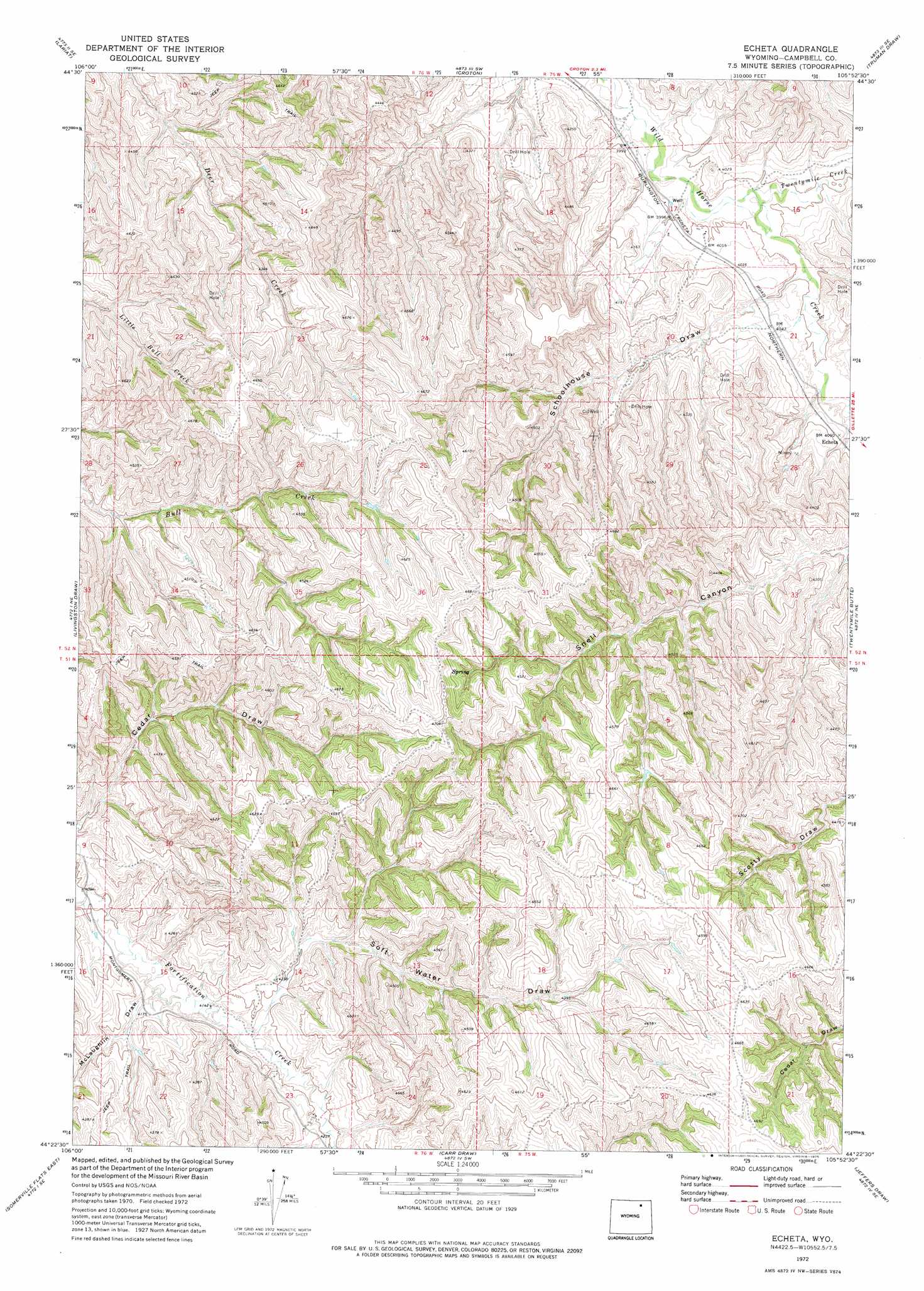
USGS Topo Quad 44105d8 - 1:24,000 scale
| Topo Map Name: | Echeta |
| USGS Topo Quad ID: | 44105d8 |
| Print Size: | ca. 21 1/4" wide x 27" high |
| Southeast Coordinates: | 44.375° N latitude / 105.875° W longitude |
| Map Center Coordinates: | 44.4375° N latitude / 105.9375° W longitude |
| U.S. State: | WY |
| Filename: | o44105d8.jpg |
| Download Map JPG Image: | Echeta topo map 1:24,000 scale |
| Map Type: | Topographic |
| Topo Series: | 7.5´ |
| Map Scale: | 1:24,000 |
| Source of Map Images: | United States Geological Survey (USGS) |
| Alternate Map Versions: |
Echeta WY 1972, updated 1975 Download PDF Buy paper map Echeta WY 2012 Download PDF Buy paper map Echeta WY 2015 Download PDF Buy paper map |
1:24,000 Topo Quads surrounding Echeta
Arvada |
Arvada Ne |
Larey Draw |
Spotted Horse |
Recluse |
Jewell Draw |
Lariat |
Croton |
Truman Draw |
Wildcat |
Mitchell Draw |
Livingston Draw |
Echeta |
Twentymile Butte |
Oriva Nw |
Somerville Flats West |
Somerville Flats East |
Carr Draw |
Jeffers Draw |
Oriva |
Juniper Draw |
Laskie Draw |
Morgan Draw |
Scott Dam |
Four Bar J Ranch |
> Back to 44105a1 at 1:100,000 scale
> Back to 44104a1 at 1:250,000 scale
> Back to U.S. Topo Maps home
Echeta topo map: Gazetteer
Echeta: Dams
Broken Jaw Dam elevation 1374m 4507′Echeta: Mines
Echeta Mine elevation 1283m 4209′Eureka Strip Mine elevation 1254m 4114′
Echeta: Populated Places
Echeta elevation 1239m 4064′Echeta: Reservoirs
Broken Jaw Reservoir elevation 1374m 4507′Echeta: Streams
Twentymile Creek elevation 1212m 3976′Echeta: Valleys
McLaughlin Draw elevation 1256m 4120′Schoolhouse Draw elevation 1218m 3996′
Soft Water Draw elevation 1285m 4215′
Echeta digital topo map on disk
Buy this Echeta topo map showing relief, roads, GPS coordinates and other geographical features, as a high-resolution digital map file on DVD:
Eastern Wyoming & Western South Dakota
Buy digital topo maps: Eastern Wyoming & Western South Dakota