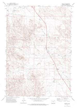
Wildcat Topo Map Wyoming
To zoom in, hover over the map of Wildcat
USGS Topo Quad 44105e6 - 1:24,000 scale
| Topo Map Name: | Wildcat |
| USGS Topo Quad ID: | 44105e6 |
| Print Size: | ca. 21 1/4" wide x 27" high |
| Southeast Coordinates: | 44.5° N latitude / 105.625° W longitude |
| Map Center Coordinates: | 44.5625° N latitude / 105.6875° W longitude |
| U.S. State: | WY |
| Filename: | o44105e6.jpg |
| Download Map JPG Image: | Wildcat topo map 1:24,000 scale |
| Map Type: | Topographic |
| Topo Series: | 7.5´ |
| Map Scale: | 1:24,000 |
| Source of Map Images: | United States Geological Survey (USGS) |
| Alternate Map Versions: |
Wildcat WY 1971, updated 1974 Download PDF Buy paper map Wildcat WY 2012 Download PDF Buy paper map Wildcat WY 2015 Download PDF Buy paper map |
1:24,000 Topo Quads surrounding Wildcat
> Back to 44105e1 at 1:100,000 scale
> Back to 44104a1 at 1:250,000 scale
> Back to U.S. Topo Maps home
Wildcat topo map: Gazetteer
Wildcat: Dams
Scott Dam elevation 1251m 4104′Wildcat: Mines
Wildcat Creek Mine elevation 1253m 4110′Wildcat: Populated Places
Wildcat elevation 1288m 4225′Wildcat: Reservoirs
Fletcher Reservoir elevation 1237m 4058′Horse Creek Reservoir elevation 1264m 4146′
Scott Reservoir elevation 1251m 4104′
Wildcat: Streams
Jamison Prong Wildcat Creek elevation 1232m 4041′North Fork Wildcat Creek elevation 1220m 4002′
Wildcat: Valleys
Boruff Draw elevation 1245m 4084′Bright Spring Draw elevation 1254m 4114′
Dry Gulch elevation 1257m 4124′
Gibbon Draw elevation 1273m 4176′
Hensley Draw elevation 1231m 4038′
Soukup Draw elevation 1238m 4061′
Wildcat digital topo map on disk
Buy this Wildcat topo map showing relief, roads, GPS coordinates and other geographical features, as a high-resolution digital map file on DVD:
Eastern Wyoming & Western South Dakota
Buy digital topo maps: Eastern Wyoming & Western South Dakota


