Larey Draw Topo Map Wyoming
To zoom in, hover over the map of Larey Draw
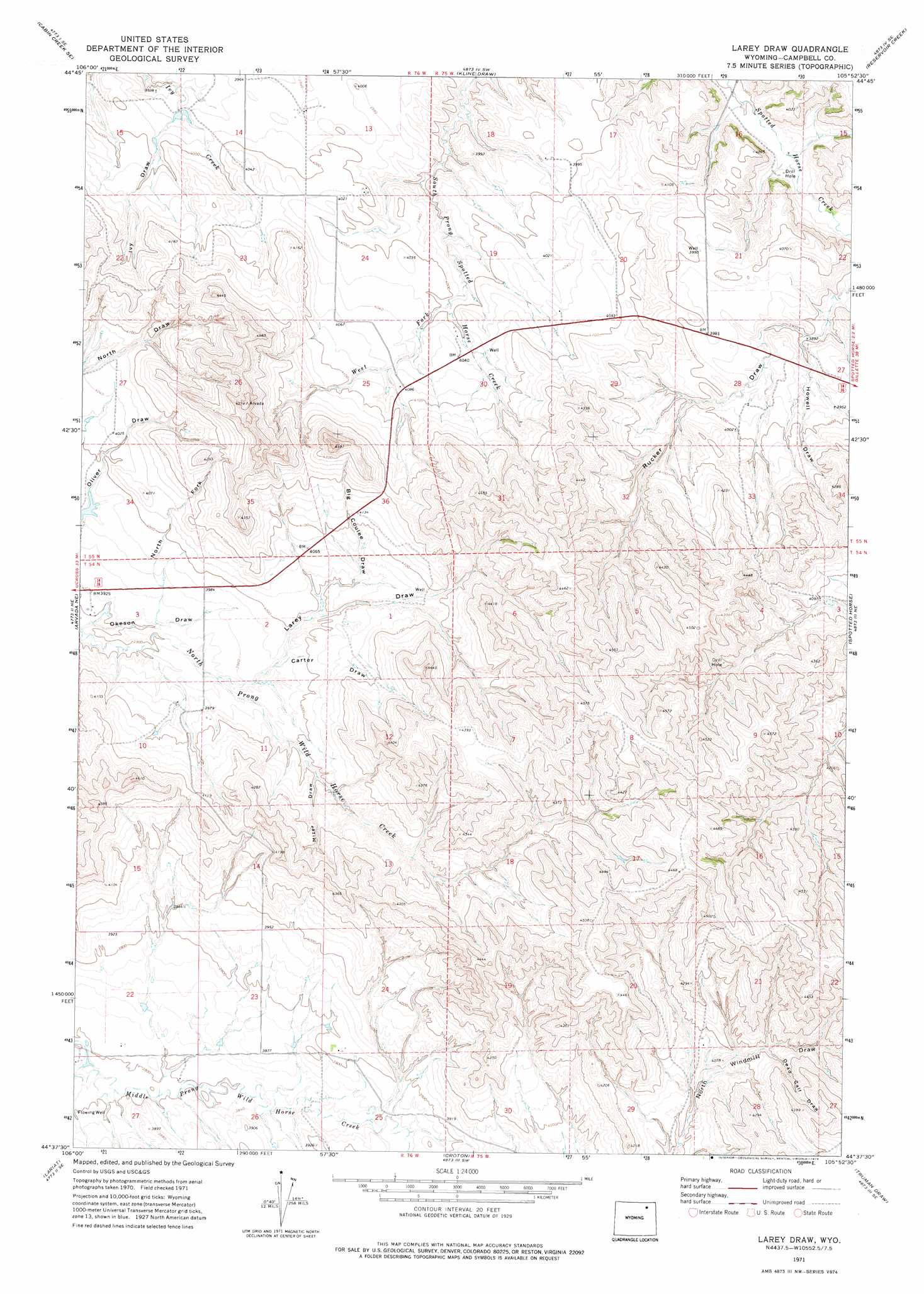
USGS Topo Quad 44105f8 - 1:24,000 scale
| Topo Map Name: | Larey Draw |
| USGS Topo Quad ID: | 44105f8 |
| Print Size: | ca. 21 1/4" wide x 27" high |
| Southeast Coordinates: | 44.625° N latitude / 105.875° W longitude |
| Map Center Coordinates: | 44.6875° N latitude / 105.9375° W longitude |
| U.S. State: | WY |
| Filename: | o44105f8.jpg |
| Download Map JPG Image: | Larey Draw topo map 1:24,000 scale |
| Map Type: | Topographic |
| Topo Series: | 7.5´ |
| Map Scale: | 1:24,000 |
| Source of Map Images: | United States Geological Survey (USGS) |
| Alternate Map Versions: |
Larey Draw WY 1971, updated 1974 Download PDF Buy paper map Larey Draw WY 2012 Download PDF Buy paper map Larey Draw WY 2015 Download PDF Buy paper map |
1:24,000 Topo Quads surrounding Larey Draw
Cabin Creek Nw |
Cabin Creek Ne |
Black Draw |
Dead Horse Lake |
Corral Creek |
Fawn Draw |
Cabin Creek Se |
Kline Draw |
Reservoir Creek |
Homestead Draw Sw |
Arvada |
Arvada Ne |
Larey Draw |
Spotted Horse |
Recluse |
Jewell Draw |
Lariat |
Croton |
Truman Draw |
Wildcat |
Mitchell Draw |
Livingston Draw |
Echeta |
Twentymile Butte |
Oriva Nw |
> Back to 44105e1 at 1:100,000 scale
> Back to 44104a1 at 1:250,000 scale
> Back to U.S. Topo Maps home
Larey Draw topo map: Gazetteer
Larey Draw: Dams
Fitzgerald Dam elevation 1220m 4002′Suranyi Dam elevation 1250m 4101′
Larey Draw: Reservoirs
Fitzgerald Reservoir elevation 1220m 4002′Suranyi Reservoir elevation 1250m 4101′
Larey Draw: Streams
West Fork South Prong Spotted Horse Creek elevation 1213m 3979′Larey Draw: Valleys
Big Coulee Draw elevation 1224m 4015′Carter Draw elevation 1207m 3959′
Dead Calf Draw elevation 1246m 4087′
Howell Draw elevation 1186m 3891′
Ivy Draw elevation 1204m 3950′
Larey Draw elevation 1200m 3937′
Mizer Draw elevation 1214m 3982′
North Fork Okeson Draw elevation 1194m 3917′
Larey Draw digital topo map on disk
Buy this Larey Draw topo map showing relief, roads, GPS coordinates and other geographical features, as a high-resolution digital map file on DVD:
Eastern Wyoming & Western South Dakota
Buy digital topo maps: Eastern Wyoming & Western South Dakota