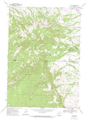
Story Topo Map Wyoming
To zoom in, hover over the map of Story
USGS Topo Quad 44106e8 - 1:24,000 scale
| Topo Map Name: | Story |
| USGS Topo Quad ID: | 44106e8 |
| Print Size: | ca. 21 1/4" wide x 27" high |
| Southeast Coordinates: | 44.5° N latitude / 106.875° W longitude |
| Map Center Coordinates: | 44.5625° N latitude / 106.9375° W longitude |
| U.S. State: | WY |
| Filename: | o44106e8.jpg |
| Download Map JPG Image: | Story topo map 1:24,000 scale |
| Map Type: | Topographic |
| Topo Series: | 7.5´ |
| Map Scale: | 1:24,000 |
| Source of Map Images: | United States Geological Survey (USGS) |
| Alternate Map Versions: |
Story WY 1967, updated 1972 Download PDF Buy paper map Story WY 1993, updated 1997 Download PDF Buy paper map Story WY 2012 Download PDF Buy paper map Story WY 2015 Download PDF Buy paper map |
| FStopo: | US Forest Service topo Story is available: Download FStopo PDF Download FStopo TIF |
1:24,000 Topo Quads surrounding Story
> Back to 44106e1 at 1:100,000 scale
> Back to 44106a1 at 1:250,000 scale
> Back to U.S. Topo Maps home
Story topo map: Gazetteer
Story: Canals
Big Piney Divide Ditch elevation 1615m 5298′Meade Coffeen Ditch elevation 1470m 4822′
Prairie Dog Kruse Ditch elevation 1461m 4793′
Story: Dams
Moncreiffe Dam elevation 1535m 5036′Story: Mines
Little Falls Claim Mine elevation 1842m 6043′Story: Parks
Wagon Box Battle Monument elevation 1624m 5328′Story: Populated Places
Story elevation 1535m 5036′Story: Reservoirs
Moncreiffe Reservoir elevation 1535m 5036′Mountain Reservoir elevation 1537m 5042′
Story: Ridges
Moncreiffe Ridge elevation 1907m 6256′Story: Springs
Bard Spring elevation 2283m 7490′Story: Streams
Gin Creek elevation 1958m 6423′Spring Creek elevation 1556m 5104′
Story: Summits
Grandmas Mountain elevation 2112m 6929′Story: Trails
Story Penrose Trail elevation 2073m 6801′Story: Valleys
Long Draw elevation 1826m 5990′Story digital topo map on disk
Buy this Story topo map showing relief, roads, GPS coordinates and other geographical features, as a high-resolution digital map file on DVD:
Eastern Wyoming & Western South Dakota
Buy digital topo maps: Eastern Wyoming & Western South Dakota


