Fawn Draw Topo Map Wyoming
To zoom in, hover over the map of Fawn Draw
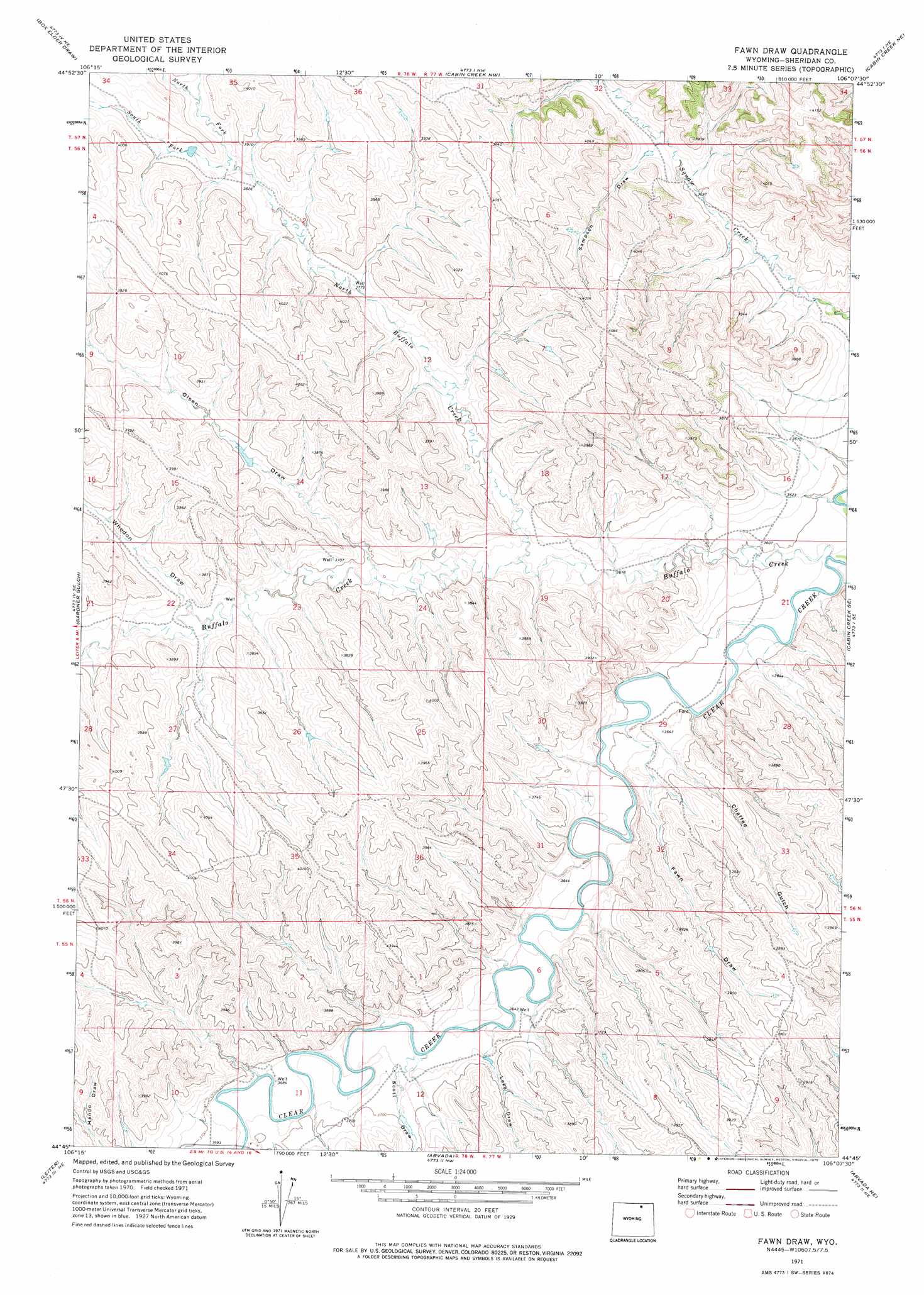
USGS Topo Quad 44106g2 - 1:24,000 scale
| Topo Map Name: | Fawn Draw |
| USGS Topo Quad ID: | 44106g2 |
| Print Size: | ca. 21 1/4" wide x 27" high |
| Southeast Coordinates: | 44.75° N latitude / 106.125° W longitude |
| Map Center Coordinates: | 44.8125° N latitude / 106.1875° W longitude |
| U.S. State: | WY |
| Filename: | o44106g2.jpg |
| Download Map JPG Image: | Fawn Draw topo map 1:24,000 scale |
| Map Type: | Topographic |
| Topo Series: | 7.5´ |
| Map Scale: | 1:24,000 |
| Source of Map Images: | United States Geological Survey (USGS) |
| Alternate Map Versions: |
Fawn Draw WY 1971, updated 1975 Download PDF Buy paper map Fawn Draw WY 2012 Download PDF Buy paper map Fawn Draw WY 2015 Download PDF Buy paper map |
1:24,000 Topo Quads surrounding Fawn Draw
Forks Ranch |
Quietus |
Bear Creek School |
Sayle Hall |
Bradshaw Creek |
Roundup Draw |
Box Elder Draw |
Cabin Creek Nw |
Cabin Creek Ne |
Black Draw |
Shuler Draw |
Gardner Gulch |
Fawn Draw |
Cabin Creek Se |
Kline Draw |
Clearmont |
Leiter |
Arvada |
Arvada Ne |
Larey Draw |
Julio Draw |
Arpan Butte |
Jewell Draw |
Lariat |
Croton |
> Back to 44106e1 at 1:100,000 scale
> Back to 44106a1 at 1:250,000 scale
> Back to U.S. Topo Maps home
Fawn Draw topo map: Gazetteer
Fawn Draw: Dams
Cultra Dam elevation 1131m 3710′Fawn Draw: Mines
Davis Ford Mine elevation 1159m 3802′Fawn Draw: Reservoirs
Cultra Reservoir elevation 1131m 3710′Fawn Draw: Streams
Buffalo Creek elevation 1085m 3559′North Buffalo Creek elevation 1109m 3638′
North Fork North Buffalo Creek elevation 1166m 3825′
South Fork North Buffalo Creek elevation 1166m 3825′
Fawn Draw: Valleys
Chaffee Gulch elevation 1104m 3622′Fawn Draw elevation 1109m 3638′
Lake Draw elevation 1116m 3661′
Olsen Draw elevation 1124m 3687′
Sampson Draw elevation 1131m 3710′
Scott Draw elevation 1115m 3658′
Whedon Draw elevation 1137m 3730′
Fawn Draw digital topo map on disk
Buy this Fawn Draw topo map showing relief, roads, GPS coordinates and other geographical features, as a high-resolution digital map file on DVD:
Eastern Wyoming & Western South Dakota
Buy digital topo maps: Eastern Wyoming & Western South Dakota