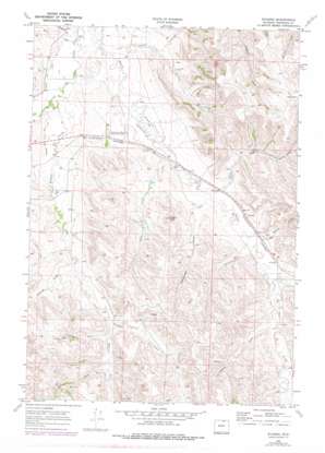
Wyarno Topo Map Wyoming
To zoom in, hover over the map of Wyarno
USGS Topo Quad 44106g7 - 1:24,000 scale
| Topo Map Name: | Wyarno |
| USGS Topo Quad ID: | 44106g7 |
| Print Size: | ca. 21 1/4" wide x 27" high |
| Southeast Coordinates: | 44.75° N latitude / 106.75° W longitude |
| Map Center Coordinates: | 44.8125° N latitude / 106.8125° W longitude |
| U.S. State: | WY |
| Filename: | o44106g7.jpg |
| Download Map JPG Image: | Wyarno topo map 1:24,000 scale |
| Map Type: | Topographic |
| Topo Series: | 7.5´ |
| Map Scale: | 1:24,000 |
| Source of Map Images: | United States Geological Survey (USGS) |
| Alternate Map Versions: |
Wyarno WY 1968, updated 1973 Download PDF Buy paper map Wyarno WY 1968, updated 1978 Download PDF Buy paper map Wyarno WY 2012 Download PDF Buy paper map Wyarno WY 2015 Download PDF Buy paper map |
1:24,000 Topo Quads surrounding Wyarno
> Back to 44106e1 at 1:100,000 scale
> Back to 44106a1 at 1:250,000 scale
> Back to U.S. Topo Maps home
Wyarno topo map: Gazetteer
Wyarno: Airports
Symons Airport elevation 1125m 3690′Wyarno: Canals
Prairie Dog Ditch Number 11 elevation 1138m 3733′Prairie Dog Ditch Number 13 elevation 1123m 3684′
Wyarno: Dams
Burgess Number 1 Dam elevation 1105m 3625′Burgess Number 2 Dam elevation 1104m 3622′
Hape Dam elevation 1172m 3845′
Kahn and Roberts Dam elevation 1153m 3782′
Kahn Dam elevation 1146m 3759′
Paul Number 3 Dam elevation 1183m 3881′
Wyarno: Mines
Arno Quarry Mine elevation 1150m 3772′Wyarno: Populated Places
Wyarno elevation 1154m 3786′Wyarno: Reservoirs
Burgass Reservoir Number 2 elevation 1104m 3622′Burgess Reservoir Number 1 elevation 1105m 3625′
Hape Reservoir elevation 1172m 3845′
Kahn and Roberts Reservoir elevation 1153m 3782′
Kahn Reservoir elevation 1146m 3759′
Paul Number 3 Reservoir elevation 1183m 3881′
Wyarno: Streams
Dow Prong elevation 1147m 3763′Dutch Creek elevation 1152m 3779′
Dutch Creek elevation 1105m 3625′
Plum Creek elevation 1124m 3687′
West Fork Wildcat Creek elevation 1180m 3871′
Wildcat Creek elevation 1116m 3661′
Wyarno: Summits
Hazel Peak elevation 1274m 4179′Wyarno: Valleys
Allens Draw elevation 1197m 3927′Bates Draw elevation 1110m 3641′
Dawson Draw elevation 1165m 3822′
Eyechaner Draw elevation 1138m 3733′
Fields Draw elevation 1189m 3900′
Helvey Draw elevation 1159m 3802′
Johnston Draw elevation 1113m 3651′
Negro Draw elevation 1141m 3743′
Wyarno Draw elevation 1159m 3802′
Wyarno digital topo map on disk
Buy this Wyarno topo map showing relief, roads, GPS coordinates and other geographical features, as a high-resolution digital map file on DVD:
Eastern Wyoming & Western South Dakota
Buy digital topo maps: Eastern Wyoming & Western South Dakota


