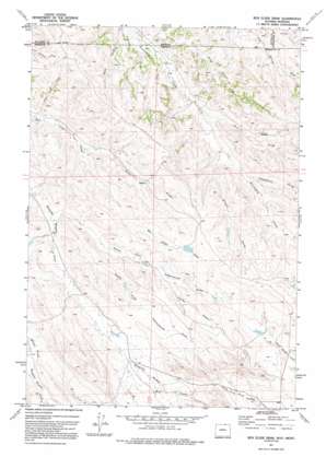
Box Elder Draw Topo Map Wyoming
To zoom in, hover over the map of Box Elder Draw
USGS Topo Quad 44106h3 - 1:24,000 scale
| Topo Map Name: | Box Elder Draw |
| USGS Topo Quad ID: | 44106h3 |
| Print Size: | ca. 21 1/4" wide x 27" high |
| Southeast Coordinates: | 44.875° N latitude / 106.25° W longitude |
| Map Center Coordinates: | 44.9375° N latitude / 106.3125° W longitude |
| U.S. States: | WY, MT |
| Filename: | o44106h3.jpg |
| Download Map JPG Image: | Box Elder Draw topo map 1:24,000 scale |
| Map Type: | Topographic |
| Topo Series: | 7.5´ |
| Map Scale: | 1:24,000 |
| Source of Map Images: | United States Geological Survey (USGS) |
| Alternate Map Versions: |
Box Elder Draw WY 1971, updated 1975 Download PDF Buy paper map Box Elder Draw WY 1971, updated 1992 Download PDF Buy paper map Box Elder Draw WY 2011 Download PDF Buy paper map Box Elder Draw WY 2012 Download PDF Buy paper map Box Elder Draw WY 2015 Download PDF Buy paper map |
1:24,000 Topo Quads surrounding Box Elder Draw
> Back to 44106e1 at 1:100,000 scale
> Back to 44106a1 at 1:250,000 scale
> Back to U.S. Topo Maps home
Box Elder Draw topo map: Gazetteer
Box Elder Draw: Streams
Grenell Prong elevation 1171m 3841′Iron Springs Creek elevation 1176m 3858′
Schoolhouse Prong elevation 1183m 3881′
West Prong Seventysix Creek elevation 1159m 3802′
Box Elder Draw: Valleys
Dooley Draw elevation 1200m 3937′King Draw elevation 1147m 3763′
King Draw elevation 1148m 3766′
North Fork Cottonwood Draw elevation 1153m 3782′
North Prong Box Elder Draw elevation 1166m 3825′
South Fork Cottonwood Draw elevation 1153m 3782′
Box Elder Draw digital topo map on disk
Buy this Box Elder Draw topo map showing relief, roads, GPS coordinates and other geographical features, as a high-resolution digital map file on DVD:
Eastern Wyoming & Western South Dakota
Buy digital topo maps: Eastern Wyoming & Western South Dakota


