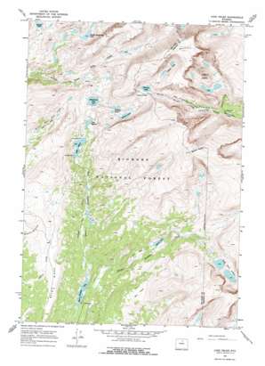
Lake Helen Topo Map Wyoming
To zoom in, hover over the map of Lake Helen
USGS Topo Quad 44107c2 - 1:24,000 scale
| Topo Map Name: | Lake Helen |
| USGS Topo Quad ID: | 44107c2 |
| Print Size: | ca. 21 1/4" wide x 27" high |
| Southeast Coordinates: | 44.25° N latitude / 107.125° W longitude |
| Map Center Coordinates: | 44.3125° N latitude / 107.1875° W longitude |
| U.S. State: | WY |
| Filename: | o44107c2.jpg |
| Download Map JPG Image: | Lake Helen topo map 1:24,000 scale |
| Map Type: | Topographic |
| Topo Series: | 7.5´ |
| Map Scale: | 1:24,000 |
| Source of Map Images: | United States Geological Survey (USGS) |
| Alternate Map Versions: |
Lake Helen WY 1967, updated 1972 Download PDF Buy paper map Lake Helen WY 1967, updated 1975 Download PDF Buy paper map Lake Helen WY 1967, updated 1987 Download PDF Buy paper map Lake Helen WY 1993, updated 1997 Download PDF Buy paper map Lake Helen WY 2012 Download PDF Buy paper map Lake Helen WY 2015 Download PDF Buy paper map |
| FStopo: | US Forest Service topo Lake Helen is available: Download FStopo PDF Download FStopo TIF |
1:24,000 Topo Quads surrounding Lake Helen
> Back to 44107a1 at 1:100,000 scale
> Back to 44106a1 at 1:250,000 scale
> Back to U.S. Topo Maps home
Lake Helen topo map: Gazetteer
Lake Helen: Flats
Elk Park elevation 3082m 10111′Medicine Park elevation 3135m 10285′
Lake Helen: Gaps
Florence Pass elevation 3331m 10928′Lake Helen: Lakes
Florence Lake elevation 3311m 10862′Fortress Lakes elevation 3199m 10495′
Golden Lakes elevation 3425m 11236′
Gunboat Lake elevation 3217m 10554′
Lake Helen elevation 3039m 9970′
Lake Marion elevation 3060m 10039′
Lost Twin Lakes elevation 3168m 10393′
Middle Cloud Peak Lake elevation 3177m 10423′
Mirror Lake elevation 2936m 9632′
Mistymoon Lake elevation 3121m 10239′
Powell Lakes elevation 3518m 11541′
Summit Lake elevation 3162m 10374′
West Tensleep Lake elevation 2767m 9078′
Lake Helen: Parks
Medicine Cabin Park elevation 2922m 9586′Lake Helen: Ridges
Bald Ridge elevation 3004m 9855′Lake Helen: Streams
Powell Creek elevation 2936m 9632′Lake Helen: Summits
Bomber Mountain elevation 3795m 12450′Mather Peaks elevation 3769m 12365′
Lake Helen: Trails
Mistymoon Trail elevation 2868m 9409′Lake Helen: Valleys
Florence Canyon elevation 2936m 9632′Lake Helen digital topo map on disk
Buy this Lake Helen topo map showing relief, roads, GPS coordinates and other geographical features, as a high-resolution digital map file on DVD:
Eastern Wyoming & Western South Dakota
Buy digital topo maps: Eastern Wyoming & Western South Dakota


