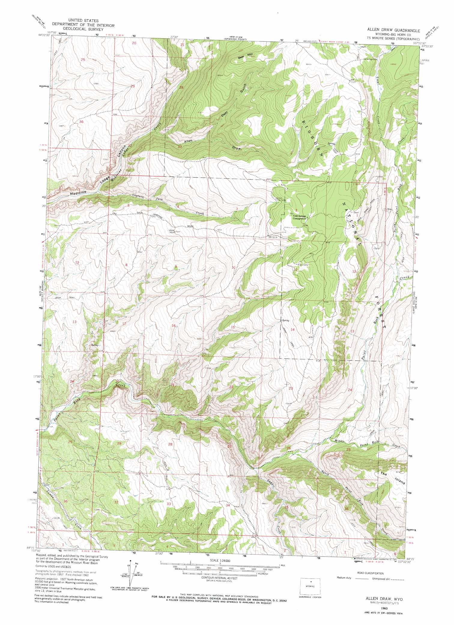
Allen Draw Topo Map Wyoming
To zoom in, hover over the map of Allen Draw
USGS Topo Quad 44107c4 - 1:24,000 scale
| Topo Map Name: | Allen Draw |
| USGS Topo Quad ID: | 44107c4 |
| Print Size: | ca. 21 1/4" wide x 27" high |
| Southeast Coordinates: | 44.25° N latitude / 107.375° W longitude |
| Map Center Coordinates: | 44.3125° N latitude / 107.4375° W longitude |
| U.S. State: | WY |
| Filename: | o44107c4.jpg |
| Download Map JPG Image: | Allen Draw topo map 1:24,000 scale |
| Map Type: | Topographic |
| Topo Series: | 7.5´ |
| Map Scale: | 1:24,000 |
| Source of Map Images: | United States Geological Survey (USGS) |
| Alternate Map Versions: |
Allen Draw WY 1993, updated 1997 Download PDF Buy paper map Allen Draw WY 1993, updated 1997 Download PDF Buy paper map Allen Draw WY 2012 Download PDF Buy paper map Allen Draw WY 2015 Download PDF Buy paper map |
| FStopo: | US Forest Service topo Allen Draw is available: Download FStopo PDF Download FStopo TIF |
1:24,000 Topo Quads surrounding Allen Draw
Black Mountain |
Shell Falls |
Shell Reservoir |
Dome Lake |
Park Reservoir |
White Sulphur Spring |
Bush Butte |
Spanish Point |
Shell Lake |
Cloud Peak |
Flitner Reservoir |
Hyatt Ranch |
Allen Draw |
Lake Solitude |
Lake Helen |
Weintz Draw |
Hyattville |
Pierce Draw |
Brokenback Narrows |
Meadowlark Lake |
Broom Draw |
Wild Horse Hill |
Ten Sleep |
Old Maid Gulch |
Onion Gulch |
> Back to 44107a1 at 1:100,000 scale
> Back to 44106a1 at 1:250,000 scale
> Back to U.S. Topo Maps home
Allen Draw topo map: Gazetteer
Allen Draw: Streams
Captain Jack Creek elevation 1782m 5846′Laddie Creek elevation 1772m 5813′
Middle Paint Rock Creek elevation 1914m 6279′
North Paint Rock Creek elevation 2132m 6994′
Sheep Creek elevation 2694m 8838′
South Paint Rock Creek elevation 1834m 6017′
Trout Creek elevation 2392m 7847′
Allen Draw: Summits
Bear Mountain elevation 2720m 8923′The Island elevation 2502m 8208′
Allen Draw: Valleys
Allen Draw elevation 2013m 6604′Deer Gulch elevation 2222m 7290′
Allen Draw digital topo map on disk
Buy this Allen Draw topo map showing relief, roads, GPS coordinates and other geographical features, as a high-resolution digital map file on DVD:
Eastern Wyoming & Western South Dakota
Buy digital topo maps: Eastern Wyoming & Western South Dakota