Spanish Point Topo Map Wyoming
To zoom in, hover over the map of Spanish Point
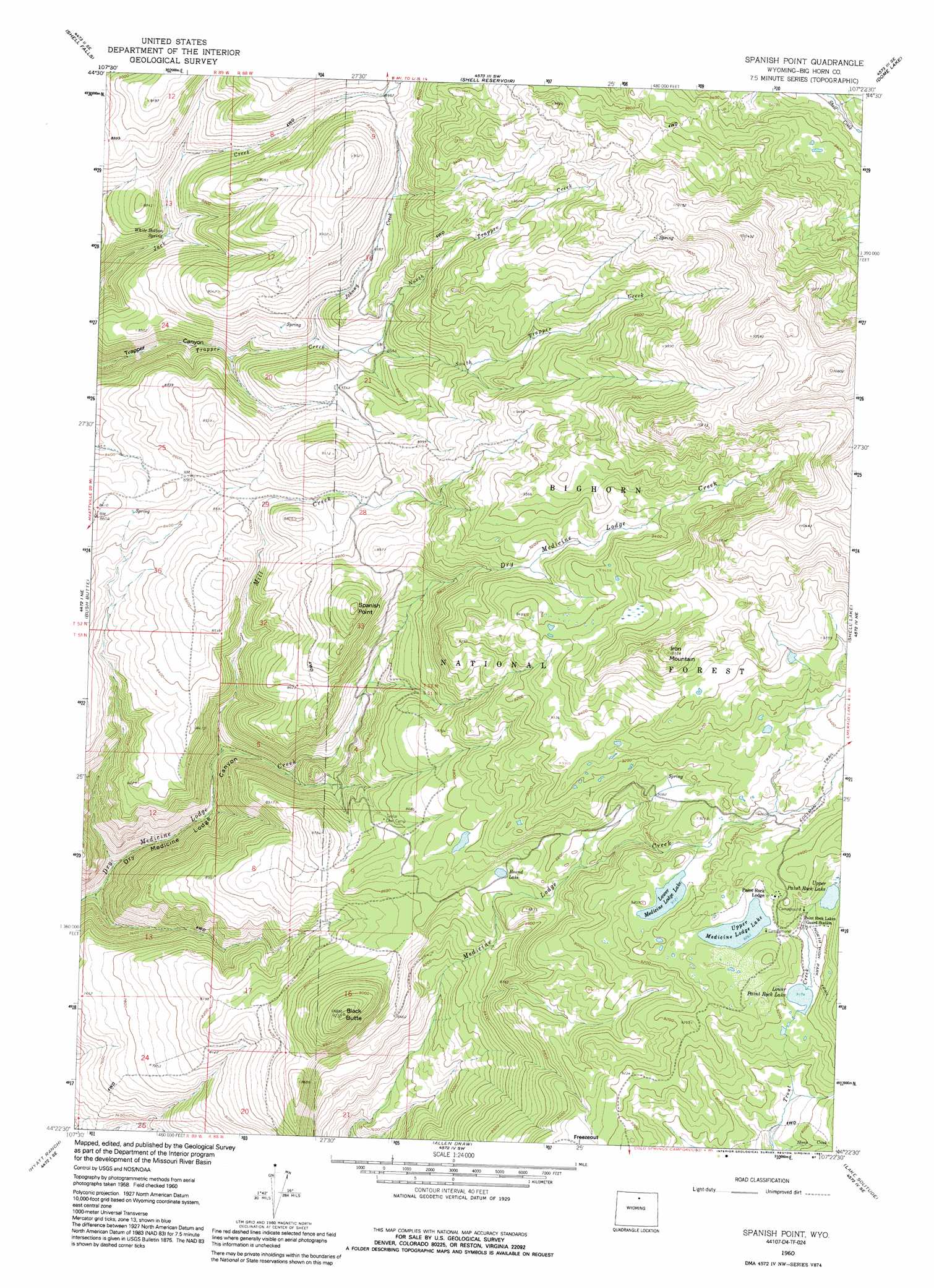
USGS Topo Quad 44107d4 - 1:24,000 scale
| Topo Map Name: | Spanish Point |
| USGS Topo Quad ID: | 44107d4 |
| Print Size: | ca. 21 1/4" wide x 27" high |
| Southeast Coordinates: | 44.375° N latitude / 107.375° W longitude |
| Map Center Coordinates: | 44.4375° N latitude / 107.4375° W longitude |
| U.S. State: | WY |
| Filename: | o44107d4.jpg |
| Download Map JPG Image: | Spanish Point topo map 1:24,000 scale |
| Map Type: | Topographic |
| Topo Series: | 7.5´ |
| Map Scale: | 1:24,000 |
| Source of Map Images: | United States Geological Survey (USGS) |
| Alternate Map Versions: |
Spanish Point WY 1960, updated 1962 Download PDF Buy paper map Spanish Point WY 1960, updated 1974 Download PDF Buy paper map Spanish Point WY 1960, updated 1987 Download PDF Buy paper map Spanish Point WY 1960, updated 1991 Download PDF Buy paper map Spanish Point WY 1993, updated 1997 Download PDF Buy paper map Spanish Point WY 2012 Download PDF Buy paper map Spanish Point WY 2015 Download PDF Buy paper map |
| FStopo: | US Forest Service topo Spanish Point is available: Download FStopo PDF Download FStopo TIF |
1:24,000 Topo Quads surrounding Spanish Point
Hidden Tepee Creek |
Granite Pass |
Woodrock |
Walker Mountain |
Beckton |
Black Mountain |
Shell Falls |
Shell Reservoir |
Dome Lake |
Park Reservoir |
White Sulphur Spring |
Bush Butte |
Spanish Point |
Shell Lake |
Cloud Peak |
Flitner Reservoir |
Hyatt Ranch |
Allen Draw |
Lake Solitude |
Lake Helen |
Weintz Draw |
Hyattville |
Pierce Draw |
Brokenback Narrows |
Meadowlark Lake |
> Back to 44107a1 at 1:100,000 scale
> Back to 44106a1 at 1:250,000 scale
> Back to U.S. Topo Maps home
Spanish Point topo map: Gazetteer
Spanish Point: Cliffs
Spanish Point elevation 2818m 9245′Spanish Point: Flats
Freezeout elevation 2782m 9127′Spanish Point: Lakes
Lower Medicine Lodge Lake elevation 2781m 9124′Lower Paint Rock Lake elevation 2797m 9176′
Round Lake elevation 2631m 8631′
Upper Medicine Lodge Lake elevation 2825m 9268′
Upper Paint Rock Lake elevation 2824m 9265′
Spanish Point: Mines
Spanish Point Agate Mine elevation 2641m 8664′Spanish Point: Springs
White Bottom Spring elevation 2541m 8336′Spanish Point: Streams
Johnny Creek elevation 2584m 8477′Mill Creek elevation 2342m 7683′
North Trapper Creek elevation 2614m 8576′
South Trapper Creek elevation 2615m 8579′
Spanish Point: Summits
Black Butte elevation 2810m 9219′Iron Mountain elevation 3075m 10088′
Spanish Point digital topo map on disk
Buy this Spanish Point topo map showing relief, roads, GPS coordinates and other geographical features, as a high-resolution digital map file on DVD:
Eastern Wyoming & Western South Dakota
Buy digital topo maps: Eastern Wyoming & Western South Dakota