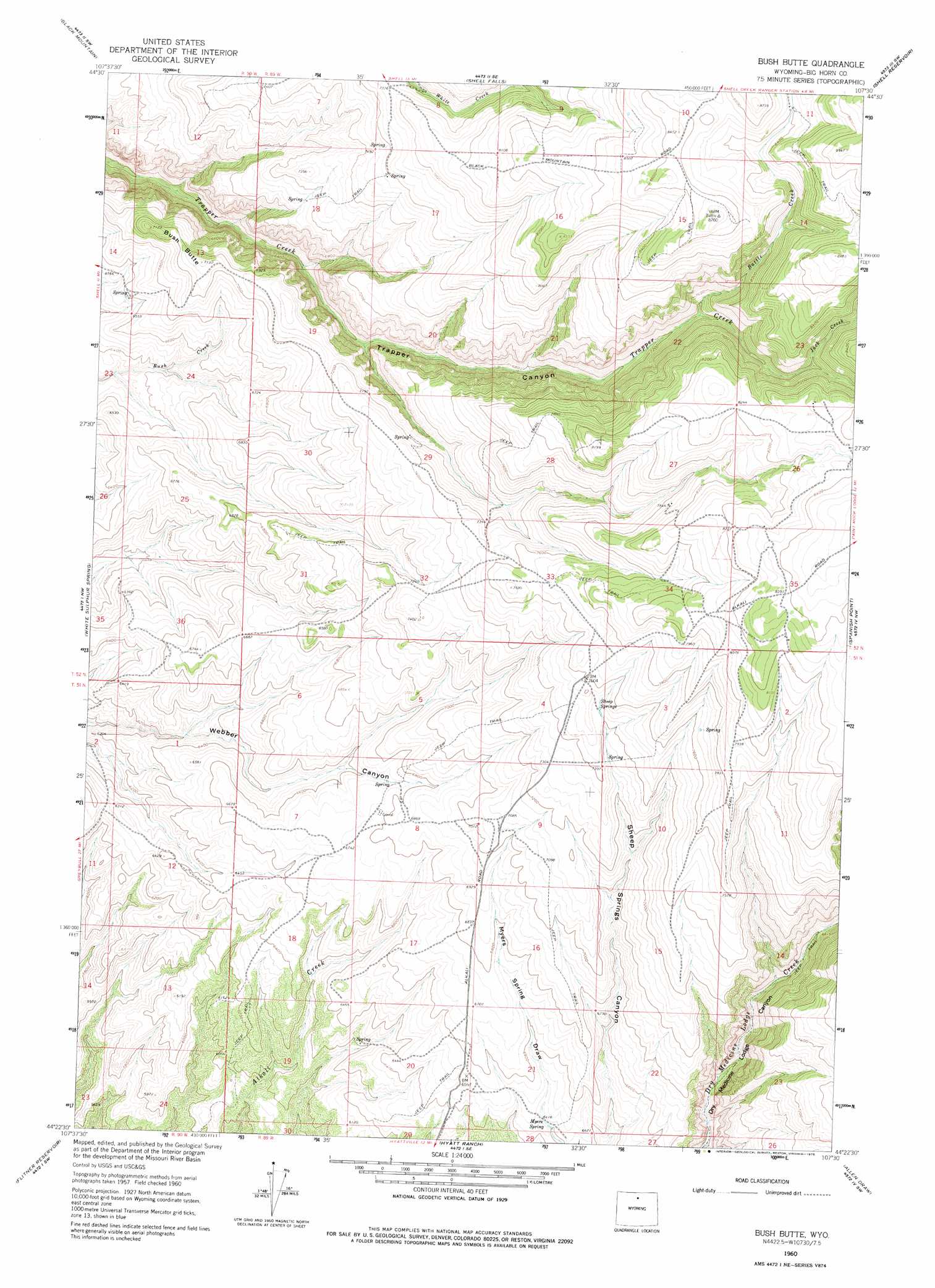
Bush Butte Topo Map Wyoming
To zoom in, hover over the map of Bush Butte
USGS Topo Quad 44107d5 - 1:24,000 scale
| Topo Map Name: | Bush Butte |
| USGS Topo Quad ID: | 44107d5 |
| Print Size: | ca. 21 1/4" wide x 27" high |
| Southeast Coordinates: | 44.375° N latitude / 107.5° W longitude |
| Map Center Coordinates: | 44.4375° N latitude / 107.5625° W longitude |
| U.S. State: | WY |
| Filename: | o44107d5.jpg |
| Download Map JPG Image: | Bush Butte topo map 1:24,000 scale |
| Map Type: | Topographic |
| Topo Series: | 7.5´ |
| Map Scale: | 1:24,000 |
| Source of Map Images: | United States Geological Survey (USGS) |
| Alternate Map Versions: |
Bush Butte WY 1960, updated 1962 Download PDF Buy paper map Bush Butte WY 1960, updated 1975 Download PDF Buy paper map Bush Butte WY 1960, updated 1975 Download PDF Buy paper map Bush Butte WY 2012 Download PDF Buy paper map Bush Butte WY 2015 Download PDF Buy paper map |
1:24,000 Topo Quads surrounding Bush Butte
Leavitt Reservoir |
Hidden Tepee Creek |
Granite Pass |
Woodrock |
Walker Mountain |
Shell |
Black Mountain |
Shell Falls |
Shell Reservoir |
Dome Lake |
Manderson Ne |
White Sulphur Spring |
Bush Butte |
Spanish Point |
Shell Lake |
Manderson Se |
Flitner Reservoir |
Hyatt Ranch |
Allen Draw |
Lake Solitude |
Mcdermotts Butte |
Weintz Draw |
Hyattville |
Pierce Draw |
Brokenback Narrows |
> Back to 44107a1 at 1:100,000 scale
> Back to 44106a1 at 1:250,000 scale
> Back to U.S. Topo Maps home
Bush Butte topo map: Gazetteer
Bush Butte: Springs
Myers Spring elevation 1956m 6417′Sheep Springs elevation 2278m 7473′
Bush Butte: Streams
Battle Creek elevation 2240m 7349′Jack Creek elevation 2372m 7782′
Bush Butte: Summits
Bush Butte elevation 2176m 7139′Bush Butte digital topo map on disk
Buy this Bush Butte topo map showing relief, roads, GPS coordinates and other geographical features, as a high-resolution digital map file on DVD:
Eastern Wyoming & Western South Dakota
Buy digital topo maps: Eastern Wyoming & Western South Dakota