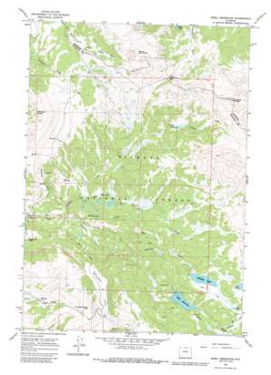
Shell Reservoir Topo Map Wyoming
To zoom in, hover over the map of Shell Reservoir
USGS Topo Quad 44107e4 - 1:24,000 scale
| Topo Map Name: | Shell Reservoir |
| USGS Topo Quad ID: | 44107e4 |
| Print Size: | ca. 21 1/4" wide x 27" high |
| Southeast Coordinates: | 44.5° N latitude / 107.375° W longitude |
| Map Center Coordinates: | 44.5625° N latitude / 107.4375° W longitude |
| U.S. State: | WY |
| Filename: | o44107e4.jpg |
| Download Map JPG Image: | Shell Reservoir topo map 1:24,000 scale |
| Map Type: | Topographic |
| Topo Series: | 7.5´ |
| Map Scale: | 1:24,000 |
| Source of Map Images: | United States Geological Survey (USGS) |
| Alternate Map Versions: |
Shell Reservoir WY 1964, updated 1968 Download PDF Buy paper map Shell Reservoir WY 1964, updated 1980 Download PDF Buy paper map Shell Reservoir WY 1964, updated 1987 Download PDF Buy paper map Shell Reservoir WY 1993, updated 1997 Download PDF Buy paper map Shell Reservoir WY 1993, updated 1997 Download PDF Buy paper map Shell Reservoir WY 2012 Download PDF Buy paper map Shell Reservoir WY 2015 Download PDF Buy paper map |
| FStopo: | US Forest Service topo Shell Reservoir is available: Download FStopo PDF Download FStopo TIF |
1:24,000 Topo Quads surrounding Shell Reservoir
> Back to 44107e1 at 1:100,000 scale
> Back to 44106a1 at 1:250,000 scale
> Back to U.S. Topo Maps home
Shell Reservoir topo map: Gazetteer
Shell Reservoir: Dams
Adelaide Dam elevation 2887m 9471′Shell Dam elevation 2743m 8999′
Shell Reservoir: Forests
Bighorn National Forest elevation 2610m 8562′Shell Reservoir: Gaps
Woodchuck Pass elevation 2937m 9635′Shell Reservoir: Lakes
Adelaide Lake elevation 2820m 9251′Bruce Mountain Lake elevation 2876m 9435′
Calvin Lake elevation 2913m 9557′
Lake Arden elevation 2876m 9435′
Mud Lake elevation 2836m 9304′
Willett Lake elevation 2834m 9297′
Shell Reservoir: Reservoirs
Adelaide Reservoir elevation 2887m 9471′Shell Reservoir elevation 2744m 9002′
Shell Reservoir: Streams
Adelaide Creek elevation 2605m 8546′Antelope Creek elevation 2341m 7680′
Buckley Creek elevation 2792m 9160′
Crooked Creek elevation 2469m 8100′
Mail Creek elevation 2439m 8001′
McKinnon Creek elevation 2438m 7998′
Moraine Creek elevation 2614m 8576′
Willett Creek elevation 2428m 7965′
Shell Reservoir: Summits
Antelope Butte elevation 3027m 9931′Bruce Mountain elevation 3148m 10328′
Crooked Creek Hill elevation 2931m 9616′
Dome Peak elevation 3294m 10807′
Shell Reservoir: Trails
Adelaide Trail elevation 2442m 8011′Shell Reservoir digital topo map on disk
Buy this Shell Reservoir topo map showing relief, roads, GPS coordinates and other geographical features, as a high-resolution digital map file on DVD:
Eastern Wyoming & Western South Dakota
Buy digital topo maps: Eastern Wyoming & Western South Dakota


