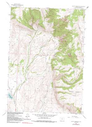
Leavitt Reservoir Topo Map Wyoming
To zoom in, hover over the map of Leavitt Reservoir
USGS Topo Quad 44107f7 - 1:24,000 scale
| Topo Map Name: | Leavitt Reservoir |
| USGS Topo Quad ID: | 44107f7 |
| Print Size: | ca. 21 1/4" wide x 27" high |
| Southeast Coordinates: | 44.625° N latitude / 107.75° W longitude |
| Map Center Coordinates: | 44.6875° N latitude / 107.8125° W longitude |
| U.S. State: | WY |
| Filename: | o44107f7.jpg |
| Download Map JPG Image: | Leavitt Reservoir topo map 1:24,000 scale |
| Map Type: | Topographic |
| Topo Series: | 7.5´ |
| Map Scale: | 1:24,000 |
| Source of Map Images: | United States Geological Survey (USGS) |
| Alternate Map Versions: |
Leavitt Reservoir WY 1960, updated 1963 Download PDF Buy paper map Leavitt Reservoir WY 1960, updated 1972 Download PDF Buy paper map Leavitt Reservoir WY 1960, updated 1991 Download PDF Buy paper map Leavitt Reservoir WY 1993, updated 1997 Download PDF Buy paper map Leavitt Reservoir WY 2012 Download PDF Buy paper map Leavitt Reservoir WY 2015 Download PDF Buy paper map |
| FStopo: | US Forest Service topo Leavitt Reservoir is available: Download FStopo PDF Download FStopo TIF |
1:24,000 Topo Quads surrounding Leavitt Reservoir
> Back to 44107e1 at 1:100,000 scale
> Back to 44106a1 at 1:250,000 scale
> Back to U.S. Topo Maps home
Leavitt Reservoir topo map: Gazetteer
Leavitt Reservoir: Canals
London Ditch elevation 1797m 5895′Leavitt Reservoir: Dams
Leavitt Dam elevation 1469m 4819′Leavitt Reservoir: Mines
Beaver Creek Mine elevation 1466m 4809′Leavitt Reservoir: Reservoirs
Leavitt Reservoir elevation 1469m 4819′Leavitt Reservoir elevation 1454m 4770′
Leavitt Reservoir: Streams
Cedar Creek elevation 1546m 5072′Cow Creek elevation 1920m 6299′
Hudson Falls Creek elevation 1807m 5928′
North Beaver Creek elevation 1594m 5229′
South Beaver Creek elevation 1593m 5226′
Whaley Creek elevation 1920m 6299′
Leavitt Reservoir: Summits
Hunt Mountain elevation 3053m 10016′Leavitt Reservoir: Valleys
Davis Draw elevation 1454m 4770′Fenton Draw elevation 1476m 4842′
Leavitt Reservoir digital topo map on disk
Buy this Leavitt Reservoir topo map showing relief, roads, GPS coordinates and other geographical features, as a high-resolution digital map file on DVD:
Eastern Wyoming & Western South Dakota
Buy digital topo maps: Eastern Wyoming & Western South Dakota


