Wolf Topo Map Wyoming
To zoom in, hover over the map of Wolf
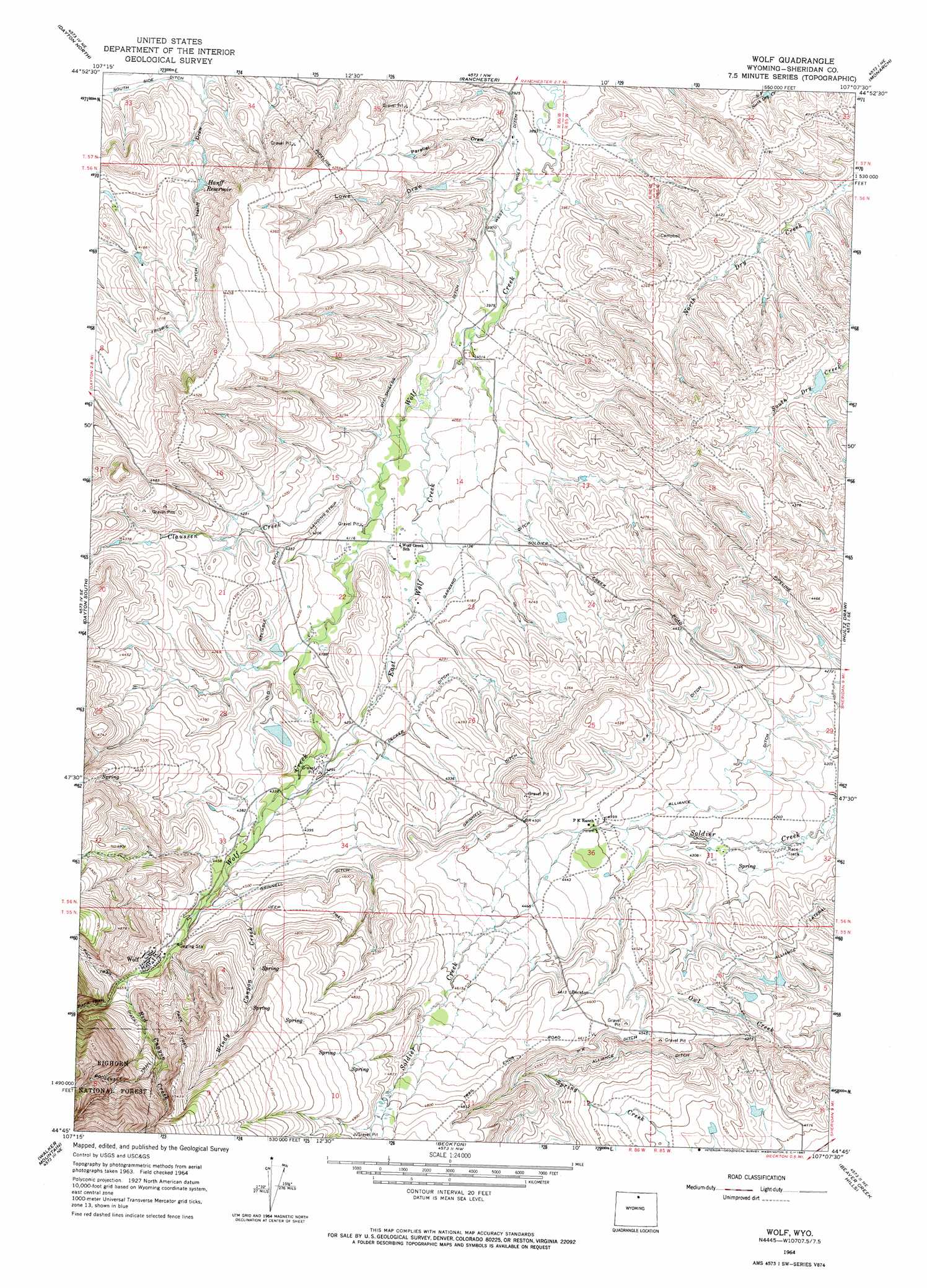
USGS Topo Quad 44107g2 - 1:24,000 scale
| Topo Map Name: | Wolf |
| USGS Topo Quad ID: | 44107g2 |
| Print Size: | ca. 21 1/4" wide x 27" high |
| Southeast Coordinates: | 44.75° N latitude / 107.125° W longitude |
| Map Center Coordinates: | 44.8125° N latitude / 107.1875° W longitude |
| U.S. State: | WY |
| Filename: | o44107g2.jpg |
| Download Map JPG Image: | Wolf topo map 1:24,000 scale |
| Map Type: | Topographic |
| Topo Series: | 7.5´ |
| Map Scale: | 1:24,000 |
| Source of Map Images: | United States Geological Survey (USGS) |
| Alternate Map Versions: |
Wolf WY 1964, updated 1967 Download PDF Buy paper map Wolf WY 1993, updated 1997 Download PDF Buy paper map Wolf WY 2012 Download PDF Buy paper map Wolf WY 2015 Download PDF Buy paper map |
| FStopo: | US Forest Service topo Wolf is available: Download FStopo PDF Download FStopo TIF |
1:24,000 Topo Quads surrounding Wolf
Pass Creek West |
Pass Creek East |
Little Bear Creek |
Bar V Ranch |
Pearl School |
Columbus Peak |
Dayton North |
Ranchester |
Monarch |
Acme |
Skull Ridge |
Dayton South |
Wolf |
Hultz Draw |
Sheridan |
Woodrock |
Walker Mountain |
Beckton |
Beaver Creek Hills |
Big Horn |
Shell Reservoir |
Dome Lake |
Park Reservoir |
Little Goose Peak |
Story |
> Back to 44107e1 at 1:100,000 scale
> Back to 44106a1 at 1:250,000 scale
> Back to U.S. Topo Maps home
Wolf topo map: Gazetteer
Wolf: Canals
Alliance Ditch elevation 1313m 4307′Decker Ditch elevation 1305m 4281′
Dye-Shields Ditch elevation 1236m 4055′
Garrard Ditch elevation 1266m 4153′
Grinnell Ditch elevation 1355m 4445′
Old Reliable Ditch elevation 1299m 4261′
P K Ditch elevation 1362m 4468′
West Wolf Ditch elevation 1200m 3937′
Wolf: Dams
J and H Ranch Number 1 Dam elevation 1258m 4127′Roberts Dam elevation 1317m 4320′
Wolf: Populated Places
Wolf elevation 1410m 4625′Wolf: Reservoirs
Hanff Reservoir elevation 1245m 4084′J and H Ranch Number 1 Reservoir elevation 1258m 4127′
Roberts Reservoir elevation 1317m 4320′
Wolf: Streams
Claussen Creek elevation 1250m 4101′East Wolf Creek elevation 1225m 4019′
Red Canyon Creek elevation 1410m 4625′
Windy Canyon Creek elevation 1358m 4455′
Wolf: Valleys
Lowe Draw elevation 1211m 3973′Parallel Draw elevation 1207m 3959′
Wolf digital topo map on disk
Buy this Wolf topo map showing relief, roads, GPS coordinates and other geographical features, as a high-resolution digital map file on DVD:
Eastern Wyoming & Western South Dakota
Buy digital topo maps: Eastern Wyoming & Western South Dakota