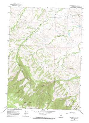
Columbus Peak Topo Map Wyoming
To zoom in, hover over the map of Columbus Peak
USGS Topo Quad 44107h4 - 1:24,000 scale
| Topo Map Name: | Columbus Peak |
| USGS Topo Quad ID: | 44107h4 |
| Print Size: | ca. 21 1/4" wide x 27" high |
| Southeast Coordinates: | 44.875° N latitude / 107.375° W longitude |
| Map Center Coordinates: | 44.9375° N latitude / 107.4375° W longitude |
| U.S. State: | WY |
| Filename: | o44107h4.jpg |
| Download Map JPG Image: | Columbus Peak topo map 1:24,000 scale |
| Map Type: | Topographic |
| Topo Series: | 7.5´ |
| Map Scale: | 1:24,000 |
| Source of Map Images: | United States Geological Survey (USGS) |
| Alternate Map Versions: |
Columbus Peak WY 1964, updated 1968 Download PDF Buy paper map Columbus Peak WY 1993, updated 1997 Download PDF Buy paper map Columbus Peak WY 2012 Download PDF Buy paper map Columbus Peak WY 2015 Download PDF Buy paper map |
| FStopo: | US Forest Service topo Columbus Peak is available: Download FStopo PDF Download FStopo TIF |
1:24,000 Topo Quads surrounding Columbus Peak
> Back to 44107e1 at 1:100,000 scale
> Back to 44106a1 at 1:250,000 scale
> Back to U.S. Topo Maps home
Columbus Peak topo map: Gazetteer
Columbus Peak: Canals
Church Ditch elevation 1420m 4658′Tschirgi Ditch Number 1 elevation 1437m 4714′
Columbus Peak: Dams
Kiewit Number 1 Dam elevation 1480m 4855′Kiewit Number 2 Dam elevation 1514m 4967′
Reynolds Number 1 Dam elevation 1330m 4363′
Reynolds Number 2 Dam elevation 1285m 4215′
Columbus Peak: Mines
Acme Mine elevation 1870m 6135′Barbula Turley Mine elevation 1367m 4484′
Columbus Peak: Reservoirs
Kiewit Reservoir Number 1 elevation 1480m 4855′Kiewit Reservoir Number 2 elevation 1514m 4967′
Reynolds Reservoir Number 1 elevation 1330m 4363′
Reynolds Reservoir Number 2 elevation 1285m 4215′
Columbus Peak: Streams
East Fork East Pass Creek elevation 1783m 5849′Middle Fork East Pass Creek elevation 1687m 5534′
Taffner Creek elevation 1478m 4849′
West Fork East Pass Creek elevation 1591m 5219′
Columbus Peak: Summits
Columbus Peak elevation 1651m 5416′Columbus Peak digital topo map on disk
Buy this Columbus Peak topo map showing relief, roads, GPS coordinates and other geographical features, as a high-resolution digital map file on DVD:
Eastern Wyoming & Western South Dakota
Buy digital topo maps: Eastern Wyoming & Western South Dakota


