Schuster Flats Topo Map Wyoming
To zoom in, hover over the map of Schuster Flats
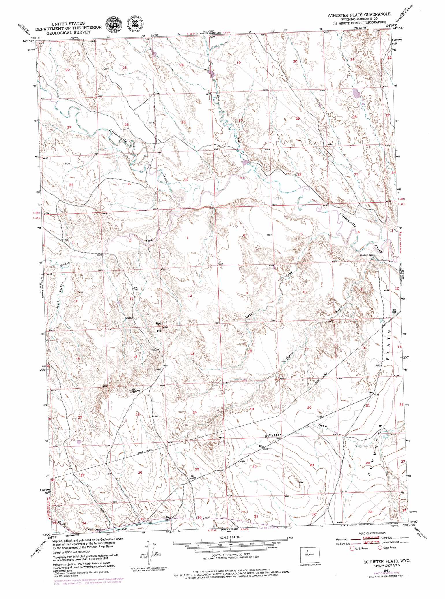
USGS Topo Quad 44108a2 - 1:24,000 scale
| Topo Map Name: | Schuster Flats |
| USGS Topo Quad ID: | 44108a2 |
| Print Size: | ca. 21 1/4" wide x 27" high |
| Southeast Coordinates: | 44° N latitude / 108.125° W longitude |
| Map Center Coordinates: | 44.0625° N latitude / 108.1875° W longitude |
| U.S. State: | WY |
| Filename: | o44108a2.jpg |
| Download Map JPG Image: | Schuster Flats topo map 1:24,000 scale |
| Map Type: | Topographic |
| Topo Series: | 7.5´ |
| Map Scale: | 1:24,000 |
| Source of Map Images: | United States Geological Survey (USGS) |
| Alternate Map Versions: |
Schuster Flats WY 1951, updated 1952 Download PDF Buy paper map Schuster Flats WY 1951, updated 1979 Download PDF Buy paper map Schuster Flats WY 2012 Download PDF Buy paper map Schuster Flats WY 2015 Download PDF Buy paper map |
1:24,000 Topo Quads surrounding Schuster Flats
Sheep Mountain |
Wardel Reservoir |
Jones Reservoir |
Orchard Bench |
Manderson |
Dutch Nick Flat Nw |
Sucker Dam |
Schuster Flats Nw |
Schuster Flats Ne |
Rairden |
Dutch Nick Flat Sw |
Dutch Nick Flat |
Schuster Flats |
Schuster Flats Se |
Worland |
Blue Mesa West |
Blue Mesa East |
Chimney Gulch |
Neiber |
Banjo Flats West |
Gloin Reservoir |
Little Sand Draw |
Kirby |
Cedar Mountain |
Zimmerman Buttes |
> Back to 44108a1 at 1:100,000 scale
> Back to 44108a1 at 1:250,000 scale
> Back to U.S. Topo Maps home
Schuster Flats topo map: Gazetteer
Schuster Flats: Flats
Schuster Flats elevation 1335m 4379′Schuster Flats: Streams
Middle Fork Fifteenmile Creek elevation 1305m 4281′North Fork Fifteenmile Creek elevation 1298m 4258′
South Fork Fifteenmile Creek elevation 1325m 4347′
Schuster Flats: Summits
Red Hill elevation 1412m 4632′Schuster Flats: Valleys
Basin Draw elevation 1287m 4222′Butler Draw elevation 1281m 4202′
Schuster Flats digital topo map on disk
Buy this Schuster Flats topo map showing relief, roads, GPS coordinates and other geographical features, as a high-resolution digital map file on DVD: