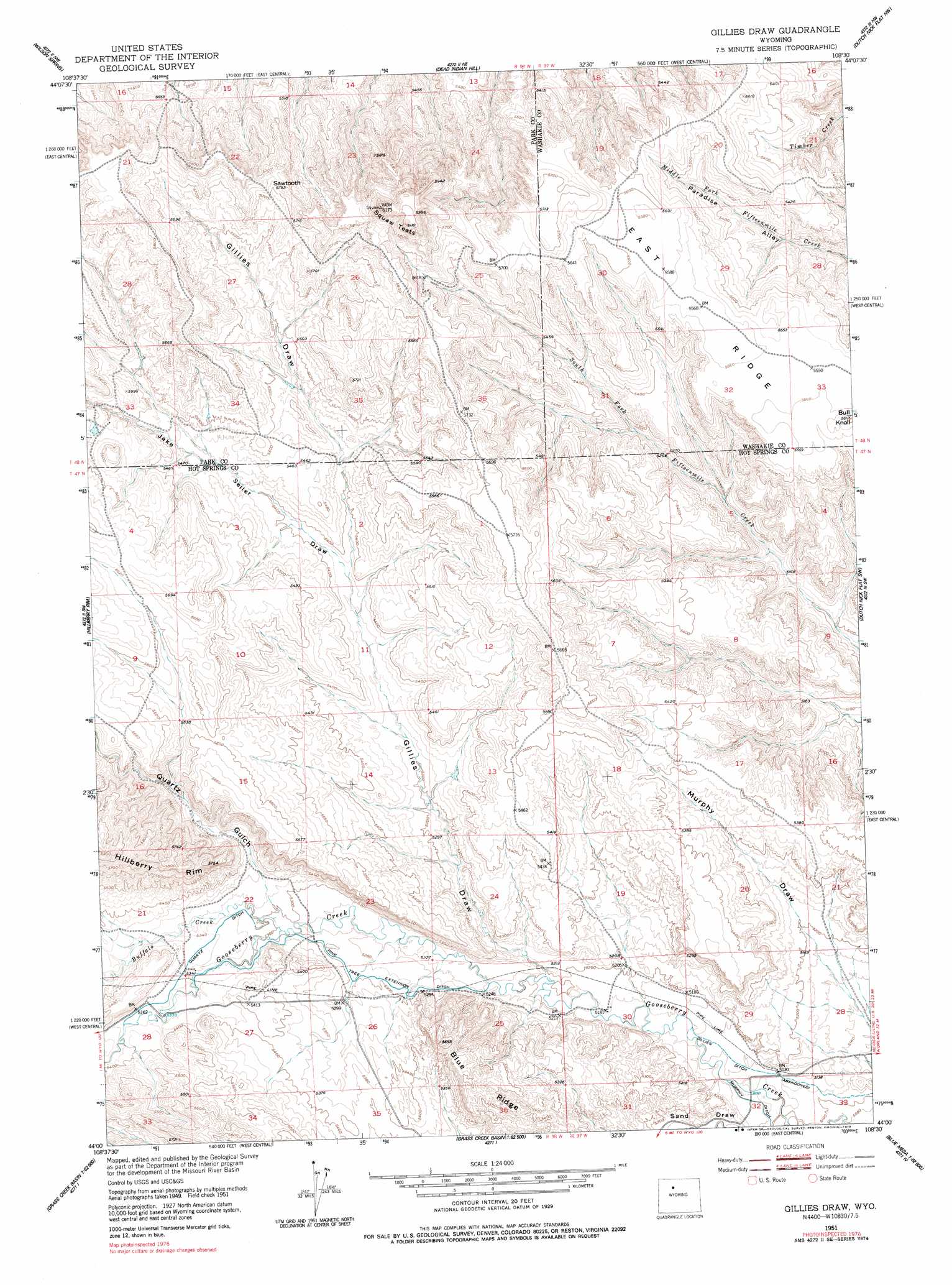
Gillies Draw Topo Map Wyoming
To zoom in, hover over the map of Gillies Draw
USGS Topo Quad 44108a5 - 1:24,000 scale
| Topo Map Name: | Gillies Draw |
| USGS Topo Quad ID: | 44108a5 |
| Print Size: | ca. 21 1/4" wide x 27" high |
| Southeast Coordinates: | 44° N latitude / 108.5° W longitude |
| Map Center Coordinates: | 44.0625° N latitude / 108.5625° W longitude |
| U.S. State: | WY |
| Filename: | o44108a5.jpg |
| Download Map JPG Image: | Gillies Draw topo map 1:24,000 scale |
| Map Type: | Topographic |
| Topo Series: | 7.5´ |
| Map Scale: | 1:24,000 |
| Source of Map Images: | United States Geological Survey (USGS) |
| Alternate Map Versions: |
Gillies Draw WY 1951, updated 1953 Download PDF Buy paper map Gillies Draw WY 1951, updated 1978 Download PDF Buy paper map Gillies Draw WY 2012 Download PDF Buy paper map Gillies Draw WY 2015 Download PDF Buy paper map |
1:24,000 Topo Quads surrounding Gillies Draw
Sleepers Ranch |
Sheets Flat |
Tatman Mountain |
Sheep Mountain |
Wardel Reservoir |
Meeteetse East |
Wilson Spring |
Dead Indian Hill |
Dutch Nick Flat Nw |
Sucker Dam |
Little Buffalo Basin |
Hillberry Rim |
Gillies Draw |
Dutch Nick Flat Sw |
Dutch Nick Flat |
Adam Weiss Peak |
Grass Creek |
Red Ridge |
Blue Mesa West |
Blue Mesa East |
Twentyone Creek |
Crater Sink |
Hamilton Dome |
Gloin Reservoir |
Little Sand Draw |
> Back to 44108a1 at 1:100,000 scale
> Back to 44108a1 at 1:250,000 scale
> Back to U.S. Topo Maps home
Gillies Draw topo map: Gazetteer
Gillies Draw: Canals
Murphy Ditch elevation 1561m 5121′Pine Tree Extension Ditch elevation 1602m 5255′
Quartz Ditch elevation 1628m 5341′
Gillies Draw: Streams
Buffalo Creek elevation 1615m 5298′Gillies Draw: Summits
Bull Knoll elevation 1709m 5606′Sawtooth elevation 1744m 5721′
Squaw Teats elevation 1832m 6010′
Gillies Draw: Valleys
Gillies Draw elevation 1585m 5200′Jake Seller Draw elevation 1639m 5377′
Quartz Gulch elevation 1613m 5291′
Sand Draw elevation 1564m 5131′
Gillies Draw digital topo map on disk
Buy this Gillies Draw topo map showing relief, roads, GPS coordinates and other geographical features, as a high-resolution digital map file on DVD: