Schuster Flats Nw Topo Map Wyoming
To zoom in, hover over the map of Schuster Flats Nw
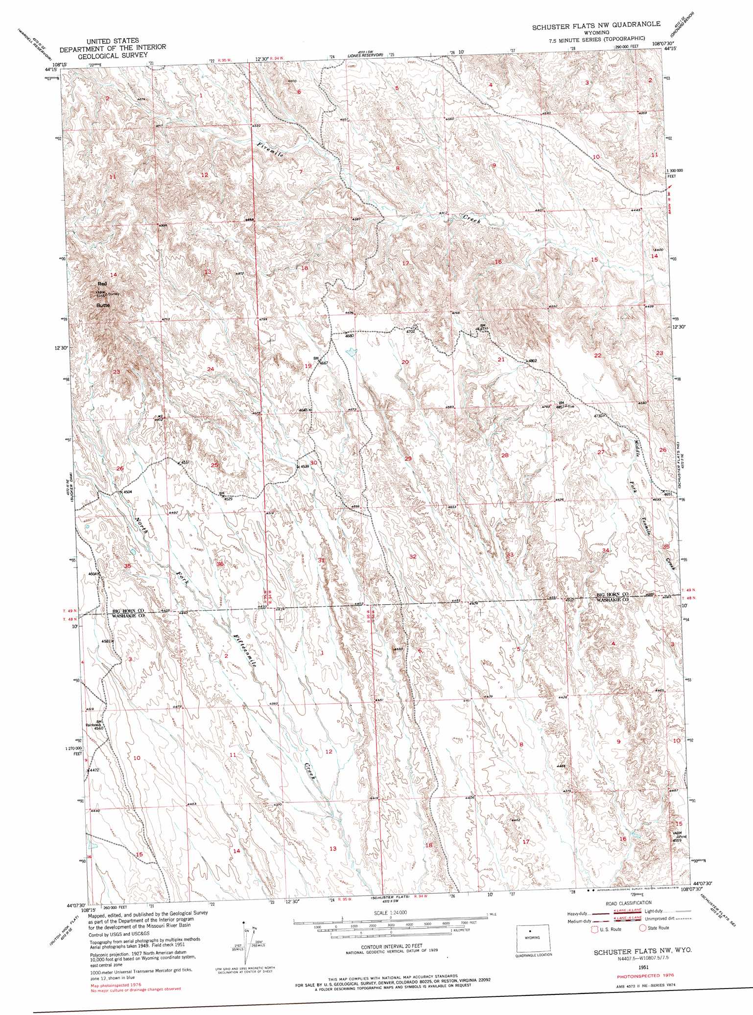
USGS Topo Quad 44108b2 - 1:24,000 scale
| Topo Map Name: | Schuster Flats Nw |
| USGS Topo Quad ID: | 44108b2 |
| Print Size: | ca. 21 1/4" wide x 27" high |
| Southeast Coordinates: | 44.125° N latitude / 108.125° W longitude |
| Map Center Coordinates: | 44.1875° N latitude / 108.1875° W longitude |
| U.S. State: | WY |
| Filename: | o44108b2.jpg |
| Download Map JPG Image: | Schuster Flats Nw topo map 1:24,000 scale |
| Map Type: | Topographic |
| Topo Series: | 7.5´ |
| Map Scale: | 1:24,000 |
| Source of Map Images: | United States Geological Survey (USGS) |
| Alternate Map Versions: |
Schuster Flats NW WY 1951, updated 1952 Download PDF Buy paper map Schuster Flats NW WY 1951, updated 1978 Download PDF Buy paper map Schuster Flats NW WY 2012 Download PDF Buy paper map Schuster Flats NW WY 2015 Download PDF Buy paper map |
1:24,000 Topo Quads surrounding Schuster Flats Nw
Burlington |
Otto |
Gould Butte |
Greybull South |
Wild Horse Flats |
Sheep Mountain |
Wardel Reservoir |
Jones Reservoir |
Orchard Bench |
Manderson |
Dutch Nick Flat Nw |
Sucker Dam |
Schuster Flats Nw |
Schuster Flats Ne |
Rairden |
Dutch Nick Flat Sw |
Dutch Nick Flat |
Schuster Flats |
Schuster Flats Se |
Worland |
Blue Mesa West |
Blue Mesa East |
Chimney Gulch |
Neiber |
Banjo Flats West |
> Back to 44108a1 at 1:100,000 scale
> Back to 44108a1 at 1:250,000 scale
> Back to U.S. Topo Maps home
Schuster Flats Nw digital topo map on disk
Buy this Schuster Flats Nw topo map showing relief, roads, GPS coordinates and other geographical features, as a high-resolution digital map file on DVD: