Elk Butte Topo Map Wyoming
To zoom in, hover over the map of Elk Butte
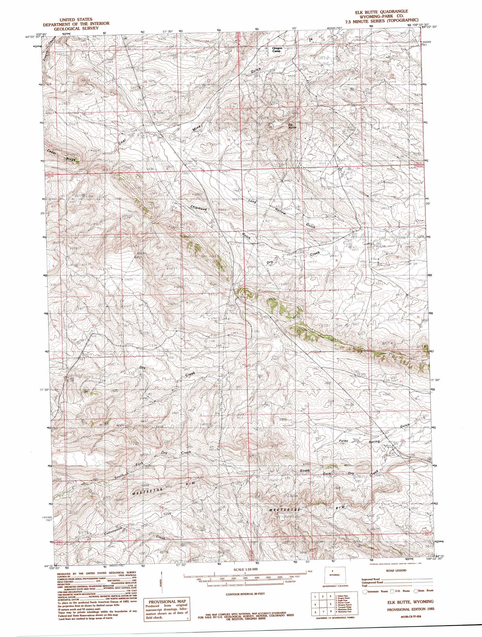
USGS Topo Quad 44108c8 - 1:24,000 scale
| Topo Map Name: | Elk Butte |
| USGS Topo Quad ID: | 44108c8 |
| Print Size: | ca. 21 1/4" wide x 27" high |
| Southeast Coordinates: | 44.25° N latitude / 108.875° W longitude |
| Map Center Coordinates: | 44.3125° N latitude / 108.9375° W longitude |
| U.S. State: | WY |
| Filename: | o44108c8.jpg |
| Download Map JPG Image: | Elk Butte topo map 1:24,000 scale |
| Map Type: | Topographic |
| Topo Series: | 7.5´ |
| Map Scale: | 1:24,000 |
| Source of Map Images: | United States Geological Survey (USGS) |
| Alternate Map Versions: |
Elk Butte WY 1985, updated 1985 Download PDF Buy paper map Elk Butte WY 2012 Download PDF Buy paper map Elk Butte WY 2015 Download PDF Buy paper map |
1:24,000 Topo Quads surrounding Elk Butte
Shoshone Canyon |
Cody |
Corbett Dam |
Stone Barn Camp |
Gilmore Hill |
Irma Flats |
Indian Pass |
Oregon Basin |
Eagle Pass |
Y U Bench Nw |
Devils Tooth |
Horner Creek |
Elk Butte |
Sleepers Ranch |
Sheets Flat |
Thomas Reservoir |
Tonopah Ridge |
Meeteetse West |
Meeteetse East |
Wilson Spring |
Pitchfork |
Sunshine Reservoir |
Iron Creek |
Little Buffalo Basin |
Hillberry Rim |
> Back to 44108a1 at 1:100,000 scale
> Back to 44108a1 at 1:250,000 scale
> Back to U.S. Topo Maps home
Elk Butte topo map: Gazetteer
Elk Butte: Dams
First Enlargement Thomsen Dam elevation 1784m 5853′Elk Butte: Mines
West Wiley Mine elevation 1938m 6358′Elk Butte: Populated Places
Dry Creek elevation 1723m 5652′Elk Butte: Reservoirs
First Enlargement Thomsen Reservoir elevation 1784m 5853′Elk Butte: Summits
Elk Butte elevation 1888m 6194′Elk Butte digital topo map on disk
Buy this Elk Butte topo map showing relief, roads, GPS coordinates and other geographical features, as a high-resolution digital map file on DVD: