Greybull North Topo Map Wyoming
To zoom in, hover over the map of Greybull North
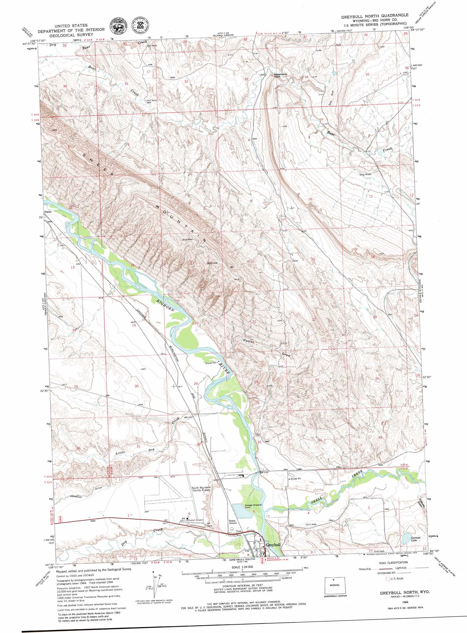
USGS Topo Quad 44108e1 - 1:24,000 scale
| Topo Map Name: | Greybull North |
| USGS Topo Quad ID: | 44108e1 |
| Print Size: | ca. 21 1/4" wide x 27" high |
| Southeast Coordinates: | 44.5° N latitude / 108° W longitude |
| Map Center Coordinates: | 44.5625° N latitude / 108.0625° W longitude |
| U.S. State: | WY |
| Filename: | o44108e1.jpg |
| Download Map JPG Image: | Greybull North topo map 1:24,000 scale |
| Map Type: | Topographic |
| Topo Series: | 7.5´ |
| Map Scale: | 1:24,000 |
| Source of Map Images: | United States Geological Survey (USGS) |
| Alternate Map Versions: |
Greybull North WY 1966, updated 1969 Download PDF Buy paper map Greybull North WY 1966, updated 1979 Download PDF Buy paper map Greybull North WY 2012 Download PDF Buy paper map Greybull North WY 2015 Download PDF Buy paper map |
1:24,000 Topo Quads surrounding Greybull North
Lovell Lakes |
Kane |
Cottonwood Canyon |
Medicine Wheel |
Bald Mountain |
North Emblem Reservoir |
Spence |
Alkali Creek |
Bear Creek Ranch |
Leavitt Reservoir |
Emblem Se |
Sheep Canyon |
Greybull North |
Devils Kitchen |
Shell |
Otto |
Gould Butte |
Greybull South |
Wild Horse Flats |
Manderson Ne |
Wardel Reservoir |
Jones Reservoir |
Orchard Bench |
Manderson |
Manderson Se |
> Back to 44108e1 at 1:100,000 scale
> Back to 44108a1 at 1:250,000 scale
> Back to U.S. Topo Maps home
Greybull North topo map: Gazetteer
Greybull North: Airports
South Big Horn County Airport elevation 1194m 3917′Greybull North: Dams
Garnett Dam elevation 1193m 3914′Greybull North: Mines
Big Horn River Area Mine elevation 1269m 4163′Crystal Mine elevation 1194m 3917′
Greybull Area Number Four Mine elevation 1246m 4087′
Greybull Area Number Three Mine elevation 1258m 4127′
Greybull Area Number Two Mine elevation 1303m 4274′
Robertson Claim Number One Mine elevation 1301m 4268′
Sheep Mountain Anticline Number One Mine elevation 1352m 4435′
Sheep Mountain Anticline Number Two Mine elevation 1348m 4422′
Wyo-Ben Products Mine elevation 1151m 3776′
Greybull North: Pillars
Steamship Rock elevation 1237m 4058′Greybull North: Ranges
Sheep Mountain elevation 1471m 4826′Greybull North: Reservoirs
Garnett Lake elevation 1215m 3986′Garnett Reservoir elevation 1193m 3914′
Greybull North: Streams
Dry Creek elevation 1148m 3766′Little Dry Creek elevation 1143m 3750′
Shell Creek elevation 1149m 3769′
Greybull North: Valleys
Frenchy Draw elevation 1171m 3841′Porter Draw elevation 1144m 3753′
Greybull North digital topo map on disk
Buy this Greybull North topo map showing relief, roads, GPS coordinates and other geographical features, as a high-resolution digital map file on DVD: