Gilmore Hill Nw Topo Map Wyoming
To zoom in, hover over the map of Gilmore Hill Nw
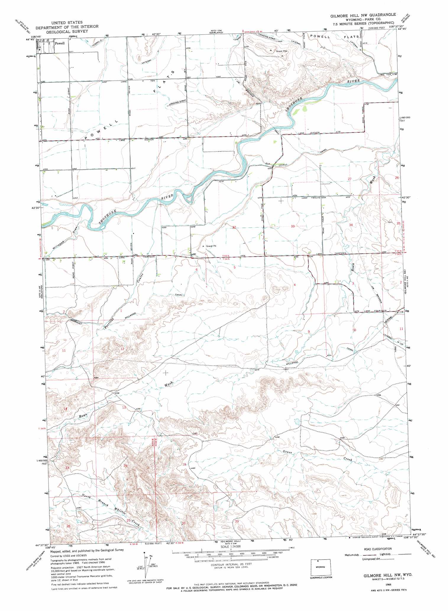
USGS Topo Quad 44108f6 - 1:24,000 scale
| Topo Map Name: | Gilmore Hill Nw |
| USGS Topo Quad ID: | 44108f6 |
| Print Size: | ca. 21 1/4" wide x 27" high |
| Southeast Coordinates: | 44.625° N latitude / 108.625° W longitude |
| Map Center Coordinates: | 44.6875° N latitude / 108.6875° W longitude |
| U.S. State: | WY |
| Filename: | o44108f6.jpg |
| Download Map JPG Image: | Gilmore Hill Nw topo map 1:24,000 scale |
| Map Type: | Topographic |
| Topo Series: | 7.5´ |
| Map Scale: | 1:24,000 |
| Source of Map Images: | United States Geological Survey (USGS) |
| Alternate Map Versions: |
Gilmore Hill NW WY 1966, updated 1970 Download PDF Buy paper map Gilmore Hill NW WY 1966, updated 1984 Download PDF Buy paper map Gilmore Hill NW WY 2012 Download PDF Buy paper map Gilmore Hill NW WY 2015 Download PDF Buy paper map |
1:24,000 Topo Quads surrounding Gilmore Hill Nw
Elk Basin Nw |
Elk Basin |
Deaver Reservoir |
Frannie |
Cowley |
Elk Basin Sw |
Elk Basin Se |
Garland |
Byron |
Lovell |
Vocation |
Ralston |
Gilmore Hill Nw |
Gilmore Hill Ne |
Jack Horner Reservoir |
Corbett Dam |
Stone Barn Camp |
Gilmore Hill |
Gilmore Hill Se |
Emblem |
Oregon Basin |
Eagle Pass |
Y U Bench Nw |
Y U Bench Ne |
Burlington |
> Back to 44108e1 at 1:100,000 scale
> Back to 44108a1 at 1:250,000 scale
> Back to U.S. Topo Maps home
Gilmore Hill Nw topo map: Gazetteer
Gilmore Hill Nw: Canals
Lateral U elevation 1329m 4360′Lateral W elevation 1291m 4235′
Gilmore Hill Nw: Trails
Jim Bridger Trail elevation 1271m 4169′Gilmore Hill Nw: Valleys
Peerless Coulee elevation 1284m 4212′Willwood Draw elevation 1295m 4248′
Gilmore Hill Nw digital topo map on disk
Buy this Gilmore Hill Nw topo map showing relief, roads, GPS coordinates and other geographical features, as a high-resolution digital map file on DVD: