Ralston Topo Map Wyoming
To zoom in, hover over the map of Ralston
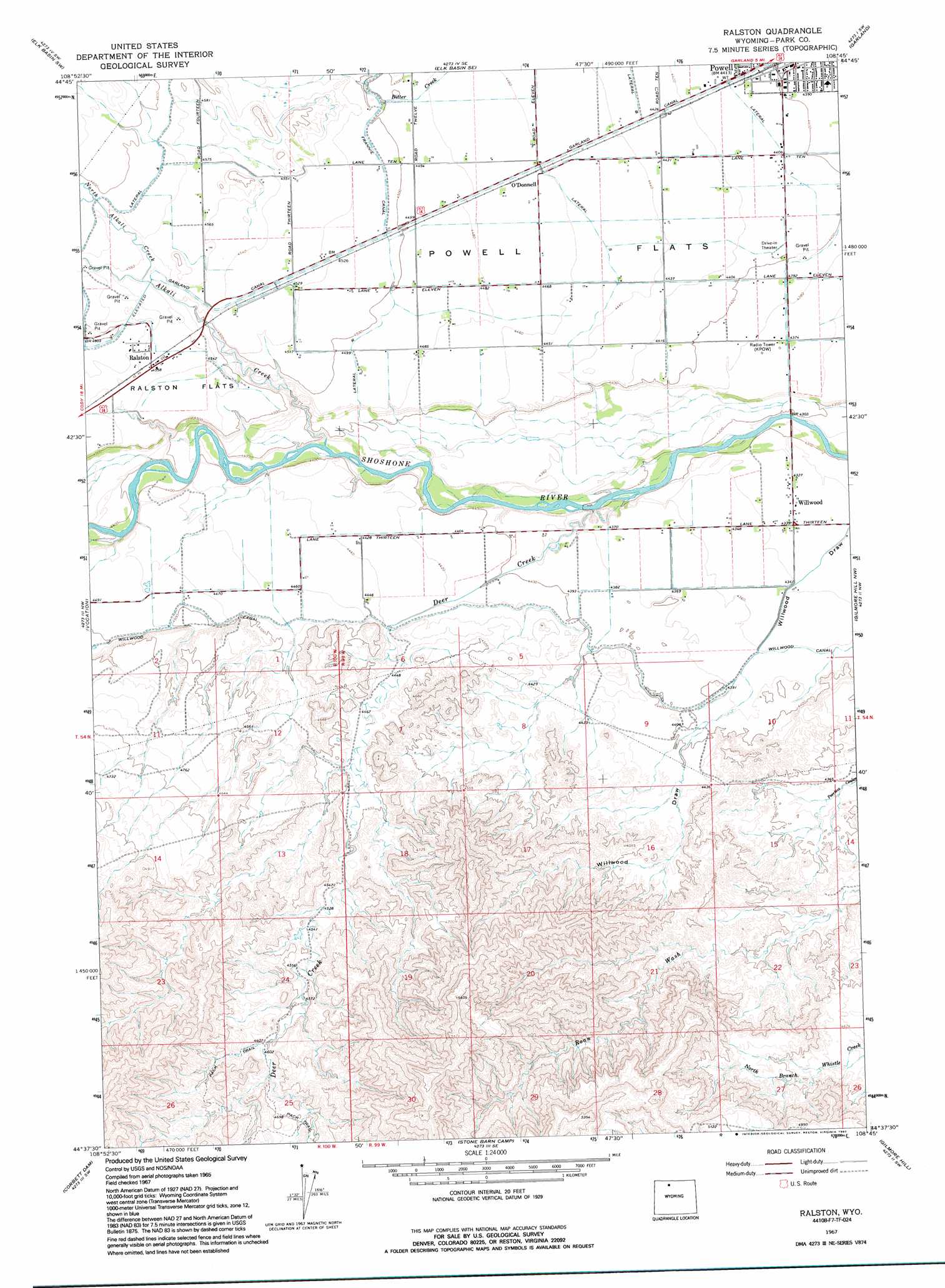
USGS Topo Quad 44108f7 - 1:24,000 scale
| Topo Map Name: | Ralston |
| USGS Topo Quad ID: | 44108f7 |
| Print Size: | ca. 21 1/4" wide x 27" high |
| Southeast Coordinates: | 44.625° N latitude / 108.75° W longitude |
| Map Center Coordinates: | 44.6875° N latitude / 108.8125° W longitude |
| U.S. State: | WY |
| Filename: | o44108f7.jpg |
| Download Map JPG Image: | Ralston topo map 1:24,000 scale |
| Map Type: | Topographic |
| Topo Series: | 7.5´ |
| Map Scale: | 1:24,000 |
| Source of Map Images: | United States Geological Survey (USGS) |
| Alternate Map Versions: |
Ralston WY 1967, updated 1971 Download PDF Buy paper map Ralston WY 1967, updated 1992 Download PDF Buy paper map Ralston WY 2012 Download PDF Buy paper map Ralston WY 2015 Download PDF Buy paper map |
1:24,000 Topo Quads surrounding Ralston
Badger Basin |
Elk Basin Nw |
Elk Basin |
Deaver Reservoir |
Frannie |
Badlands Hills |
Elk Basin Sw |
Elk Basin Se |
Garland |
Byron |
Eaglenest Basin |
Vocation |
Ralston |
Gilmore Hill Nw |
Gilmore Hill Ne |
Cody |
Corbett Dam |
Stone Barn Camp |
Gilmore Hill |
Gilmore Hill Se |
Indian Pass |
Oregon Basin |
Eagle Pass |
Y U Bench Nw |
Y U Bench Ne |
> Back to 44108e1 at 1:100,000 scale
> Back to 44108a1 at 1:250,000 scale
> Back to U.S. Topo Maps home
Ralston topo map: Gazetteer
Ralston: Canals
Lateral R elevation 1371m 4498′Lateral S elevation 1359m 4458′
Lateral T elevation 1344m 4409′
Ralston: Populated Places
Ralston elevation 1388m 4553′Willwood elevation 1321m 4333′
Ralston: Streams
Alkali Creek Patch elevation 1331m 4366′Deer Creek elevation 1311m 4301′
North Alkali Creek elevation 1385m 4543′
Ralston digital topo map on disk
Buy this Ralston topo map showing relief, roads, GPS coordinates and other geographical features, as a high-resolution digital map file on DVD: