Cottonwood Canyon Topo Map Wyoming
To zoom in, hover over the map of Cottonwood Canyon
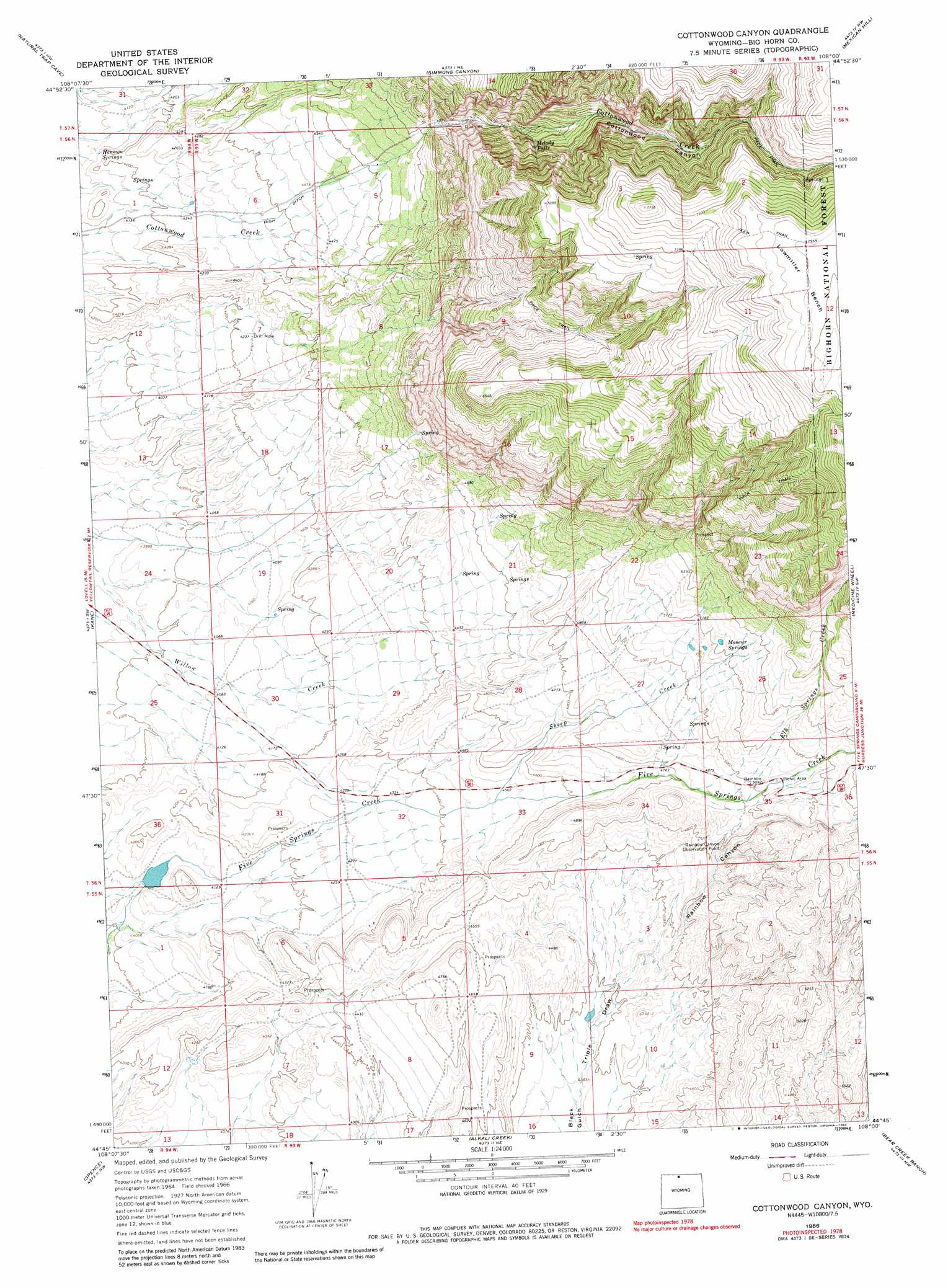
USGS Topo Quad 44108g1 - 1:24,000 scale
| Topo Map Name: | Cottonwood Canyon |
| USGS Topo Quad ID: | 44108g1 |
| Print Size: | ca. 21 1/4" wide x 27" high |
| Southeast Coordinates: | 44.75° N latitude / 108° W longitude |
| Map Center Coordinates: | 44.8125° N latitude / 108.0625° W longitude |
| U.S. State: | WY |
| Filename: | o44108g1.jpg |
| Download Map JPG Image: | Cottonwood Canyon topo map 1:24,000 scale |
| Map Type: | Topographic |
| Topo Series: | 7.5´ |
| Map Scale: | 1:24,000 |
| Source of Map Images: | United States Geological Survey (USGS) |
| Alternate Map Versions: |
Cottonwood Canyon WY 1966, updated 1969 Download PDF Buy paper map Cottonwood Canyon WY 1966, updated 1982 Download PDF Buy paper map Cottonwood Canyon WY 1993, updated 1997 Download PDF Buy paper map Cottonwood Canyon WY 2012 Download PDF Buy paper map Cottonwood Canyon WY 2015 Download PDF Buy paper map |
| FStopo: | US Forest Service topo Cottonwood Canyon is available: Download FStopo PDF Download FStopo TIF |
1:24,000 Topo Quads surrounding Cottonwood Canyon
Mystery Cave |
Hillsboro |
Two Point |
Bear Hole |
Red Springs |
Sykes Spring |
Natural Trap Cave |
Simmons Canyon |
Mexican Hill |
Boyd Ridge |
Lovell Lakes |
Kane |
Cottonwood Canyon |
Medicine Wheel |
Bald Mountain |
North Emblem Reservoir |
Spence |
Alkali Creek |
Bear Creek Ranch |
Leavitt Reservoir |
Emblem Se |
Sheep Canyon |
Greybull North |
Devils Kitchen |
Shell |
> Back to 44108e1 at 1:100,000 scale
> Back to 44108a1 at 1:250,000 scale
> Back to U.S. Topo Maps home
Cottonwood Canyon topo map: Gazetteer
Cottonwood Canyon: Benches
Lowmiller Bench elevation 2425m 7956′Cottonwood Canyon: Canals
High Ditch elevation 1342m 4402′Cottonwood Canyon: Dams
Five Springs Number 1 Dam elevation 1258m 4127′Cottonwood Canyon: Falls
Melody Falls elevation 1811m 5941′Cottonwood Canyon: Reservoirs
Five Springs Number 1 Reservoir elevation 1258m 4127′Cottonwood Canyon: Springs
Harmon Springs elevation 1251m 4104′Moncur Springs elevation 1634m 5360′
Cottonwood Canyon: Streams
Elk Springs Creek elevation 1516m 4973′Sheep Creek elevation 1368m 4488′
Cottonwood Canyon: Valleys
Cottonwood Canyon elevation 1490m 4888′Rainbow Canyon elevation 1404m 4606′
Triple Draw elevation 1328m 4356′
Cottonwood Canyon digital topo map on disk
Buy this Cottonwood Canyon topo map showing relief, roads, GPS coordinates and other geographical features, as a high-resolution digital map file on DVD: