Elk Basin Se Topo Map Wyoming
To zoom in, hover over the map of Elk Basin Se
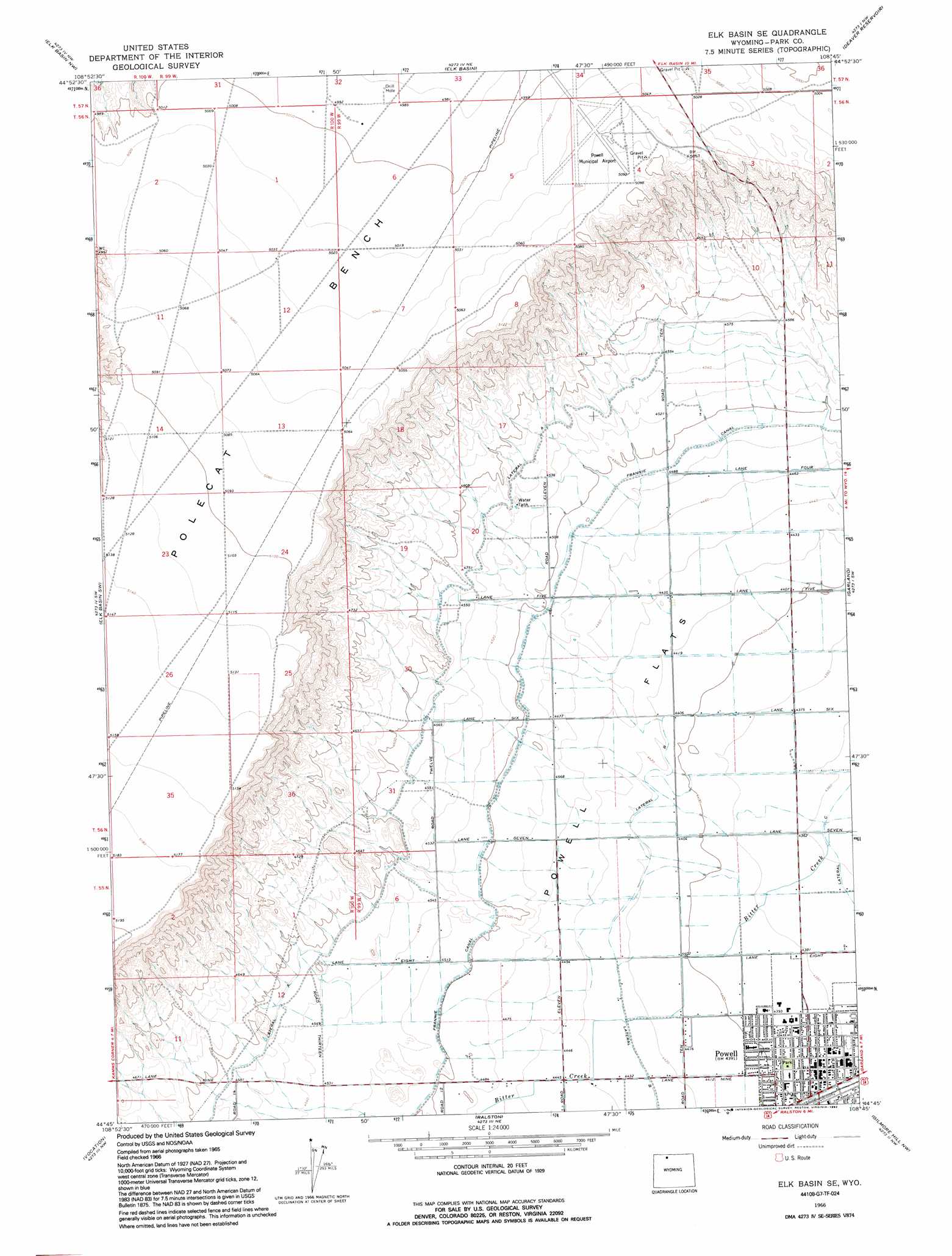
USGS Topo Quad 44108g7 - 1:24,000 scale
| Topo Map Name: | Elk Basin Se |
| USGS Topo Quad ID: | 44108g7 |
| Print Size: | ca. 21 1/4" wide x 27" high |
| Southeast Coordinates: | 44.75° N latitude / 108.75° W longitude |
| Map Center Coordinates: | 44.8125° N latitude / 108.8125° W longitude |
| U.S. State: | WY |
| Filename: | o44108g7.jpg |
| Download Map JPG Image: | Elk Basin Se topo map 1:24,000 scale |
| Map Type: | Topographic |
| Topo Series: | 7.5´ |
| Map Scale: | 1:24,000 |
| Source of Map Images: | United States Geological Survey (USGS) |
| Alternate Map Versions: |
Elk Basin SE WY 1966, updated 1969 Download PDF Buy paper map Elk Basin SE WY 1966, updated 1992 Download PDF Buy paper map Elk Basin SE WY 2012 Download PDF Buy paper map Elk Basin SE WY 2015 Download PDF Buy paper map |
1:24,000 Topo Quads surrounding Elk Basin Se
Hollenbeck Draw |
Long Draw |
Hunters Creek |
Warren |
Bear Canyon |
Badger Basin |
Elk Basin Nw |
Elk Basin |
Deaver Reservoir |
Frannie |
Badlands Hills |
Elk Basin Sw |
Elk Basin Se |
Garland |
Byron |
Eaglenest Basin |
Vocation |
Ralston |
Gilmore Hill Nw |
Gilmore Hill Ne |
Cody |
Corbett Dam |
Stone Barn Camp |
Gilmore Hill |
Gilmore Hill Se |
> Back to 44108e1 at 1:100,000 scale
> Back to 44108a1 at 1:250,000 scale
> Back to U.S. Topo Maps home
Elk Basin Se topo map: Gazetteer
Elk Basin Se: Airports
Powell Hospital Heliport elevation 1343m 4406′Powell Municipal Airport elevation 1538m 5045′
Elk Basin Se: Benches
Polecat Bench elevation 1542m 5059′Elk Basin Se: Canals
Frannie Canal elevation 1370m 4494′Lateral A elevation 1397m 4583′
Lateral B elevation 1348m 4422′
Lateral C elevation 1329m 4360′
Elk Basin Se: Flats
Powell Flats elevation 1353m 4438′Elk Basin Se: Populated Places
Powell elevation 1339m 4393′Elk Basin Se digital topo map on disk
Buy this Elk Basin Se topo map showing relief, roads, GPS coordinates and other geographical features, as a high-resolution digital map file on DVD: