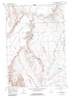
Deaver Reservoir Topo Map Wyoming
To zoom in, hover over the map of Deaver Reservoir
USGS Topo Quad 44108h6 - 1:24,000 scale
| Topo Map Name: | Deaver Reservoir |
| USGS Topo Quad ID: | 44108h6 |
| Print Size: | ca. 21 1/4" wide x 27" high |
| Southeast Coordinates: | 44.875° N latitude / 108.625° W longitude |
| Map Center Coordinates: | 44.9375° N latitude / 108.6875° W longitude |
| U.S. State: | WY |
| Filename: | o44108h6.jpg |
| Download Map JPG Image: | Deaver Reservoir topo map 1:24,000 scale |
| Map Type: | Topographic |
| Topo Series: | 7.5´ |
| Map Scale: | 1:24,000 |
| Source of Map Images: | United States Geological Survey (USGS) |
| Alternate Map Versions: |
Deaver Reservoir WY 1966, updated 1969 Download PDF Buy paper map Deaver Reservoir WY 1966, updated 1988 Download PDF Buy paper map Deaver Reservoir WY 2011 Download PDF Buy paper map Deaver Reservoir WY 2012 Download PDF Buy paper map Deaver Reservoir WY 2015 Download PDF Buy paper map |
1:24,000 Topo Quads surrounding Deaver Reservoir
> Back to 44108e1 at 1:100,000 scale
> Back to 44108a1 at 1:250,000 scale
> Back to U.S. Topo Maps home
Deaver Reservoir topo map: Gazetteer
Deaver Reservoir: Dams
Deaver Dam elevation 1317m 4320′Deaver Reservoir: Lakes
Blue Lake elevation 1314m 4311′Deaver Reservoir: Oilfields
Frannie Oil Field elevation 1361m 4465′Polecat Oil Field elevation 1395m 4576′
Deaver Reservoir: Reservoirs
Deaver Reservoir elevation 1317m 4320′Deaver Reservoir elevation 1314m 4311′
Deaver Reservoir: Trails
Jim Bridger Trail elevation 1298m 4258′Deaver Reservoir digital topo map on disk
Buy this Deaver Reservoir topo map showing relief, roads, GPS coordinates and other geographical features, as a high-resolution digital map file on DVD:


