Aldrich Basin Topo Map Wyoming
To zoom in, hover over the map of Aldrich Basin
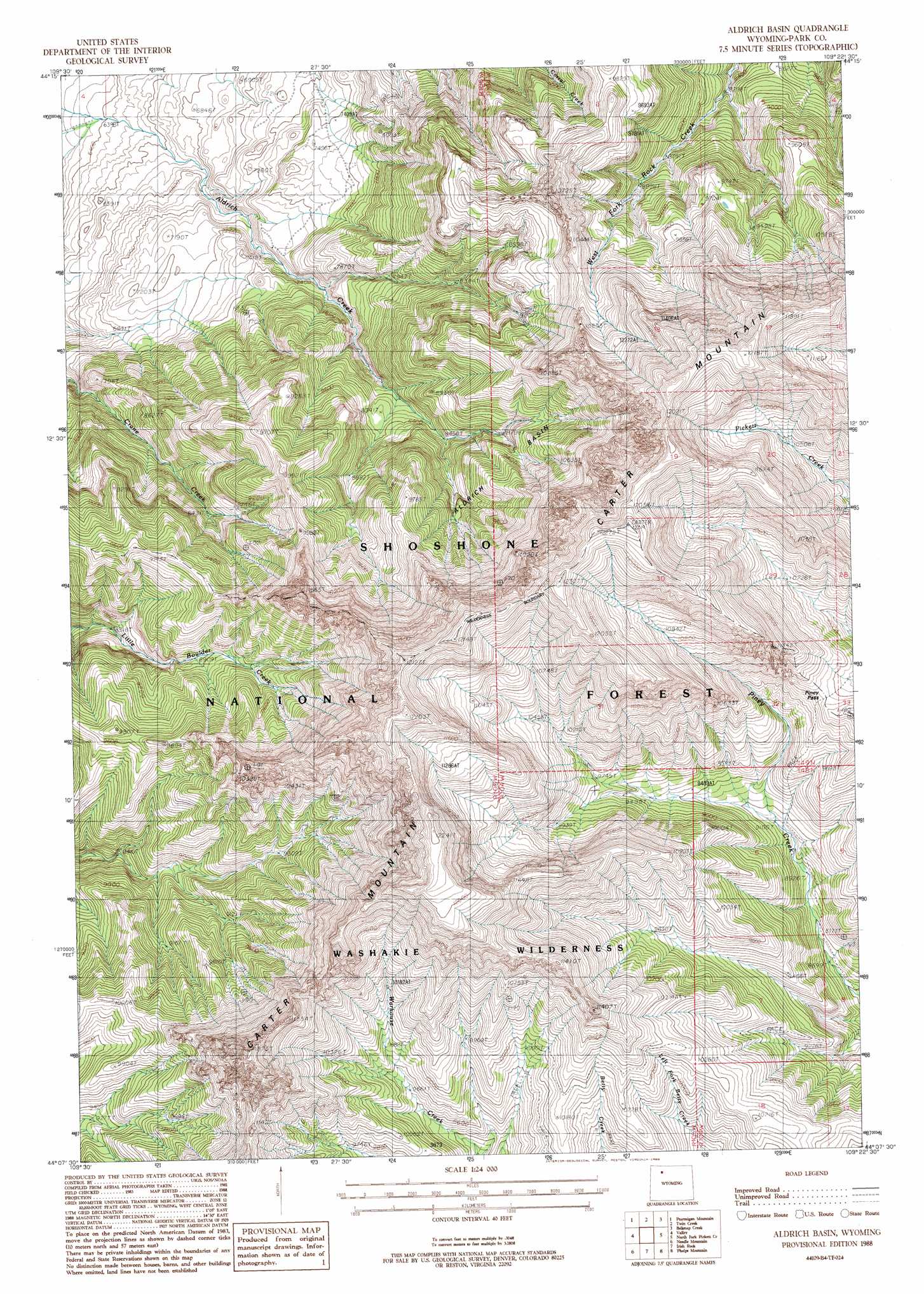
USGS Topo Quad 44109b4 - 1:24,000 scale
| Topo Map Name: | Aldrich Basin |
| USGS Topo Quad ID: | 44109b4 |
| Print Size: | ca. 21 1/4" wide x 27" high |
| Southeast Coordinates: | 44.125° N latitude / 109.375° W longitude |
| Map Center Coordinates: | 44.1875° N latitude / 109.4375° W longitude |
| U.S. State: | WY |
| Filename: | o44109b4.jpg |
| Download Map JPG Image: | Aldrich Basin topo map 1:24,000 scale |
| Map Type: | Topographic |
| Topo Series: | 7.5´ |
| Map Scale: | 1:24,000 |
| Source of Map Images: | United States Geological Survey (USGS) |
| Alternate Map Versions: |
Aldrich Basin WY 1988, updated 1988 Download PDF Buy paper map Aldrich Basin WY 1991, updated 1996 Download PDF Buy paper map Aldrich Basin WY 2012 Download PDF Buy paper map Aldrich Basin WY 2015 Download PDF Buy paper map |
| FStopo: | US Forest Service topo Aldrich Basin is available: Download FStopo PDF Download FStopo TIF |
1:24,000 Topo Quads surrounding Aldrich Basin
Clayton Mountain |
Flag Peak |
Wapiti |
Castle Rock Creek |
Irma Flats |
Lake Creek |
Ptarmigan Mountain |
Twin Creek |
Belknap Creek |
Devils Tooth |
Clouds Home Peak |
Valley |
Aldrich Basin |
North Fork Pickett Creek |
Thomas Reservoir |
Fall Creek |
Needle Mountain |
Irish Rock |
Phelps Mountain |
Pitchfork |
Hardluck Mountain |
Emerald Lake |
Mount Burwell |
Francs Peak |
Dick Creek Lakes |
> Back to 44109a1 at 1:100,000 scale
> Back to 44108a1 at 1:250,000 scale
> Back to U.S. Topo Maps home
Aldrich Basin topo map: Gazetteer
Aldrich Basin: Basins
Aldrich Basin elevation 2588m 8490′Aldrich Basin: Gaps
Piney Pass elevation 3126m 10255′Aldrich Basin: Summits
Carter Mountain elevation 3686m 12093′Aldrich Basin digital topo map on disk
Buy this Aldrich Basin topo map showing relief, roads, GPS coordinates and other geographical features, as a high-resolution digital map file on DVD: