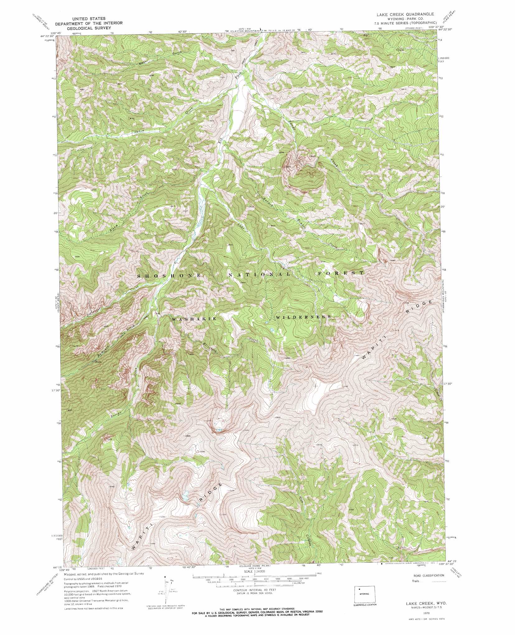
Lake Creek Topo Map Wyoming
To zoom in, hover over the map of Lake Creek
USGS Topo Quad 44109c6 - 1:24,000 scale
| Topo Map Name: | Lake Creek |
| USGS Topo Quad ID: | 44109c6 |
| Print Size: | ca. 21 1/4" wide x 27" high |
| Southeast Coordinates: | 44.25° N latitude / 109.625° W longitude |
| Map Center Coordinates: | 44.3125° N latitude / 109.6875° W longitude |
| U.S. State: | WY |
| Filename: | o44109c6.jpg |
| Download Map JPG Image: | Lake Creek topo map 1:24,000 scale |
| Map Type: | Topographic |
| Topo Series: | 7.5´ |
| Map Scale: | 1:24,000 |
| Source of Map Images: | United States Geological Survey (USGS) |
| Alternate Map Versions: |
Lake Creek WY 1970, updated 1973 Download PDF Buy paper map Lake Creek WY 1970, updated 1973 Download PDF Buy paper map Lake Creek WY 1991, updated 1997 Download PDF Buy paper map Lake Creek WY 2012 Download PDF Buy paper map Lake Creek WY 2015 Download PDF Buy paper map |
| FStopo: | US Forest Service topo Lake Creek is available: Download FStopo PDF Download FStopo TIF |
1:24,000 Topo Quads surrounding Lake Creek
Pahaska Tepee |
Sunlight Peak |
Jaggar Peak |
Dead Indian Peak |
Jim Mountain |
Eagle Creek |
Chimney Rock |
Clayton Mountain |
Flag Peak |
Wapiti |
Pinnacle Mountain |
Sheep Mesa |
Lake Creek |
Ptarmigan Mountain |
Twin Creek |
Open Creek |
Thorofare Buttes |
Clouds Home Peak |
Valley |
Aldrich Basin |
Thorofare Plateau |
Yellow Mountain |
Fall Creek |
Needle Mountain |
Irish Rock |
> Back to 44109a1 at 1:100,000 scale
> Back to 44108a1 at 1:250,000 scale
> Back to U.S. Topo Maps home
Lake Creek topo map: Gazetteer
Lake Creek: Ridges
Wapit Ridge elevation 3565m 11696′Wapiti Ridge elevation 3565m 11696′
Lake Creek: Streams
Bloom Creek elevation 2151m 7057′Borron Creek elevation 2210m 7250′
Burned Timber Creek elevation 2126m 6975′
Cabin Creek elevation 2107m 6912′
Elizabeth Creek elevation 2258m 7408′
Lake Creek elevation 2183m 7162′
Rampart Creek elevation 2238m 7342′
Swede Creek elevation 2082m 6830′
Lake Creek: Valleys
Bear Gulch elevation 2089m 6853′Lake Creek digital topo map on disk
Buy this Lake Creek topo map showing relief, roads, GPS coordinates and other geographical features, as a high-resolution digital map file on DVD: