Chimney Rock Topo Map Wyoming
To zoom in, hover over the map of Chimney Rock
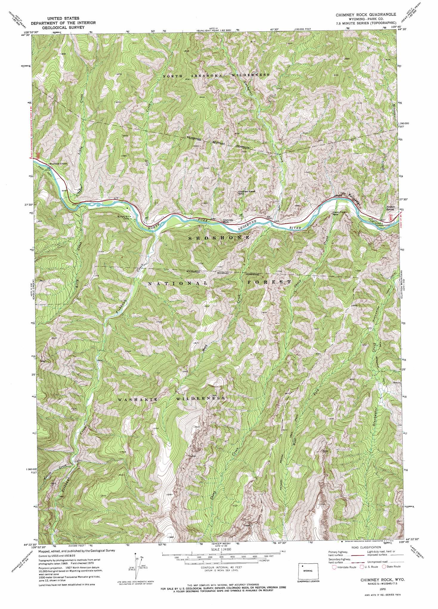
USGS Topo Quad 44109d7 - 1:24,000 scale
| Topo Map Name: | Chimney Rock |
| USGS Topo Quad ID: | 44109d7 |
| Print Size: | ca. 21 1/4" wide x 27" high |
| Southeast Coordinates: | 44.375° N latitude / 109.75° W longitude |
| Map Center Coordinates: | 44.4375° N latitude / 109.8125° W longitude |
| U.S. State: | WY |
| Filename: | o44109d7.jpg |
| Download Map JPG Image: | Chimney Rock topo map 1:24,000 scale |
| Map Type: | Topographic |
| Topo Series: | 7.5´ |
| Map Scale: | 1:24,000 |
| Source of Map Images: | United States Geological Survey (USGS) |
| Alternate Map Versions: |
Chimney Rock WY 1970, updated 1973 Download PDF Buy paper map Chimney Rock WY 1970, updated 1973 Download PDF Buy paper map Chimney Rock WY 1991, updated 1997 Download PDF Buy paper map Chimney Rock WY 2012 Download PDF Buy paper map Chimney Rock WY 2015 Download PDF Buy paper map |
| FStopo: | US Forest Service topo Chimney Rock is available: Download FStopo PDF Download FStopo TIF |
1:24,000 Topo Quads surrounding Chimney Rock
Little Saddle Mountain |
Pollux Peak |
Stinkingwater Peak |
Geers Point |
Elkhorn Peak |
Cathedral Peak |
Pahaska Tepee |
Sunlight Peak |
Jaggar Peak |
Dead Indian Peak |
Plenty Coups Peak |
Eagle Creek |
Chimney Rock |
Clayton Mountain |
Flag Peak |
Eagle Peak |
Pinnacle Mountain |
Sheep Mesa |
Lake Creek |
Ptarmigan Mountain |
The Trident |
Open Creek |
Thorofare Buttes |
Clouds Home Peak |
Valley |
> Back to 44109a1 at 1:100,000 scale
> Back to 44108a1 at 1:250,000 scale
> Back to U.S. Topo Maps home
Chimney Rock topo map: Gazetteer
Chimney Rock: Arches
Window Rock elevation 2062m 6765′Chimney Rock: Cliffs
The Palisades elevation 2028m 6653′Chimney Rock: Pillars
Chimney Rock elevation 1941m 6368′Elephant Head Rock elevation 2134m 7001′
Henry Ford Rock elevation 1964m 6443′
Chimney Rock: Springs
Newton Spring elevation 1925m 6315′Chimney Rock: Streams
Chimney Creek elevation 1928m 6325′Fishhawk Creek elevation 1934m 6345′
Goff Creek elevation 1936m 6351′
Gunbarrel Creek elevation 1916m 6286′
Libby Creek elevation 1952m 6404′
Mesa Creek elevation 1920m 6299′
Newton Creek elevation 1892m 6207′
Norris Creek elevation 2177m 7142′
Sheep Creek elevation 1903m 6243′
West Fork Blackwater Creek elevation 2156m 7073′
Chimney Rock: Trails
Blackwater Trail elevation 2119m 6952′Fire Memorial Trail elevation 2263m 7424′
Natural Bridge Trail elevation 2748m 9015′
Chimney Rock digital topo map on disk
Buy this Chimney Rock topo map showing relief, roads, GPS coordinates and other geographical features, as a high-resolution digital map file on DVD: