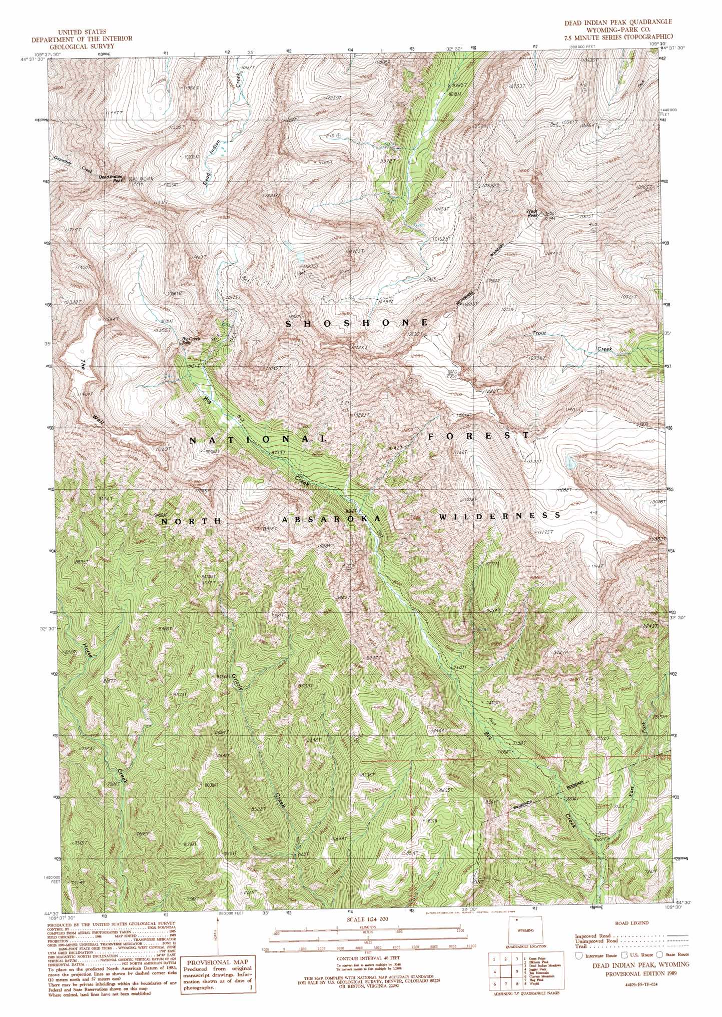
Dead Indian Peak Topo Map Wyoming
To zoom in, hover over the map of Dead Indian Peak
USGS Topo Quad 44109e5 - 1:24,000 scale
| Topo Map Name: | Dead Indian Peak |
| USGS Topo Quad ID: | 44109e5 |
| Print Size: | ca. 21 1/4" wide x 27" high |
| Southeast Coordinates: | 44.5° N latitude / 109.5° W longitude |
| Map Center Coordinates: | 44.5625° N latitude / 109.5625° W longitude |
| U.S. State: | WY |
| Filename: | o44109e5.jpg |
| Download Map JPG Image: | Dead Indian Peak topo map 1:24,000 scale |
| Map Type: | Topographic |
| Topo Series: | 7.5´ |
| Map Scale: | 1:24,000 |
| Source of Map Images: | United States Geological Survey (USGS) |
| Alternate Map Versions: |
Dead Indian Peak WY 1989, updated 1989 Download PDF Buy paper map Dead Indian Peak WY 1991, updated 1996 Download PDF Buy paper map Dead Indian Peak WY 2012 Download PDF Buy paper map Dead Indian Peak WY 2015 Download PDF Buy paper map |
| FStopo: | US Forest Service topo Dead Indian Peak is available: Download FStopo PDF Download FStopo TIF |
1:24,000 Topo Quads surrounding Dead Indian Peak
Hurricane Mesa |
Hunter Peak |
Windy Mountain |
Dillworth Bench |
Bald Peak |
Stinkingwater Peak |
Geers Point |
Elkhorn Peak |
Dead Indian Meadows |
Pat O' Hara Mountain |
Sunlight Peak |
Jaggar Peak |
Dead Indian Peak |
Jim Mountain |
Logan Mountain |
Chimney Rock |
Clayton Mountain |
Flag Peak |
Wapiti |
Castle Rock Creek |
Sheep Mesa |
Lake Creek |
Ptarmigan Mountain |
Twin Creek |
Belknap Creek |
> Back to 44109e1 at 1:100,000 scale
> Back to 44108a1 at 1:250,000 scale
> Back to U.S. Topo Maps home
Dead Indian Peak topo map: Gazetteer
Dead Indian Peak: Falls
Big Creek Falls elevation 3010m 9875′Dead Indian Peak: Ridges
The Wall elevation 3474m 11397′Dead Indian Peak: Streams
East Fork Big Creek elevation 2014m 6607′Dead Indian Peak: Summits
Dead Indian Peak elevation 3703m 12148′Trout Peak elevation 3724m 12217′
Dead Indian Peak digital topo map on disk
Buy this Dead Indian Peak topo map showing relief, roads, GPS coordinates and other geographical features, as a high-resolution digital map file on DVD: