Goff Lake Topo Map Wyoming
To zoom in, hover over the map of Goff Lake
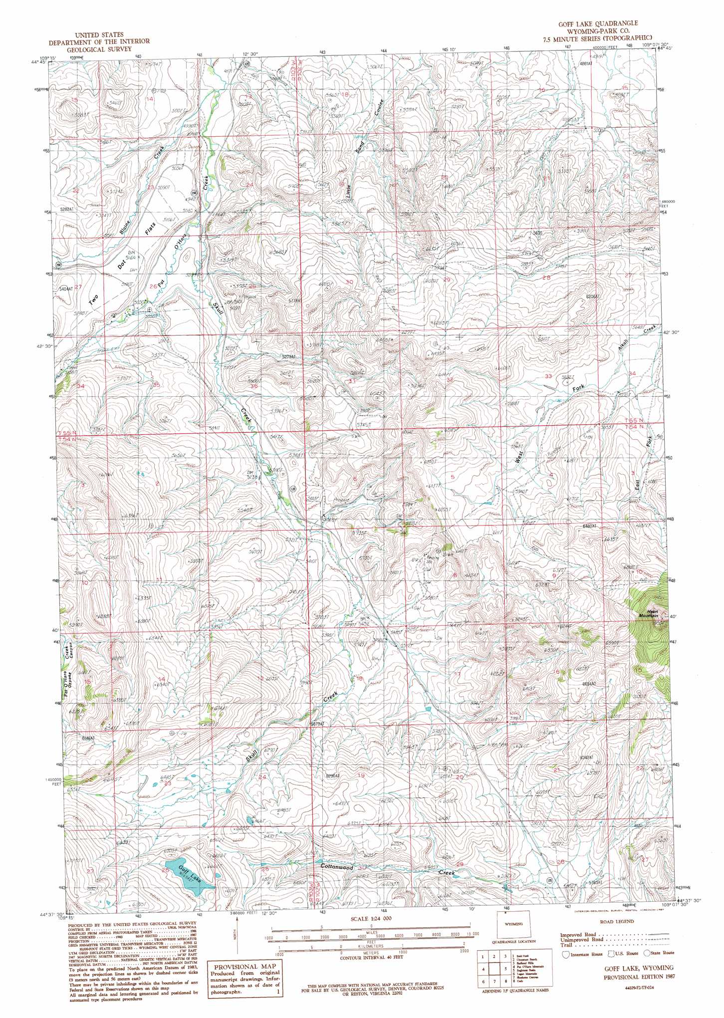
USGS Topo Quad 44109f2 - 1:24,000 scale
| Topo Map Name: | Goff Lake |
| USGS Topo Quad ID: | 44109f2 |
| Print Size: | ca. 21 1/4" wide x 27" high |
| Southeast Coordinates: | 44.625° N latitude / 109.125° W longitude |
| Map Center Coordinates: | 44.6875° N latitude / 109.1875° W longitude |
| U.S. State: | WY |
| Filename: | o44109f2.jpg |
| Download Map JPG Image: | Goff Lake topo map 1:24,000 scale |
| Map Type: | Topographic |
| Topo Series: | 7.5´ |
| Map Scale: | 1:24,000 |
| Source of Map Images: | United States Geological Survey (USGS) |
| Alternate Map Versions: |
Goff Lake WY 1987, updated 1987 Download PDF Buy paper map Goff Lake WY 2012 Download PDF Buy paper map Goff Lake WY 2015 Download PDF Buy paper map |
1:24,000 Topo Quads surrounding Goff Lake
Deep Lake |
North Bennett Creek |
Clark |
Badger Basin |
Elk Basin Nw |
Dillworth Bench |
Bald Peak |
Chapman Bench |
Badlands Hills |
Elk Basin Sw |
Dead Indian Meadows |
Pat O' Hara Mountain |
Goff Lake |
Eaglenest Basin |
Vocation |
Jim Mountain |
Logan Mountain |
Shoshone Canyon |
Cody |
Corbett Dam |
Wapiti |
Castle Rock Creek |
Irma Flats |
Indian Pass |
Oregon Basin |
> Back to 44109e1 at 1:100,000 scale
> Back to 44108a1 at 1:250,000 scale
> Back to U.S. Topo Maps home
Goff Lake topo map: Gazetteer
Goff Lake: Flats
Two Dot Flats elevation 1565m 5134′Goff Lake: Mines
Allison Mine elevation 1673m 5488′Goff Lake: Streams
Blaine Creek elevation 1473m 4832′East Fork Alkali Creek elevation 1744m 5721′
Skull Creek elevation 1508m 4947′
West Fork Alkali Creek elevation 1740m 5708′
Goff Lake: Summits
Heart Mountain elevation 2387m 7831′Goff Lake digital topo map on disk
Buy this Goff Lake topo map showing relief, roads, GPS coordinates and other geographical features, as a high-resolution digital map file on DVD: