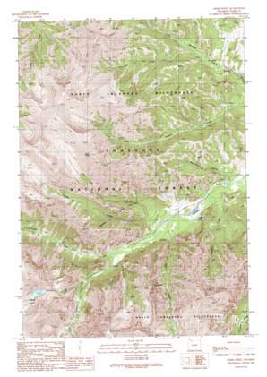
Geers Point Topo Map Wyoming
To zoom in, hover over the map of Geers Point
USGS Topo Quad 44109f6 - 1:24,000 scale
| Topo Map Name: | Geers Point |
| USGS Topo Quad ID: | 44109f6 |
| Print Size: | ca. 21 1/4" wide x 27" high |
| Southeast Coordinates: | 44.625° N latitude / 109.625° W longitude |
| Map Center Coordinates: | 44.6875° N latitude / 109.6875° W longitude |
| U.S. State: | WY |
| Filename: | o44109f6.jpg |
| Download Map JPG Image: | Geers Point topo map 1:24,000 scale |
| Map Type: | Topographic |
| Topo Series: | 7.5´ |
| Map Scale: | 1:24,000 |
| Source of Map Images: | United States Geological Survey (USGS) |
| Alternate Map Versions: |
Geers Point WY 1989, updated 1989 Download PDF Buy paper map Geers Point WY 1991, updated 1997 Download PDF Buy paper map Geers Point WY 2012 Download PDF Buy paper map Geers Point WY 2015 Download PDF Buy paper map |
| FStopo: | US Forest Service topo Geers Point is available: Download FStopo PDF Download FStopo TIF |
1:24,000 Topo Quads surrounding Geers Point
> Back to 44109e1 at 1:100,000 scale
> Back to 44108a1 at 1:250,000 scale
> Back to U.S. Topo Maps home
Geers Point topo map: Gazetteer
Geers Point: Lakes
Copper Lakes elevation 2962m 9717′Sulphur Lake elevation 2171m 7122′
Geers Point: Streams
Company Creek elevation 2155m 7070′Fall Creek elevation 2271m 7450′
Gas Creek elevation 2172m 7125′
Jaggar Creek elevation 2174m 7132′
Spring Creek elevation 2179m 7148′
Sulphur Creek elevation 2207m 7240′
Geers Point: Summits
Geers Point elevation 3401m 11158′Geers Point: Valleys
Strawberry Gulch elevation 2160m 7086′Geers Point digital topo map on disk
Buy this Geers Point topo map showing relief, roads, GPS coordinates and other geographical features, as a high-resolution digital map file on DVD:


