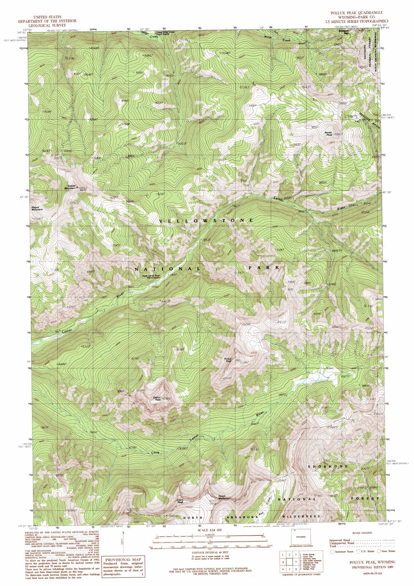
Pollux Peak Topo Map Wyoming
To zoom in, hover over the map of Pollux Peak
USGS Topo Quad 44109f8 - 1:24,000 scale
| Topo Map Name: | Pollux Peak |
| USGS Topo Quad ID: | 44109f8 |
| Print Size: | ca. 21 1/4" wide x 27" high |
| Southeast Coordinates: | 44.625° N latitude / 109.875° W longitude |
| Map Center Coordinates: | 44.6875° N latitude / 109.9375° W longitude |
| U.S. State: | WY |
| Filename: | o44109f8.jpg |
| Download Map JPG Image: | Pollux Peak topo map 1:24,000 scale |
| Map Type: | Topographic |
| Topo Series: | 7.5´ |
| Map Scale: | 1:24,000 |
| Source of Map Images: | United States Geological Survey (USGS) |
| Alternate Map Versions: |
Pollux Peak WY 1989, updated 1989 Download PDF Buy paper map Pollux Peak WY 1991, updated 1996 Download PDF Buy paper map Pollux Peak WY 2012 Download PDF Buy paper map Pollux Peak WY 2015 Download PDF Buy paper map |
| FStopo: | US Forest Service topo Pollux Peak is available: Download FStopo PDF Download FStopo TIF |
1:24,000 Topo Quads surrounding Pollux Peak
Mount Hornaday |
Abiathar Peak |
Pilot Peak |
Jim Smith Peak |
Muddy Creek |
Opal Creek |
Wahb Springs |
Canoe Lake |
Hurricane Mesa |
Hunter Peak |
Pelican Cone |
Little Saddle Mountain |
Pollux Peak |
Stinkingwater Peak |
Geers Point |
Mount Chittenden |
Cathedral Peak |
Pahaska Tepee |
Sunlight Peak |
Jaggar Peak |
Sylvan Lake |
Plenty Coups Peak |
Eagle Creek |
Chimney Rock |
Clayton Mountain |
> Back to 44109e1 at 1:100,000 scale
> Back to 44108a1 at 1:250,000 scale
> Back to U.S. Topo Maps home
Pollux Peak topo map: Gazetteer
Pollux Peak: Gaps
Bootjack Gap elevation 2788m 9146′Pollux Peak: Summits
Castor Peak elevation 3293m 10803′Grant Peak elevation 3307m 10849′
Notch Mountain elevation 3332m 10931′
Parker Peak elevation 3077m 10095′
Pollux Peak elevation 3348m 10984′
Saddle Mountain elevation 3168m 10393′
Pollux Peak digital topo map on disk
Buy this Pollux Peak topo map showing relief, roads, GPS coordinates and other geographical features, as a high-resolution digital map file on DVD: