Pilot Peak Topo Map Wyoming
To zoom in, hover over the map of Pilot Peak
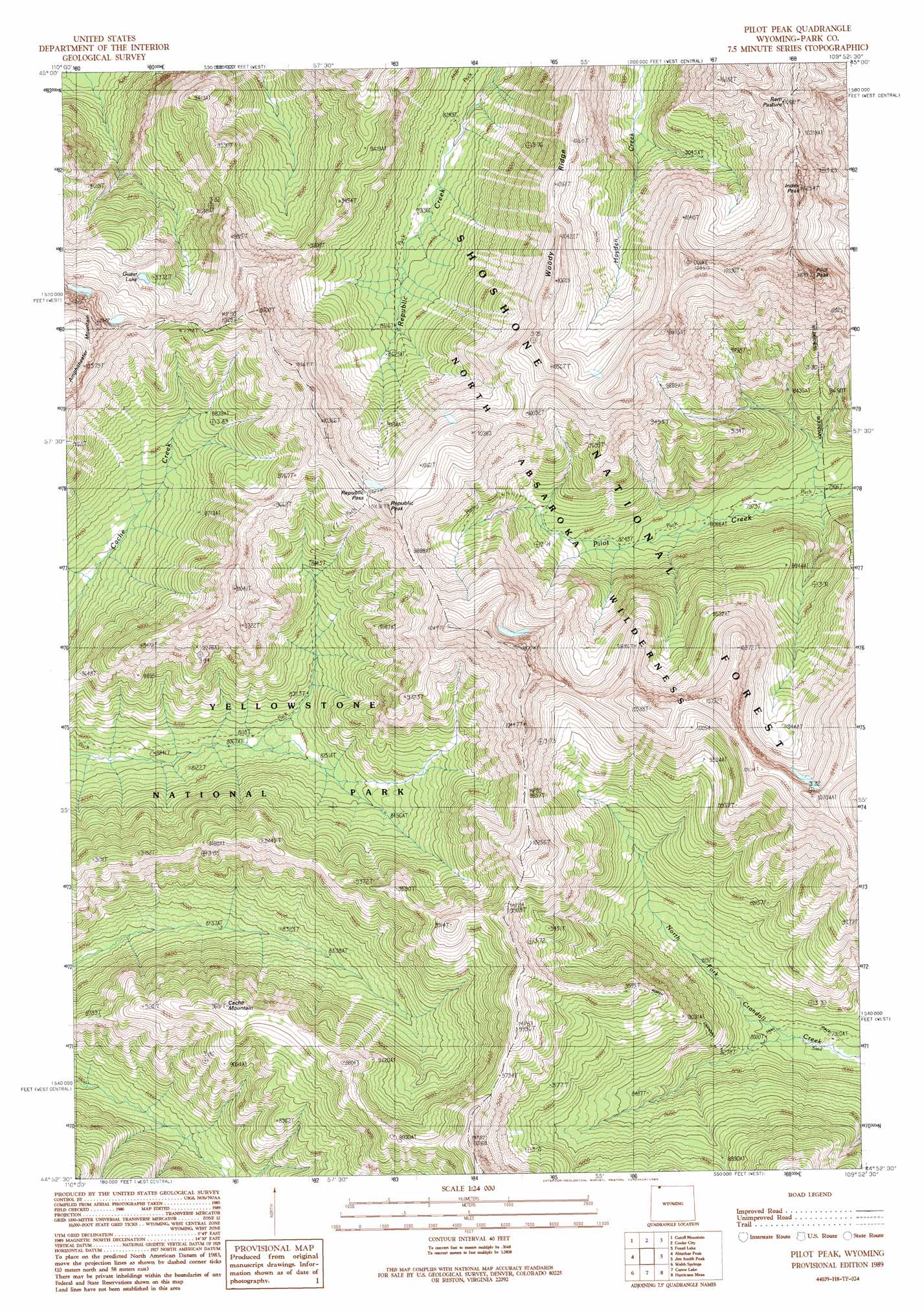
USGS Topo Quad 44109h8 - 1:24,000 scale
| Topo Map Name: | Pilot Peak |
| USGS Topo Quad ID: | 44109h8 |
| Print Size: | ca. 21 1/4" wide x 27" high |
| Southeast Coordinates: | 44.875° N latitude / 109.875° W longitude |
| Map Center Coordinates: | 44.9375° N latitude / 109.9375° W longitude |
| U.S. State: | WY |
| Filename: | o44109h8.jpg |
| Download Map JPG Image: | Pilot Peak topo map 1:24,000 scale |
| Map Type: | Topographic |
| Topo Series: | 7.5´ |
| Map Scale: | 1:24,000 |
| Source of Map Images: | United States Geological Survey (USGS) |
| Alternate Map Versions: |
Pilot Peak WY 1989, updated 1989 Download PDF Buy paper map Pilot Peak WY 1991, updated 1997 Download PDF Buy paper map Pilot Peak WY 2012 Download PDF Buy paper map Pilot Peak WY 2015 Download PDF Buy paper map |
| FStopo: | US Forest Service topo Pilot Peak is available: Download FStopo PDF Download FStopo TIF |
1:24,000 Topo Quads surrounding Pilot Peak
Haystack Peak |
Pinnacle Mountain |
Little Park Mountain |
Granite Peak |
Alpine |
Roundhead Butte |
Cutoff Mountain |
Cooke City |
Fossil Lake |
Castle Mountain |
Mount Hornaday |
Abiathar Peak |
Pilot Peak |
Jim Smith Peak |
Muddy Creek |
Opal Creek |
Wahb Springs |
Canoe Lake |
Hurricane Mesa |
Hunter Peak |
Pelican Cone |
Little Saddle Mountain |
Pollux Peak |
Stinkingwater Peak |
Geers Point |
> Back to 44109e1 at 1:100,000 scale
> Back to 44108a1 at 1:250,000 scale
> Back to U.S. Topo Maps home
Pilot Peak topo map: Gazetteer
Pilot Peak: Flats
Ram Pasture elevation 3179m 10429′Pilot Peak: Gaps
Republic Pass elevation 3046m 9993′Pilot Peak: Lakes
Guitar Lake elevation 2843m 9327′Pilot Peak: Ridges
Woody Ridge elevation 3068m 10065′Pilot Peak: Summits
Cache Mountain elevation 2924m 9593′Index Peak elevation 3264m 10708′
Pilot Peak elevation 3512m 11522′
Republic Peak elevation 3173m 10410′
Pilot Peak: Trails
Republic Trail elevation 2527m 8290′Pilot Peak digital topo map on disk
Buy this Pilot Peak topo map showing relief, roads, GPS coordinates and other geographical features, as a high-resolution digital map file on DVD: