Huckleberry Mountain Topo Map Wyoming
To zoom in, hover over the map of Huckleberry Mountain
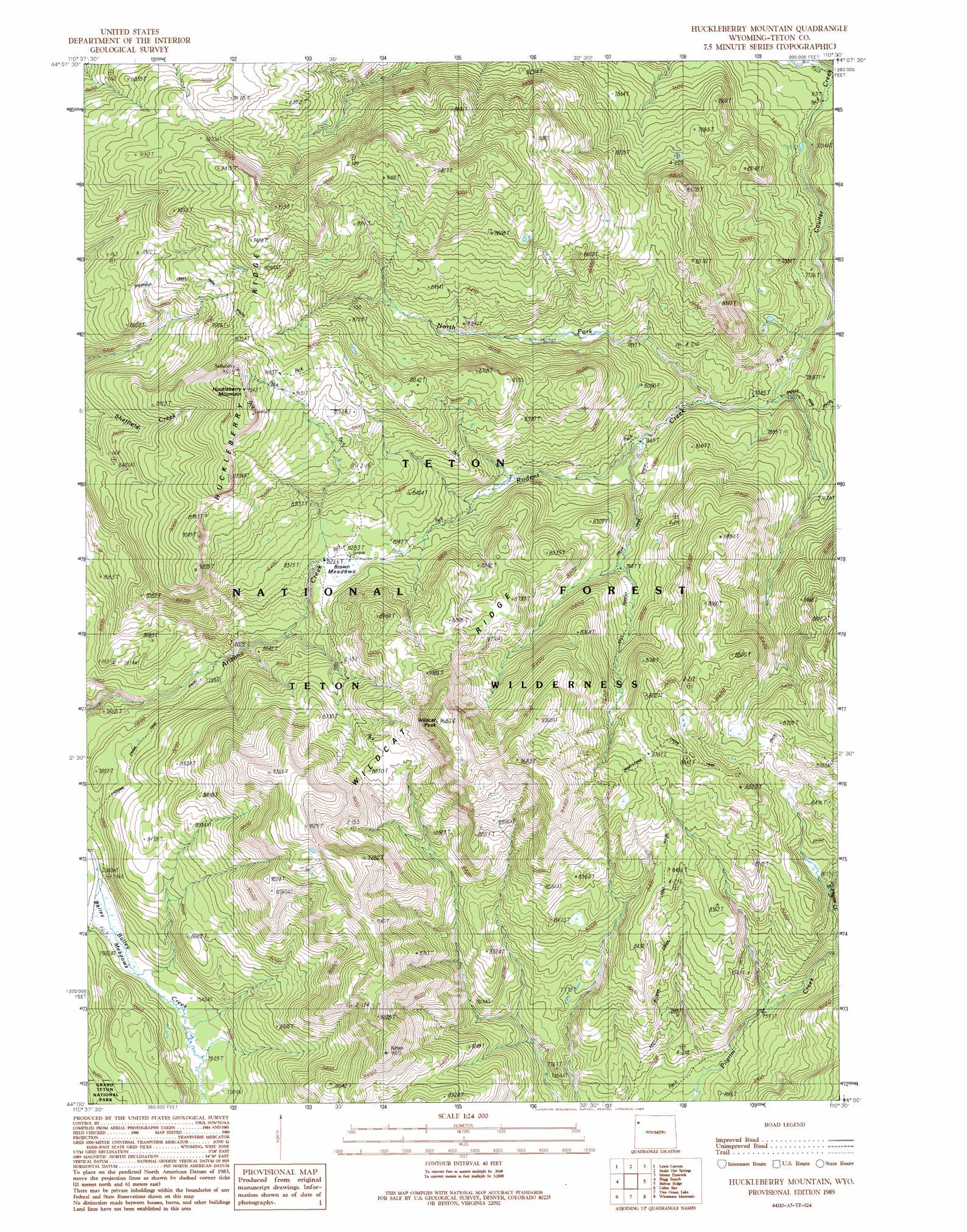
USGS Topo Quad 44110a5 - 1:24,000 scale
| Topo Map Name: | Huckleberry Mountain |
| USGS Topo Quad ID: | 44110a5 |
| Print Size: | ca. 21 1/4" wide x 27" high |
| Southeast Coordinates: | 44° N latitude / 110.5° W longitude |
| Map Center Coordinates: | 44.0625° N latitude / 110.5625° W longitude |
| U.S. State: | WY |
| Filename: | o44110a5.jpg |
| Download Map JPG Image: | Huckleberry Mountain topo map 1:24,000 scale |
| Map Type: | Topographic |
| Topo Series: | 7.5´ |
| Map Scale: | 1:24,000 |
| Source of Map Images: | United States Geological Survey (USGS) |
| Alternate Map Versions: |
Huckleberry Mountain WY 1989, updated 1989 Download PDF Buy paper map Huckleberry Mountain WY 1996, updated 1998 Download PDF Buy paper map Huckleberry Mountain WY 2012 Download PDF Buy paper map Huckleberry Mountain WY 2015 Download PDF Buy paper map |
| FStopo: | US Forest Service topo Huckleberry Mountain is available: Download FStopo PDF Download FStopo TIF |
1:24,000 Topo Quads surrounding Huckleberry Mountain
Shoshone Geyser Basin |
Lewis Falls |
Mount Sheridan |
Heart Lake |
Alder Lake |
Grassy Lake Reservoir |
Lewis Canyon |
Snake Hot Springs |
Mount Hancock |
Crooked Creek |
Survey Peak |
Flagg Ranch |
Huckleberry Mountain |
Bobcat Ridge |
Gravel Peak |
Ranger Peak |
Colter Bay |
Two Ocean Lake |
Whetstone Mountain |
Hunter Mountain |
Mount Moran |
Jenny Lake |
Moran |
Davis Hill |
Rosies Ridge |
> Back to 44110a1 at 1:100,000 scale
> Back to 44110a1 at 1:250,000 scale
> Back to U.S. Topo Maps home
Huckleberry Mountain topo map: Gazetteer
Huckleberry Mountain: Flats
Bailey Meadows elevation 2301m 7549′Brown Meadows elevation 2519m 8264′
Huckleberry Mountain: Ridges
Huckleberry Ridge elevation 2881m 9452′Wildcat Ridge elevation 2682m 8799′
Huckleberry Mountain: Streams
North Fork Rodent Creek elevation 2319m 7608′Rodent Creek elevation 2251m 7385′
Huckleberry Mountain: Summits
Huckleberry Mountain elevation 2928m 9606′Wildcat Peak elevation 2952m 9685′
Huckleberry Mountain: Trails
Arizona Creek Trail elevation 2400m 7874′Coulter Creek Trail elevation 2202m 7224′
Middle Pilgrim Trail elevation 2580m 8464′
Pilgrim Creek Trail elevation 2462m 8077′
Rodent Creek Trail elevation 2444m 8018′
West Pilgrim Trail elevation 2599m 8526′
Huckleberry Mountain digital topo map on disk
Buy this Huckleberry Mountain topo map showing relief, roads, GPS coordinates and other geographical features, as a high-resolution digital map file on DVD: