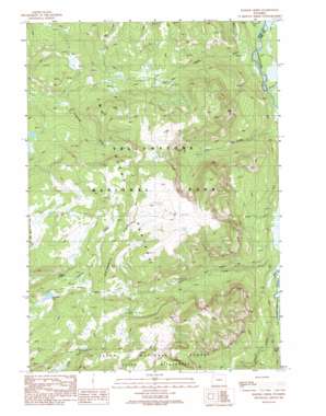
Badger Creek Topo Map Wyoming
To zoom in, hover over the map of Badger Creek
USGS Topo Quad 44110b2 - 1:24,000 scale
| Topo Map Name: | Badger Creek |
| USGS Topo Quad ID: | 44110b2 |
| Print Size: | ca. 21 1/4" wide x 27" high |
| Southeast Coordinates: | 44.125° N latitude / 110.125° W longitude |
| Map Center Coordinates: | 44.1875° N latitude / 110.1875° W longitude |
| U.S. State: | WY |
| Filename: | o44110b2.jpg |
| Download Map JPG Image: | Badger Creek topo map 1:24,000 scale |
| Map Type: | Topographic |
| Topo Series: | 7.5´ |
| Map Scale: | 1:24,000 |
| Source of Map Images: | United States Geological Survey (USGS) |
| Alternate Map Versions: |
Badger Creek WY 1989, updated 1989 Download PDF Buy paper map Badger Creek WY 1996, updated 1998 Download PDF Buy paper map Badger Creek WY 2012 Download PDF Buy paper map Badger Creek WY 2015 Download PDF Buy paper map |
| FStopo: | US Forest Service topo Badger Creek is available: Download FStopo PDF Download FStopo TIF |
1:24,000 Topo Quads surrounding Badger Creek
> Back to 44110a1 at 1:100,000 scale
> Back to 44110a1 at 1:250,000 scale
> Back to U.S. Topo Maps home
Badger Creek topo map: Gazetteer
Badger Creek: Areas
Two Ocean Plateau elevation 2889m 9478′Badger Creek: Falls
Plateau Falls elevation 2729m 8953′Badger Creek: Lakes
Mariposa Lake elevation 2730m 8956′Badger Creek: Streams
Badger Creek elevation 2374m 7788′Mountain Creek elevation 2383m 7818′
Badger Creek digital topo map on disk
Buy this Badger Creek topo map showing relief, roads, GPS coordinates and other geographical features, as a high-resolution digital map file on DVD:


