Alder Lake Topo Map Wyoming
To zoom in, hover over the map of Alder Lake
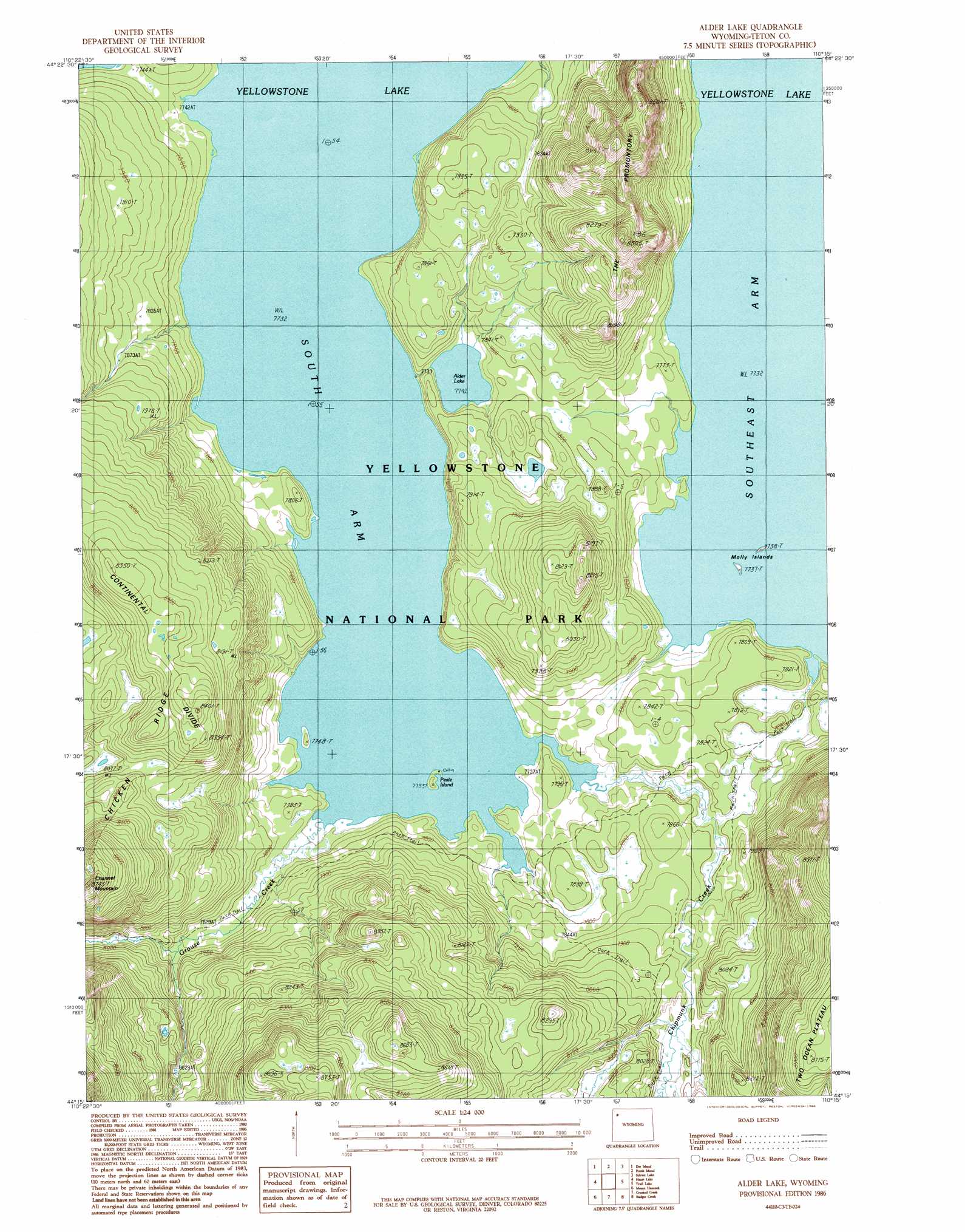
USGS Topo Quad 44110c3 - 1:24,000 scale
| Topo Map Name: | Alder Lake |
| USGS Topo Quad ID: | 44110c3 |
| Print Size: | ca. 21 1/4" wide x 27" high |
| Southeast Coordinates: | 44.25° N latitude / 110.25° W longitude |
| Map Center Coordinates: | 44.3125° N latitude / 110.3125° W longitude |
| U.S. State: | WY |
| Filename: | o44110c3.jpg |
| Download Map JPG Image: | Alder Lake topo map 1:24,000 scale |
| Map Type: | Topographic |
| Topo Series: | 7.5´ |
| Map Scale: | 1:24,000 |
| Source of Map Images: | United States Geological Survey (USGS) |
| Alternate Map Versions: |
Alder Lake WY 1986, updated 1986 Download PDF Buy paper map Alder Lake WY 2012 Download PDF Buy paper map Alder Lake WY 2015 Download PDF Buy paper map |
| FStopo: | US Forest Service topo Alder Lake is available: Download FStopo PDF Download FStopo TIF |
1:24,000 Topo Quads surrounding Alder Lake
Beach Lake |
Lake |
Lake Butte |
Mount Chittenden |
Cathedral Peak |
West Thumb |
Dot Island |
Frank Island |
Sylvan Lake |
Plenty Coups Peak |
Mount Sheridan |
Heart Lake |
Alder Lake |
Trail Lake |
Eagle Peak |
Snake Hot Springs |
Mount Hancock |
Crooked Creek |
Badger Creek |
The Trident |
Huckleberry Mountain |
Bobcat Ridge |
Gravel Peak |
Two Ocean Pass |
Yellowstone Point |
> Back to 44110a1 at 1:100,000 scale
> Back to 44110a1 at 1:250,000 scale
> Back to U.S. Topo Maps home
Alder Lake topo map: Gazetteer
Alder Lake: Bays
South Arm elevation 2358m 7736′Alder Lake: Islands
Molly Island elevation 2359m 7739′Molly Islands elevation 2359m 7739′
Peale Island elevation 2360m 7742′
Alder Lake: Lakes
Alder Lake elevation 2361m 7746′Alder Lake: Ridges
The Promontory elevation 2541m 8336′Alder Lake: Streams
Chipmunk Creek elevation 2358m 7736′Grouse Creek elevation 2358m 7736′
Alder Lake: Summits
Channel Mountain elevation 2667m 8750′Alder Lake: Trails
Trail Creek Trail elevation 2379m 7805′Alder Lake digital topo map on disk
Buy this Alder Lake topo map showing relief, roads, GPS coordinates and other geographical features, as a high-resolution digital map file on DVD: