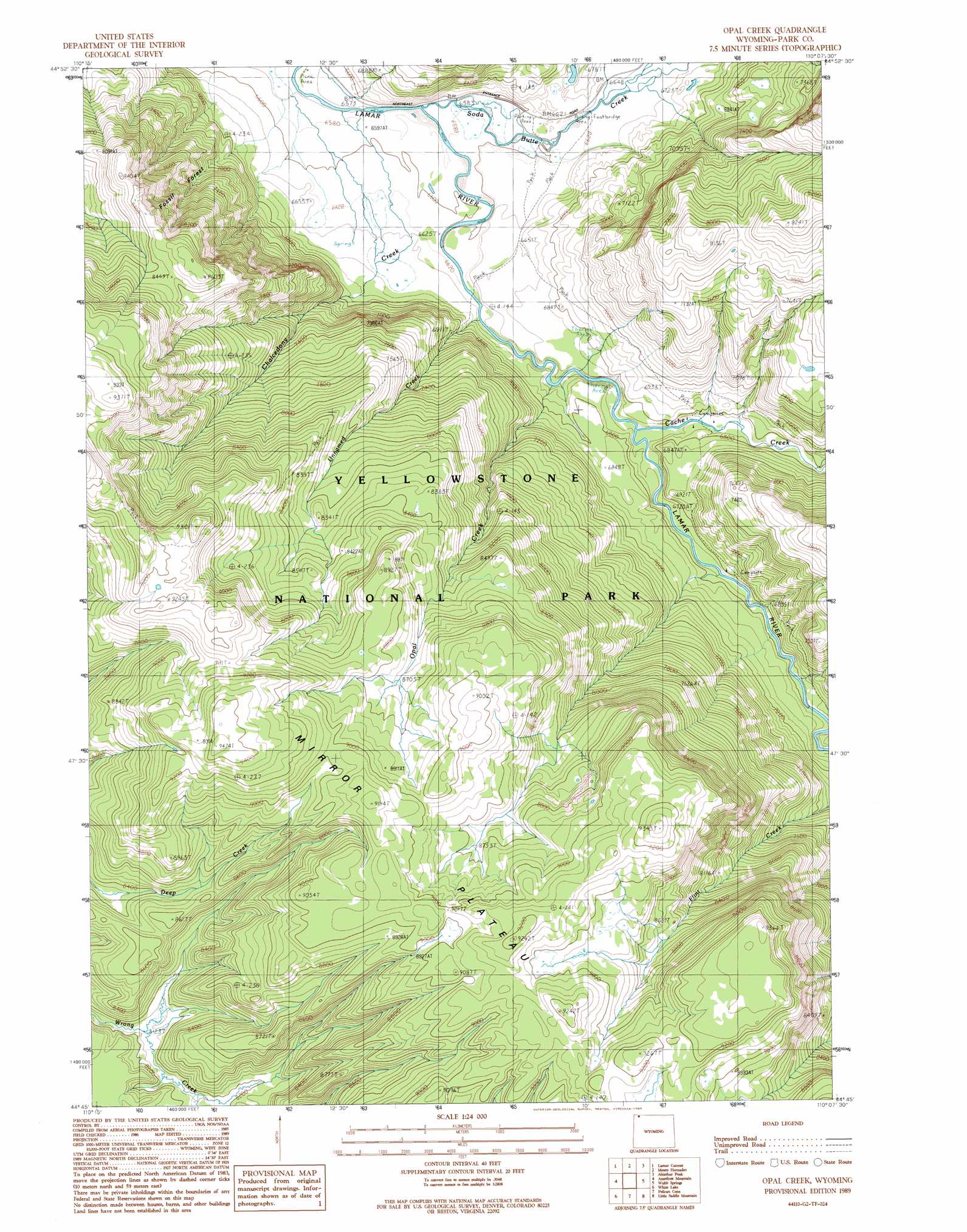
Opal Creek Topo Map Wyoming
To zoom in, hover over the map of Opal Creek
USGS Topo Quad 44110g2 - 1:24,000 scale
| Topo Map Name: | Opal Creek |
| USGS Topo Quad ID: | 44110g2 |
| Print Size: | ca. 21 1/4" wide x 27" high |
| Southeast Coordinates: | 44.75° N latitude / 110.125° W longitude |
| Map Center Coordinates: | 44.8125° N latitude / 110.1875° W longitude |
| U.S. State: | WY |
| Filename: | o44110g2.jpg |
| Download Map JPG Image: | Opal Creek topo map 1:24,000 scale |
| Map Type: | Topographic |
| Topo Series: | 7.5´ |
| Map Scale: | 1:24,000 |
| Source of Map Images: | United States Geological Survey (USGS) |
| Alternate Map Versions: |
Opal Creek WY 1989, updated 1989 Download PDF Buy paper map Opal Creek WY 2012 Download PDF Buy paper map Opal Creek WY 2015 Download PDF Buy paper map |
1:24,000 Topo Quads surrounding Opal Creek
Specimen Creek |
Hummingbird Peak |
Roundhead Butte |
Cutoff Mountain |
Cooke City |
Tower Junction |
Lamar Canyon |
Mount Hornaday |
Abiathar Peak |
Pilot Peak |
Mount Washburn |
Amethyst Mountain |
Opal Creek |
Wahb Springs |
Canoe Lake |
Canyon Village |
White Lake |
Pelican Cone |
Little Saddle Mountain |
Pollux Peak |
Lake |
Lake Butte |
Mount Chittenden |
Cathedral Peak |
Pahaska Tepee |
> Back to 44110e1 at 1:100,000 scale
> Back to 44110a1 at 1:250,000 scale
> Back to U.S. Topo Maps home
Opal Creek topo map: Gazetteer
Opal Creek: Parks
Yellowstone National Park elevation 2522m 8274′Opal Creek: Populated Places
Fossil Forest elevation 2290m 7513′Opal Creek: Streams
Cache Creek elevation 2045m 6709′Chalcedony Creek elevation 2015m 6610′
Opal Creek elevation 2031m 6663′
Soda Butte Creek elevation 2012m 6601′
Soda Butte Creek elevation 2012m 6601′
Unnamed Creek elevation 2023m 6637′
Opal Creek digital topo map on disk
Buy this Opal Creek topo map showing relief, roads, GPS coordinates and other geographical features, as a high-resolution digital map file on DVD: