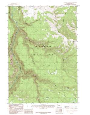
Amethyst Mountain Topo Map Wyoming
To zoom in, hover over the map of Amethyst Mountain
USGS Topo Quad 44110g3 - 1:24,000 scale
| Topo Map Name: | Amethyst Mountain |
| USGS Topo Quad ID: | 44110g3 |
| Print Size: | ca. 21 1/4" wide x 27" high |
| Southeast Coordinates: | 44.75° N latitude / 110.25° W longitude |
| Map Center Coordinates: | 44.8125° N latitude / 110.3125° W longitude |
| U.S. State: | WY |
| Filename: | o44110g3.jpg |
| Download Map JPG Image: | Amethyst Mountain topo map 1:24,000 scale |
| Map Type: | Topographic |
| Topo Series: | 7.5´ |
| Map Scale: | 1:24,000 |
| Source of Map Images: | United States Geological Survey (USGS) |
| Alternate Map Versions: |
Amethyst Mountain WY 1986, updated 1986 Download PDF Buy paper map Amethyst Mountain WY 2012 Download PDF Buy paper map Amethyst Mountain WY 2015 Download PDF Buy paper map |
1:24,000 Topo Quads surrounding Amethyst Mountain
> Back to 44110e1 at 1:100,000 scale
> Back to 44110a1 at 1:250,000 scale
> Back to U.S. Topo Maps home
Amethyst Mountain topo map: Gazetteer
Amethyst Mountain: Ridges
Specimen Ridge elevation 2554m 8379′Amethyst Mountain: Springs
Coffee Pot Hot Springs elevation 2554m 8379′Coffee Pot Hot Springs elevation 2550m 8366′
Rainbow Springs elevation 2460m 8070′
Rainbow Springs elevation 2461m 8074′
Amethyst Mountain: Streams
Agate Creek elevation 1923m 6309′Broad Creek elevation 1972m 6469′
Burnt Creek elevation 2072m 6797′
Deep Creek elevation 1926m 6318′
Quartz Creek elevation 1898m 6227′
Shallow Creek elevation 2166m 7106′
Wrong Creek elevation 2426m 7959′
Amethyst Mountain: Summits
Amethyst Mountain elevation 2929m 9609′Amethyst Mountain: Trails
Specimen Ridge Trail elevation 2592m 8503′Amethyst Mountain digital topo map on disk
Buy this Amethyst Mountain topo map showing relief, roads, GPS coordinates and other geographical features, as a high-resolution digital map file on DVD:


