Mount Holmes Topo Map Wyoming
To zoom in, hover over the map of Mount Holmes
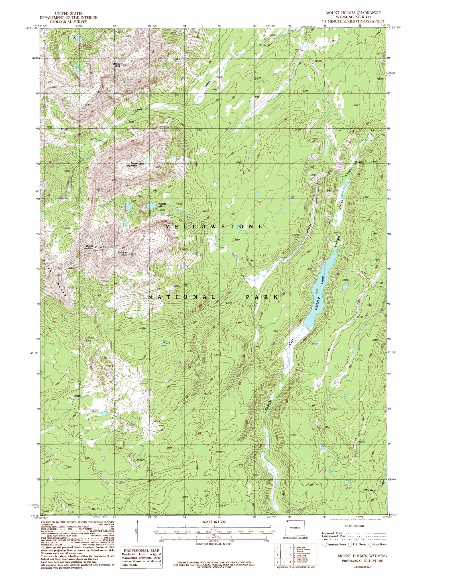
USGS Topo Quad 44110g7 - 1:24,000 scale
| Topo Map Name: | Mount Holmes |
| USGS Topo Quad ID: | 44110g7 |
| Print Size: | ca. 21 1/4" wide x 27" high |
| Southeast Coordinates: | 44.75° N latitude / 110.75° W longitude |
| Map Center Coordinates: | 44.8125° N latitude / 110.8125° W longitude |
| U.S. State: | WY |
| Filename: | o44110g7.jpg |
| Download Map JPG Image: | Mount Holmes topo map 1:24,000 scale |
| Map Type: | Topographic |
| Topo Series: | 7.5´ |
| Map Scale: | 1:24,000 |
| Source of Map Images: | United States Geological Survey (USGS) |
| Alternate Map Versions: |
Mount Holmes WY 1986, updated 1986 Download PDF Buy paper map Mount Holmes WY 2012 Download PDF Buy paper map Mount Holmes WY 2015 Download PDF Buy paper map |
1:24,000 Topo Quads surrounding Mount Holmes
Big Horn Peak |
Sportsman Lake |
Electric Peak |
Gardiner |
Ash Mountain |
Divide Lake |
Joseph Peak |
Quadrant Mountain |
Mammoth |
Blacktail Deer Creek |
Richards Creek |
Three Rivers Peak |
Mount Holmes |
Obsidian Cliff |
Cook Peak |
West Yellowstone |
Mount Jackson |
Madison Junction |
Norris Junction |
Crystal Falls |
Jack Straw Basin |
Buffalo Meadows |
Lower Geyser Basin |
Mary Lake |
Beach Lake |
> Back to 44110e1 at 1:100,000 scale
> Back to 44110a1 at 1:250,000 scale
> Back to U.S. Topo Maps home
Mount Holmes topo map: Gazetteer
Mount Holmes: Cliffs
Trilobite Point elevation 3051m 10009′Mount Holmes: Lakes
Grizzly Lake elevation 2289m 7509′Mount Holmes: Springs
Riverside Geyser elevation 2532m 8307′Mount Holmes: Streams
Straight Creek elevation 2283m 7490′Mount Holmes: Summits
Antler Peak elevation 3048m 10000′Dome Mountain elevation 2995m 9826′
Mount Holmes elevation 3149m 10331′
White Peaks elevation 2887m 9471′
Mount Holmes: Trails
Mount Holmes Trail elevation 2335m 7660′Mount Holmes digital topo map on disk
Buy this Mount Holmes topo map showing relief, roads, GPS coordinates and other geographical features, as a high-resolution digital map file on DVD: