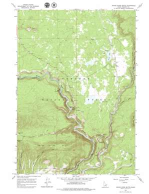
Snake River Butte Topo Map Idaho
To zoom in, hover over the map of Snake River Butte
USGS Topo Quad 44111b3 - 1:24,000 scale
| Topo Map Name: | Snake River Butte |
| USGS Topo Quad ID: | 44111b3 |
| Print Size: | ca. 21 1/4" wide x 27" high |
| Southeast Coordinates: | 44.125° N latitude / 111.25° W longitude |
| Map Center Coordinates: | 44.1875° N latitude / 111.3125° W longitude |
| U.S. State: | ID |
| Filename: | o44111b3.jpg |
| Download Map JPG Image: | Snake River Butte topo map 1:24,000 scale |
| Map Type: | Topographic |
| Topo Series: | 7.5´ |
| Map Scale: | 1:24,000 |
| Source of Map Images: | United States Geological Survey (USGS) |
| Alternate Map Versions: |
Snake River Butte ID 1965, updated 1967 Download PDF Buy paper map Snake River Butte ID 2011 Download PDF Buy paper map Snake River Butte ID 2013 Download PDF Buy paper map |
| FStopo: | US Forest Service topo Snake River Butte is available: Download FStopo PDF Download FStopo TIF |
1:24,000 Topo Quads surrounding Snake River Butte
> Back to 44111a1 at 1:100,000 scale
> Back to 44110a1 at 1:250,000 scale
> Back to U.S. Topo Maps home
Snake River Butte topo map: Gazetteer
Snake River Butte: Bends
Hole in Rocks elevation 1802m 5912′Snake River Butte: Dams
Cherry Dam elevation 1720m 5643′Snake River Butte: Falls
Lower Mesa Falls elevation 1680m 5511′Upper Mesa Falls elevation 1711m 5613′
Snake River Butte: Mines
Bear Gulch Gravel Pit elevation 1765m 5790′Snake River Butte: Populated Places
Gerrit elevation 1818m 5964′Snake River Butte: Reservoirs
Beaver Pond elevation 1822m 5977′Snake River Butte: Springs
Warm River Spring elevation 1773m 5816′Snake River Butte: Streams
Moose Creek elevation 1764m 5787′Snake River Butte: Summits
Elk Butte elevation 1934m 6345′Snake River Butte elevation 1964m 6443′
Snake River Butte: Valleys
Anderson Mill Canyon elevation 1638m 5374′Flat Canyon elevation 1808m 5931′
Trail Canyon elevation 1766m 5793′
Twisted Draw elevation 1748m 5734′
Snake River Butte digital topo map on disk
Buy this Snake River Butte topo map showing relief, roads, GPS coordinates and other geographical features, as a high-resolution digital map file on DVD:


