Island Park Dam Topo Map Idaho
To zoom in, hover over the map of Island Park Dam
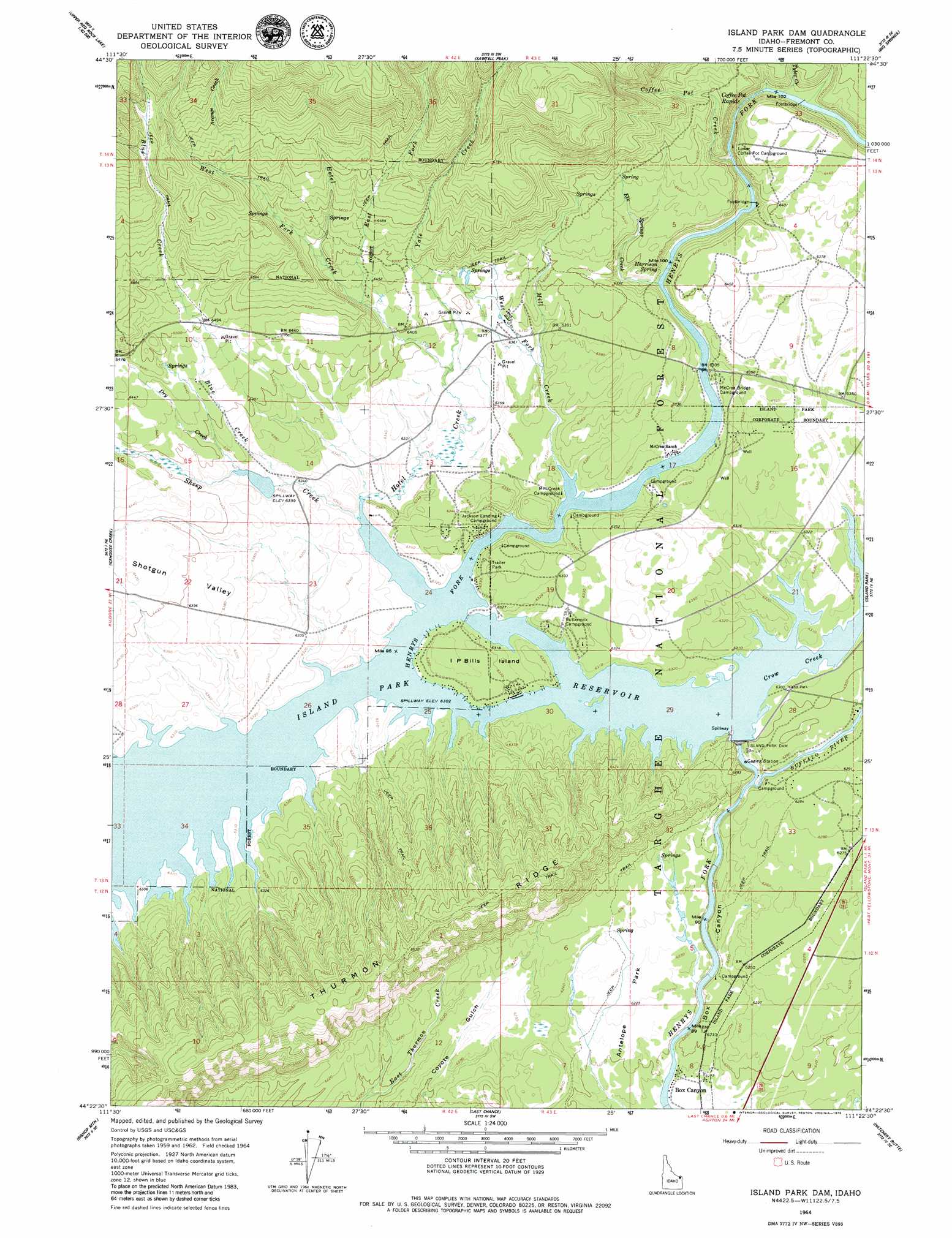
USGS Topo Quad 44111d4 - 1:24,000 scale
| Topo Map Name: | Island Park Dam |
| USGS Topo Quad ID: | 44111d4 |
| Print Size: | ca. 21 1/4" wide x 27" high |
| Southeast Coordinates: | 44.375° N latitude / 111.375° W longitude |
| Map Center Coordinates: | 44.4375° N latitude / 111.4375° W longitude |
| U.S. State: | ID |
| Filename: | o44111d4.jpg |
| Download Map JPG Image: | Island Park Dam topo map 1:24,000 scale |
| Map Type: | Topographic |
| Topo Series: | 7.5´ |
| Map Scale: | 1:24,000 |
| Source of Map Images: | United States Geological Survey (USGS) |
| Alternate Map Versions: |
Island Park Dam ID 1964, updated 1966 Download PDF Buy paper map Island Park Dam ID 1964, updated 1979 Download PDF Buy paper map Island Park Dam ID 1964, updated 1979 Download PDF Buy paper map Island Park Dam ID 2011 Download PDF Buy paper map Island Park Dam ID 2013 Download PDF Buy paper map |
| FStopo: | US Forest Service topo Island Park Dam is available: Download FStopo PDF Download FStopo TIF |
1:24,000 Topo Quads surrounding Island Park Dam
Elk Springs |
Hidden Lake Bench |
Targhee Peak |
Targhee Pass |
Madison Arm |
Upper Red Rock Lake |
Mount Jefferson |
Sawtell Peak |
Big Springs |
Reas Pass |
Sheridan Reservoir |
Icehouse Creek |
Island Park Dam |
Island Park |
Latham Spring |
Crystal Butte |
Bishop Mountain |
Last Chance |
Hatchery Butte |
Big Grassy |
Split Butte |
Blue Creek Reservoir |
Lookout Butte |
Snake River Butte |
Warm River Butte |
> Back to 44111a1 at 1:100,000 scale
> Back to 44110a1 at 1:250,000 scale
> Back to U.S. Topo Maps home
Island Park Dam topo map: Gazetteer
Island Park Dam: Dams
Island Park Dam elevation 1922m 6305′Island Park Dam: Flats
Antelope Park elevation 1897m 6223′Island Park Dam: Islands
I P Bills Island elevation 1930m 6332′Island Park Dam: Populated Places
Box Canyon elevation 1884m 6181′Rea elevation 1945m 6381′
Island Park Dam: Rapids
Coffee Pot Rapids elevation 1936m 6351′Island Park Dam: Reservoirs
Island Park Reservoir elevation 1922m 6305′Island Park Dam: Springs
Harrison Spring elevation 1953m 6407′Island Park Dam: Streams
Arange Creek elevation 2049m 6722′Blind Creek elevation 1927m 6322′
Blue Creek elevation 1927m 6322′
Buffalo River elevation 1900m 6233′
Coffee Pot Creek elevation 1928m 6325′
Crow Creek elevation 1922m 6305′
Dry Creek elevation 1943m 6374′
East Fork Hotel Creek elevation 1960m 6430′
Elk Springs Creek elevation 1926m 6318′
Hotel Creek elevation 1926m 6318′
Mill Creek elevation 1926m 6318′
Sheep Creek elevation 1929m 6328′
Tyler Creek elevation 1942m 6371′
West Fork Hotel Creek elevation 1973m 6473′
Yale Creek elevation 1940m 6364′
Island Park Dam: Valleys
Box Canyon elevation 1878m 6161′Shotgun Valley elevation 1924m 6312′
Island Park Dam digital topo map on disk
Buy this Island Park Dam topo map showing relief, roads, GPS coordinates and other geographical features, as a high-resolution digital map file on DVD: