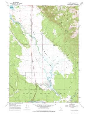
Big Springs Topo Map Idaho
To zoom in, hover over the map of Big Springs
USGS Topo Quad 44111e3 - 1:24,000 scale
| Topo Map Name: | Big Springs |
| USGS Topo Quad ID: | 44111e3 |
| Print Size: | ca. 21 1/4" wide x 27" high |
| Southeast Coordinates: | 44.5° N latitude / 111.25° W longitude |
| Map Center Coordinates: | 44.5625° N latitude / 111.3125° W longitude |
| U.S. State: | ID |
| Filename: | o44111e3.jpg |
| Download Map JPG Image: | Big Springs topo map 1:24,000 scale |
| Map Type: | Topographic |
| Topo Series: | 7.5´ |
| Map Scale: | 1:24,000 |
| Source of Map Images: | United States Geological Survey (USGS) |
| Alternate Map Versions: |
Big Springs ID 1964, updated 1966 Download PDF Buy paper map Big Springs ID 1964, updated 1977 Download PDF Buy paper map Big Springs ID 2011 Download PDF Buy paper map Big Springs ID 2013 Download PDF Buy paper map |
| FStopo: | US Forest Service topo Big Springs is available: Download FStopo PDF Download FStopo TIF |
1:24,000 Topo Quads surrounding Big Springs
> Back to 44111e1 at 1:100,000 scale
> Back to 44110a1 at 1:250,000 scale
> Back to U.S. Topo Maps home
Big Springs topo map: Gazetteer
Big Springs: Dams
Henrys Lake Dam elevation 1970m 6463′Big Springs: Flats
Henrys Lake Flat elevation 1978m 6489′Stamp Meadows elevation 1977m 6486′
Big Springs: Forests
Targhee National Forest elevation 1943m 6374′Big Springs: Parks
Henrys Lake State Park elevation 1977m 6486′Big Springs: Populated Places
Flat Rock elevation 1943m 6374′Big Springs: Reservoirs
Henrys Lake elevation 1970m 6463′Big Springs: Springs
Garner Springs elevation 1966m 6450′Big Springs: Streams
Bootjack Creek elevation 1962m 6437′Canyon Creek elevation 1961m 6433′
Crooked Creek elevation 1952m 6404′
Dry Creek elevation 1966m 6450′
Enget Creek elevation 1957m 6420′
Howard Creek elevation 1975m 6479′
Jesse Creek elevation 1955m 6414′
Jones Creek elevation 1954m 6410′
Meadow Creek elevation 1952m 6404′
Pine Creek elevation 1955m 6414′
Reas Pass Creek elevation 1958m 6423′
Sawtell Creek elevation 1955m 6414′
Stephens Creek elevation 1954m 6410′
Twin Creek elevation 1958m 6423′
Tygee Creek elevation 2043m 6702′
Big Springs: Summits
Mount Two Top elevation 2640m 8661′Big Springs: Valleys
Garner Canyon elevation 1978m 6489′White Elephant Canyon elevation 1975m 6479′
Big Springs digital topo map on disk
Buy this Big Springs topo map showing relief, roads, GPS coordinates and other geographical features, as a high-resolution digital map file on DVD:


