Sawtell Peak Topo Map Idaho
To zoom in, hover over the map of Sawtell Peak
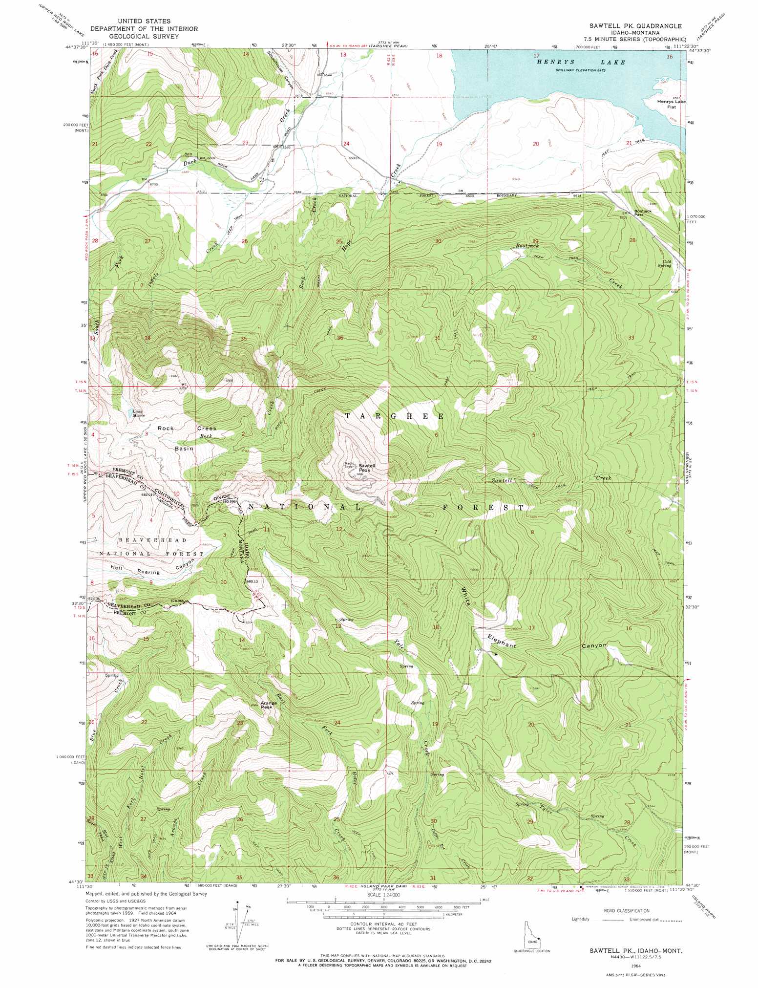
USGS Topo Quad 44111e4 - 1:24,000 scale
| Topo Map Name: | Sawtell Peak |
| USGS Topo Quad ID: | 44111e4 |
| Print Size: | ca. 21 1/4" wide x 27" high |
| Southeast Coordinates: | 44.5° N latitude / 111.375° W longitude |
| Map Center Coordinates: | 44.5625° N latitude / 111.4375° W longitude |
| U.S. States: | ID, MT |
| Filename: | o44111e4.jpg |
| Download Map JPG Image: | Sawtell Peak topo map 1:24,000 scale |
| Map Type: | Topographic |
| Topo Series: | 7.5´ |
| Map Scale: | 1:24,000 |
| Source of Map Images: | United States Geological Survey (USGS) |
| Alternate Map Versions: |
Sawtell PK ID 1964, updated 1966 Download PDF Buy paper map Sawtell Peak ID 1997, updated 2002 Download PDF Buy paper map Sawtell Peak ID 2011 Download PDF Buy paper map Sawtell Peak ID 2013 Download PDF Buy paper map |
| FStopo: | US Forest Service topo Sawtell Peak is available: Download FStopo PDF Download FStopo TIF |
1:24,000 Topo Quads surrounding Sawtell Peak
Freezeout Mountain |
Cliff Lake |
Earthquake Lake |
Hebgen Dam |
Mount Hebgen |
Elk Springs |
Hidden Lake Bench |
Targhee Peak |
Targhee Pass |
Madison Arm |
Upper Red Rock Lake |
Mount Jefferson |
Sawtell Peak |
Big Springs |
Reas Pass |
Sheridan Reservoir |
Icehouse Creek |
Island Park Dam |
Island Park |
Latham Spring |
Crystal Butte |
Bishop Mountain |
Last Chance |
Hatchery Butte |
Big Grassy |
> Back to 44111e1 at 1:100,000 scale
> Back to 44110a1 at 1:250,000 scale
> Back to U.S. Topo Maps home
Sawtell Peak topo map: Gazetteer
Sawtell Peak: Basins
Rock Creek Basin elevation 2664m 8740′Sawtell Peak: Gaps
Bootjack Pass elevation 2076m 6811′Sawtell Peak: Lakes
Lake Marie elevation 2691m 8828′Sawtell Peak: Springs
Cold Spring elevation 2008m 6587′Sawtell Peak: Streams
Hope Creek elevation 1974m 6476′Ingals Creek elevation 2020m 6627′
North Fork Duck Creek elevation 2052m 6732′
Rock Creek elevation 2001m 6564′
South Fork Duck Creek elevation 2084m 6837′
Sawtell Peak: Summits
Arange Peak elevation 2659m 8723′Sawtell Peak elevation 3008m 9868′
Sawtell Peak: Trails
Rock Creek Pack Trail elevation 2488m 8162′Sawtell Peak: Valleys
Schoolhouse Canyon elevation 2000m 6561′Sawtell Peak digital topo map on disk
Buy this Sawtell Peak topo map showing relief, roads, GPS coordinates and other geographical features, as a high-resolution digital map file on DVD: