Targhee Peak Topo Map Idaho
To zoom in, hover over the map of Targhee Peak
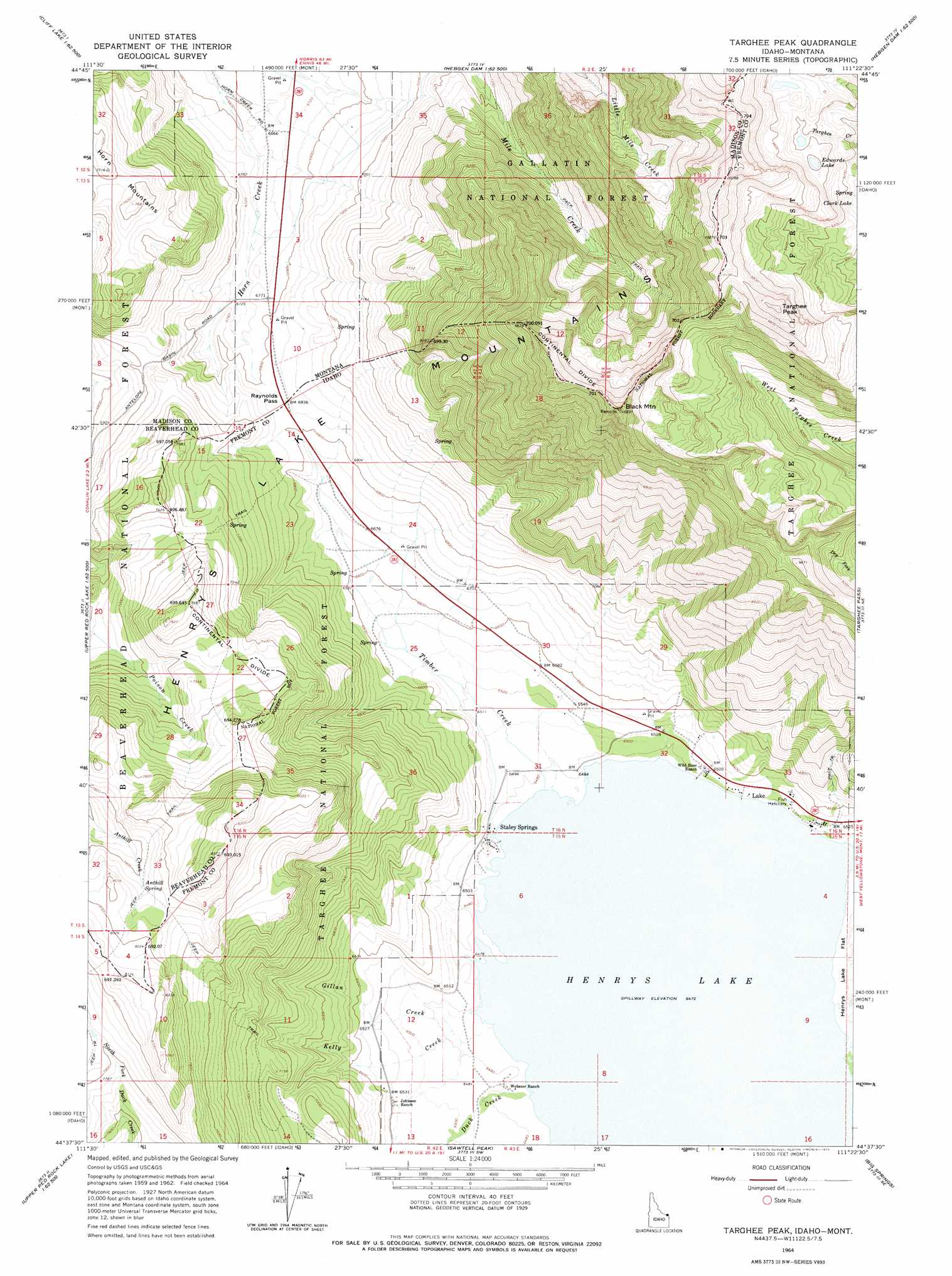
USGS Topo Quad 44111f4 - 1:24,000 scale
| Topo Map Name: | Targhee Peak |
| USGS Topo Quad ID: | 44111f4 |
| Print Size: | ca. 21 1/4" wide x 27" high |
| Southeast Coordinates: | 44.625° N latitude / 111.375° W longitude |
| Map Center Coordinates: | 44.6875° N latitude / 111.4375° W longitude |
| U.S. States: | ID, MT |
| Filename: | o44111f4.jpg |
| Download Map JPG Image: | Targhee Peak topo map 1:24,000 scale |
| Map Type: | Topographic |
| Topo Series: | 7.5´ |
| Map Scale: | 1:24,000 |
| Source of Map Images: | United States Geological Survey (USGS) |
| Alternate Map Versions: |
Targhee Peak ID 1964, updated 1966 Download PDF Buy paper map Targhee Peak ID 1964, updated 1975 Download PDF Buy paper map Targhee Peak ID 2000, updated 2005 Download PDF Buy paper map Targhee Peak ID 2011 Download PDF Buy paper map Targhee Peak ID 2013 Download PDF Buy paper map |
| FStopo: | US Forest Service topo Targhee Peak is available: Download FStopo PDF Download FStopo TIF |
1:24,000 Topo Quads surrounding Targhee Peak
Granite Mountain |
Squaw Creek |
Hilgard Peak |
Pika Point |
Upper Tepee Basin |
Freezeout Mountain |
Cliff Lake |
Earthquake Lake |
Hebgen Dam |
Mount Hebgen |
Elk Springs |
Hidden Lake Bench |
Targhee Peak |
Targhee Pass |
Madison Arm |
Upper Red Rock Lake |
Mount Jefferson |
Sawtell Peak |
Big Springs |
Reas Pass |
Sheridan Reservoir |
Icehouse Creek |
Island Park Dam |
Island Park |
Latham Spring |
> Back to 44111e1 at 1:100,000 scale
> Back to 44110a1 at 1:250,000 scale
> Back to U.S. Topo Maps home
Targhee Peak topo map: Gazetteer
Targhee Peak: Gaps
Raynolds Pass elevation 2082m 6830′Raynolds Pass elevation 2085m 6840′
Targhee Peak: Lakes
Edwards Lake elevation 2861m 9386′Targhee Peak: Populated Places
Lake elevation 1991m 6532′Staley Springs elevation 1977m 6486′
Targhee Peak: Springs
Anthill Spring elevation 2391m 7844′Targhee Peak: Streams
Duck Creek elevation 1974m 6476′Gillan Creek elevation 1974m 6476′
Kelly Creek elevation 1976m 6482′
Targhee Creek elevation 1978m 6489′
Timber Creek elevation 1974m 6476′
Targhee Peak: Summits
Black Mountain elevation 3105m 10187′Targhee Peak elevation 3121m 10239′
Targhee Peak: Wells
12S02E34DAD_01 Well elevation 2190m 7185′Targhee Peak digital topo map on disk
Buy this Targhee Peak topo map showing relief, roads, GPS coordinates and other geographical features, as a high-resolution digital map file on DVD: