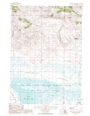
Lower Red Rock Lake Topo Map Montana
To zoom in, hover over the map of Lower Red Rock Lake
USGS Topo Quad 44111f7 - 1:24,000 scale
| Topo Map Name: | Lower Red Rock Lake |
| USGS Topo Quad ID: | 44111f7 |
| Print Size: | ca. 21 1/4" wide x 27" high |
| Southeast Coordinates: | 44.625° N latitude / 111.75° W longitude |
| Map Center Coordinates: | 44.6875° N latitude / 111.8125° W longitude |
| U.S. State: | MT |
| Filename: | o44111f7.jpg |
| Download Map JPG Image: | Lower Red Rock Lake topo map 1:24,000 scale |
| Map Type: | Topographic |
| Topo Series: | 7.5´ |
| Map Scale: | 1:24,000 |
| Source of Map Images: | United States Geological Survey (USGS) |
| Alternate Map Versions: |
Lower Red Rock Lake MT 1988, updated 1988 Download PDF Buy paper map Lower Red Rock Lake MT 1997, updated 2002 Download PDF Buy paper map Lower Red Rock Lake MT 2011 Download PDF Buy paper map Lower Red Rock Lake MT 2014 Download PDF Buy paper map |
| FStopo: | US Forest Service topo Lower Red Rock Lake is available: Download FStopo PDF Download FStopo TIF |
1:24,000 Topo Quads surrounding Lower Red Rock Lake
> Back to 44111e1 at 1:100,000 scale
> Back to 44110a1 at 1:250,000 scale
> Back to U.S. Topo Maps home
Lower Red Rock Lake topo map: Gazetteer
Lower Red Rock Lake: Lakes
Lower Red Rock Lake elevation 2015m 6610′Lower Red Rock Lake: Parks
Red Rock Lakes National Wildlife Refuge elevation 2017m 6617′Lower Red Rock Lake: Springs
13S02W01BAA_01 Spring elevation 2266m 7434′13S02W05CAAA01 Spring elevation 2407m 7896′
Cayuse Spring elevation 2412m 7913′
Lower Red Rock Lake: Streams
Matsingale Creek elevation 2016m 6614′Nye Creek elevation 2016m 6614′
Odell Creek elevation 2016m 6614′
Snowshoe Creek elevation 2037m 6683′
Sparrow Slough elevation 2016m 6614′
Tepee Creek elevation 2016m 6614′
Lower Red Rock Lake: Summits
Patchtop Mountain elevation 2498m 8195′Lower Red Rock Lake: Wells
13S01W19BADD01 Well elevation 2037m 6683′13S01W30CBA_01 Well elevation 2025m 6643′
13S02W12BCCC01 Well elevation 2116m 6942′
13S02W12CBBA01 Well elevation 2118m 6948′
13S02W14BDCA01 Well elevation 2047m 6715′
13S02W20AACA01 Well elevation 2047m 6715′
13S02W20ADCA01 Well elevation 2037m 6683′
13S02W24DCCC01 Well elevation 2031m 6663′
13S02W26DDDB01 Well elevation 2022m 6633′
Lower Red Rock Lake digital topo map on disk
Buy this Lower Red Rock Lake topo map showing relief, roads, GPS coordinates and other geographical features, as a high-resolution digital map file on DVD:


