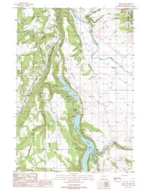
Cliff Lake Topo Map Montana
To zoom in, hover over the map of Cliff Lake
USGS Topo Quad 44111g5 - 1:24,000 scale
| Topo Map Name: | Cliff Lake |
| USGS Topo Quad ID: | 44111g5 |
| Print Size: | ca. 21 1/4" wide x 27" high |
| Southeast Coordinates: | 44.75° N latitude / 111.5° W longitude |
| Map Center Coordinates: | 44.8125° N latitude / 111.5625° W longitude |
| U.S. State: | MT |
| Filename: | o44111g5.jpg |
| Download Map JPG Image: | Cliff Lake topo map 1:24,000 scale |
| Map Type: | Topographic |
| Topo Series: | 7.5´ |
| Map Scale: | 1:24,000 |
| Source of Map Images: | United States Geological Survey (USGS) |
| Alternate Map Versions: |
Cliff Lake MT 1988, updated 1989 Download PDF Buy paper map Cliff Lake MT 1988, updated 1989 Download PDF Buy paper map Cliff Lake MT 1997, updated 2002 Download PDF Buy paper map Cliff Lake MT 2011 Download PDF Buy paper map Cliff Lake MT 2014 Download PDF Buy paper map |
| FStopo: | US Forest Service topo Cliff Lake is available: Download FStopo PDF Download FStopo TIF |
1:24,000 Topo Quads surrounding Cliff Lake
> Back to 44111e1 at 1:100,000 scale
> Back to 44110a1 at 1:250,000 scale
> Back to U.S. Topo Maps home
Cliff Lake topo map: Gazetteer
Cliff Lake: Bays
Antelope Prong elevation 1925m 6315′Cliff Lake: Benches
Cliff Lake Bench elevation 2219m 7280′Wade Lake Bench elevation 2003m 6571′
Cliff Lake: Flats
Missouri Flats elevation 1921m 6302′Cliff Lake: Lakes
Cliff Lake elevation 1925m 6315′Smith Lake elevation 1848m 6062′
Wade Lake elevation 1896m 6220′
Cliff Lake: Populated Places
Cliff Lake elevation 1853m 6079′Grahams Place elevation 1848m 6062′
Missouri Flats (historical) elevation 1924m 6312′
Schusters Place elevation 1919m 6295′
Cliff Lake: Post Offices
Cliff Lake Post Office (historical) elevation 1853m 6079′Cliff Lake: Springs
11S01E13DBC_01 Spring elevation 1900m 6233′11S01E24DBD_01 Spring elevation 1829m 6000′
11S02E32DCDC01 Spring elevation 1867m 6125′
12S01E11ADD_01 Spring elevation 1901m 6236′
Cliff Lake: Streams
Bogus Creek elevation 1900m 6233′Butte Creek elevation 1813m 5948′
Curlew Creek elevation 1813m 5948′
Deadman Creek elevation 1911m 6269′
Freezeout Creek elevation 1940m 6364′
Horn Creek elevation 1925m 6315′
Lake Creek elevation 1836m 6023′
Soap Creek elevation 1837m 6026′
Trout Creek elevation 1822m 5977′
Cliff Lake: Valleys
Jackpine Gulch elevation 1896m 6220′Well Gulch elevation 1959m 6427′
Cliff Lake: Wells
11S02E30BDCD01 Well elevation 1871m 6138′Cliff Lake digital topo map on disk
Buy this Cliff Lake topo map showing relief, roads, GPS coordinates and other geographical features, as a high-resolution digital map file on DVD:


