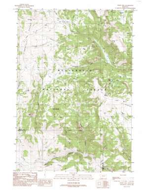
Windy Hill Topo Map Montana
To zoom in, hover over the map of Windy Hill
USGS Topo Quad 44111g7 - 1:24,000 scale
| Topo Map Name: | Windy Hill |
| USGS Topo Quad ID: | 44111g7 |
| Print Size: | ca. 21 1/4" wide x 27" high |
| Southeast Coordinates: | 44.75° N latitude / 111.75° W longitude |
| Map Center Coordinates: | 44.8125° N latitude / 111.8125° W longitude |
| U.S. State: | MT |
| Filename: | o44111g7.jpg |
| Download Map JPG Image: | Windy Hill topo map 1:24,000 scale |
| Map Type: | Topographic |
| Topo Series: | 7.5´ |
| Map Scale: | 1:24,000 |
| Source of Map Images: | United States Geological Survey (USGS) |
| Alternate Map Versions: |
Windy Hill MT 1988, updated 1988 Download PDF Buy paper map Windy Hill MT 2011 Download PDF Buy paper map Windy Hill MT 2014 Download PDF Buy paper map |
| FStopo: | US Forest Service topo Windy Hill is available: Download FStopo PDF Download FStopo TIF |
1:24,000 Topo Quads surrounding Windy Hill
> Back to 44111e1 at 1:100,000 scale
> Back to 44110a1 at 1:250,000 scale
> Back to U.S. Topo Maps home
Windy Hill topo map: Gazetteer
Windy Hill: Basins
Elk River Basin elevation 2645m 8677′Wolverine Basin elevation 2658m 8720′
Windy Hill: Lakes
Blue Lake elevation 2621m 8599′Fault Lake elevation 2786m 9140′
Windy Hill: Ridges
Crater Ridge elevation 2755m 9038′Landon Ridge elevation 2385m 7824′
Windy Hill: Streams
Barnett Creek elevation 2510m 8234′Buford Creek elevation 2269m 7444′
Cascade Creek elevation 2171m 7122′
Fossil Creek elevation 2233m 7326′
Hellroaring Creek elevation 2385m 7824′
Nelson Creek elevation 2477m 8126′
Portal Creek elevation 2150m 7053′
Rossiter Creek elevation 2659m 8723′
Windy Hill: Summits
Cascade Mountain elevation 2855m 9366′Divide Mountain elevation 2902m 9520′
Fossil Peak elevation 2724m 8937′
Lobo Mesa elevation 2848m 9343′
Monument Hill elevation 2915m 9563′
Windy Hill elevation 2940m 9645′
Windy Hill: Trails
Gazelle Creek Pack Trail elevation 2760m 9055′Lobo Mesa Pack Trail elevation 2798m 9179′
Windy Hill: Valleys
Dry Gulch elevation 2191m 7188′Windy Hill digital topo map on disk
Buy this Windy Hill topo map showing relief, roads, GPS coordinates and other geographical features, as a high-resolution digital map file on DVD:


