Dubois Topo Map Idaho
To zoom in, hover over the map of Dubois
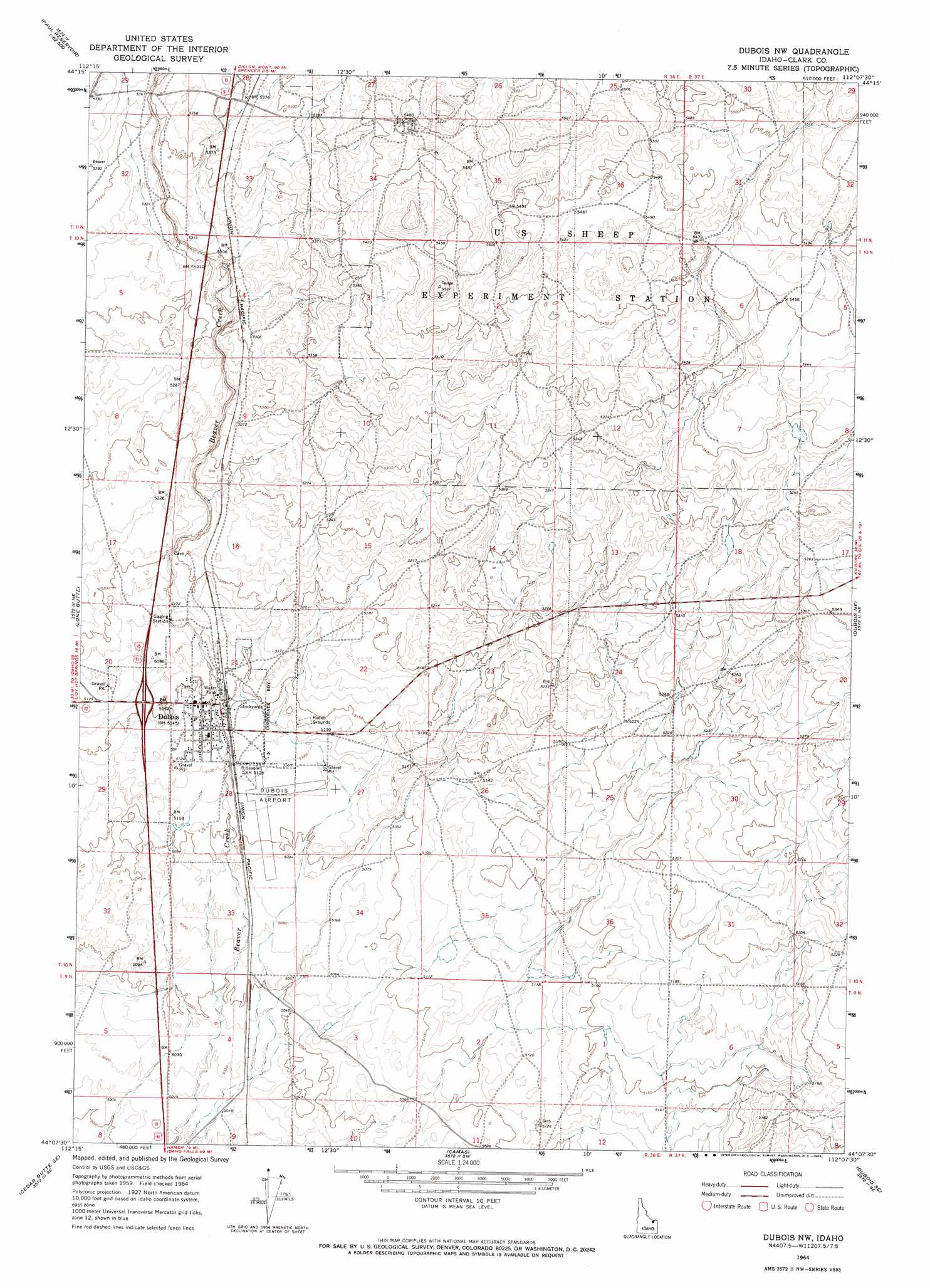
USGS Topo Quad 44112b2 - 1:24,000 scale
| Topo Map Name: | Dubois |
| USGS Topo Quad ID: | 44112b2 |
| Print Size: | ca. 21 1/4" wide x 27" high |
| Southeast Coordinates: | 44.125° N latitude / 112.125° W longitude |
| Map Center Coordinates: | 44.1875° N latitude / 112.1875° W longitude |
| U.S. State: | ID |
| Filename: | o44112b2.jpg |
| Download Map JPG Image: | Dubois topo map 1:24,000 scale |
| Map Type: | Topographic |
| Topo Series: | 7.5´ |
| Map Scale: | 1:24,000 |
| Source of Map Images: | United States Geological Survey (USGS) |
| Alternate Map Versions: |
Dubois NW ID 1964, updated 1965 Download PDF Buy paper map Dubois ID 2010 Download PDF Buy paper map Dubois ID 2013 Download PDF Buy paper map |
1:24,000 Topo Quads surrounding Dubois
Tepee Draw |
Paul Reservoir |
Spencer North |
Lookout Point |
Kilgore |
Indian Creek |
Thunder Gulch |
Spencer South |
Gardner Lake |
Idmon |
Small |
Lone Butte |
Dubois |
Dubois Ne |
Snowshoe Butte |
Cedar Butte Sw |
Cedar Butte |
Camas |
Dubois Se |
Big Grassy Ridge |
Mud Lake Nw |
Rays Lake |
Hamer |
Market Lake Ne |
Plano |
> Back to 44112a1 at 1:100,000 scale
> Back to 44112a1 at 1:250,000 scale
> Back to U.S. Topo Maps home
Dubois topo map: Gazetteer
Dubois: Airports
Dubois Municipal Airport elevation 1562m 5124′Dubois: Populated Places
Dubois elevation 1569m 5147′Dubois digital topo map on disk
Buy this Dubois topo map showing relief, roads, GPS coordinates and other geographical features, as a high-resolution digital map file on DVD: